
Map tips: each color represents a different day. Click a marker to learn more about the spot, and click the star in the map header to save the entire map under Your Places in Google Maps.
Day 1: Pictured Rocks National Lakeshore
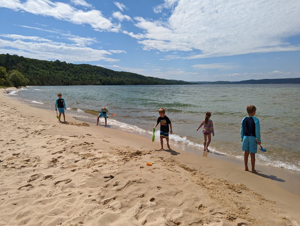
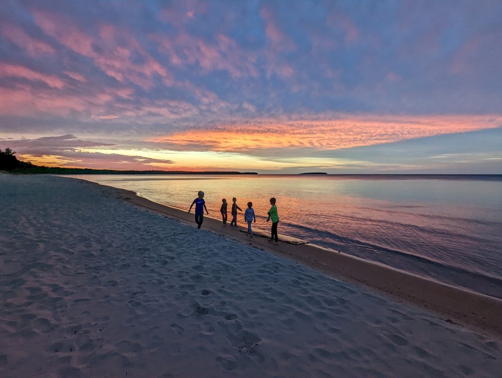
- Sand Point Beach
- Pictured Rocks Cruises
We had driven halfway from Cleveland, Ohio the previous evening and got to Munising, Michigan around 1 pm. Munising is the main city near Pictured Rocks National Lakeshore. Our first stop was Sand Point Beach, which is a nice sandy beach where we spent a couple of hours. You do need a National Park or Lakeshore pass to park here, and you can buy one at the Munising Falls Visitor Center 5 minutes down the road.
Then we stopped at Miners Pasties for a pasty (pronounced past-ee, not paste-ee), which is a basically a meal enclosed in a pastry shell. There are lots of different kinds like vegetarian, breakfast, cheeseburger, etc. but we weren’t too impressed to be honest.
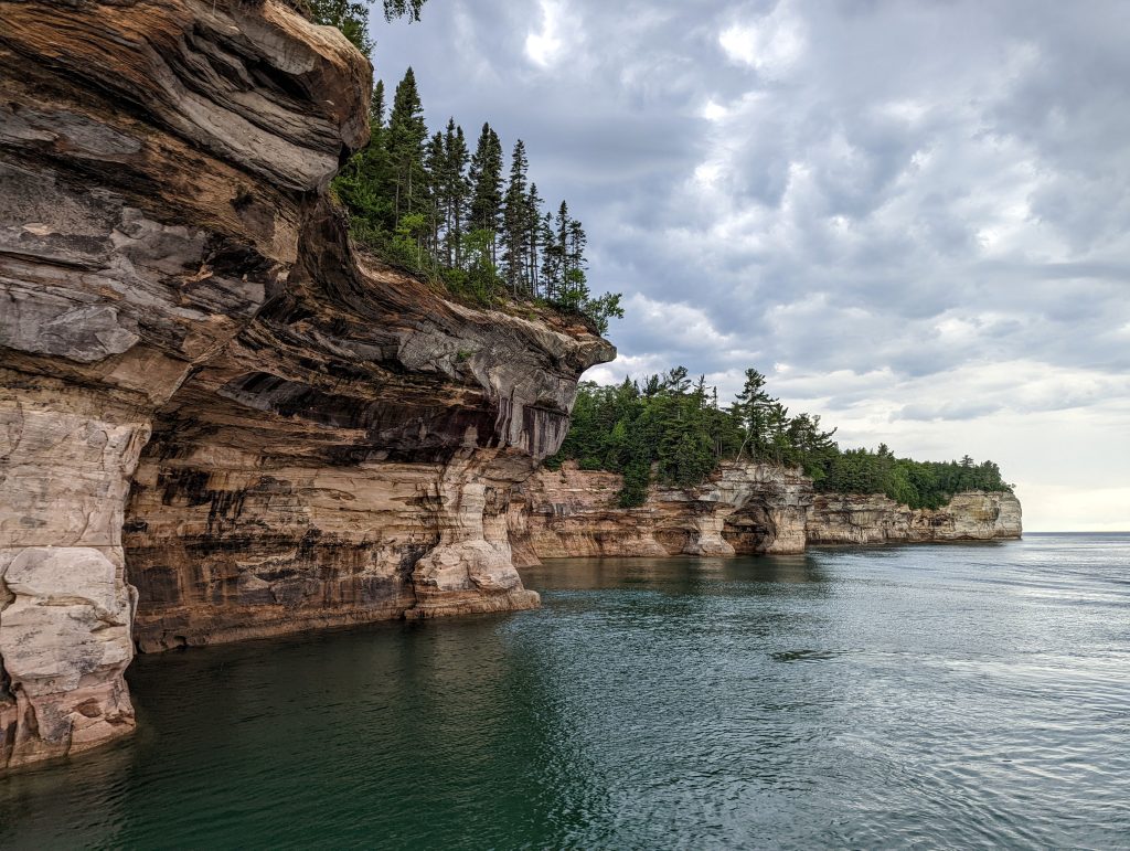
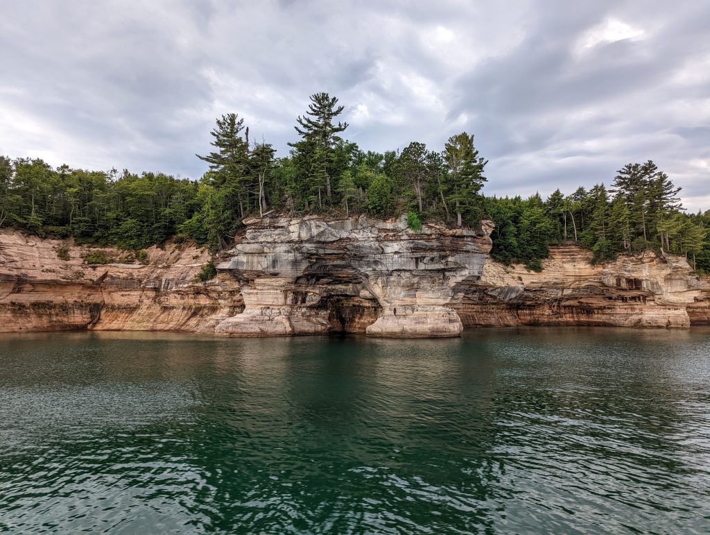
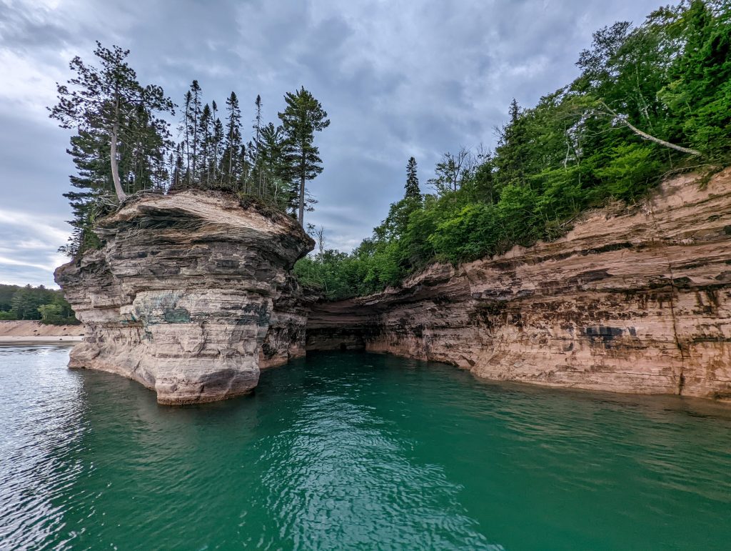
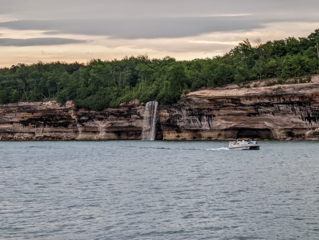
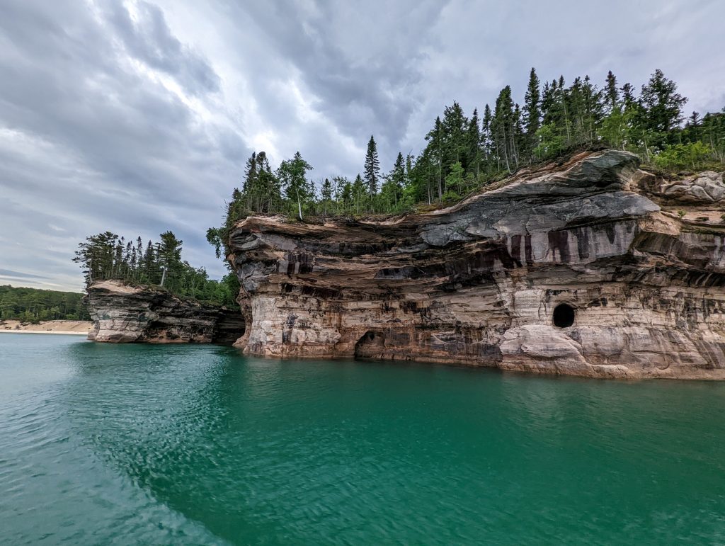
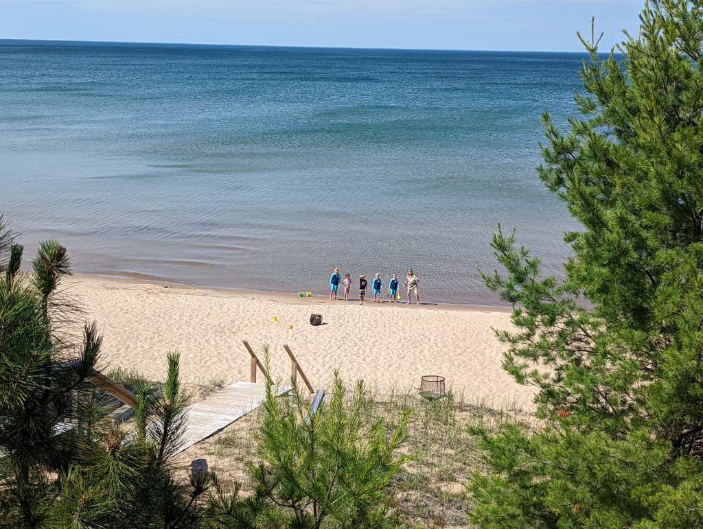
We checked in to our house in Au Train, a town about 15 minutes west of Munising and played on the beach there until it was time to go back into Munising for the cruise. Picked up pizza at Pictured Rocks Pizza (excellent) and caught the 6:30 pm cruise from Pictured Rocks Cruises. We opted for the one to Spray Falls, which costs more than the Classic tour, but you get to see the waterfall at the end. Either tour is pretty expensive but is the best way to see the coast unless you’re kayaking or canoeing and we thought it was definitely worth it.
As they state on their website, the colors of the shore are best in the afternoon or evening sun. Either cruise they offer (Classic or Spray) takes about 2 – 2.5 hours as they use the higher-speed boat for the Spray cruise that goes further. There is another boat company called Riptide Ride that offers a tour along the Pictured Rocks but it’s more of a speed boat/adventure experience and 90 minutes long.
Day 2: Day trip to Marquette
- Lakenenland
- Sugarloaf Mountain
- Presque Isle State Park
- Black Rocks
- Ellwood A Mattson Lower Harbor Park
- Ore Dock
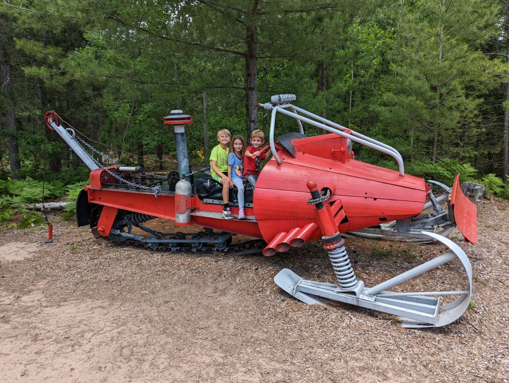
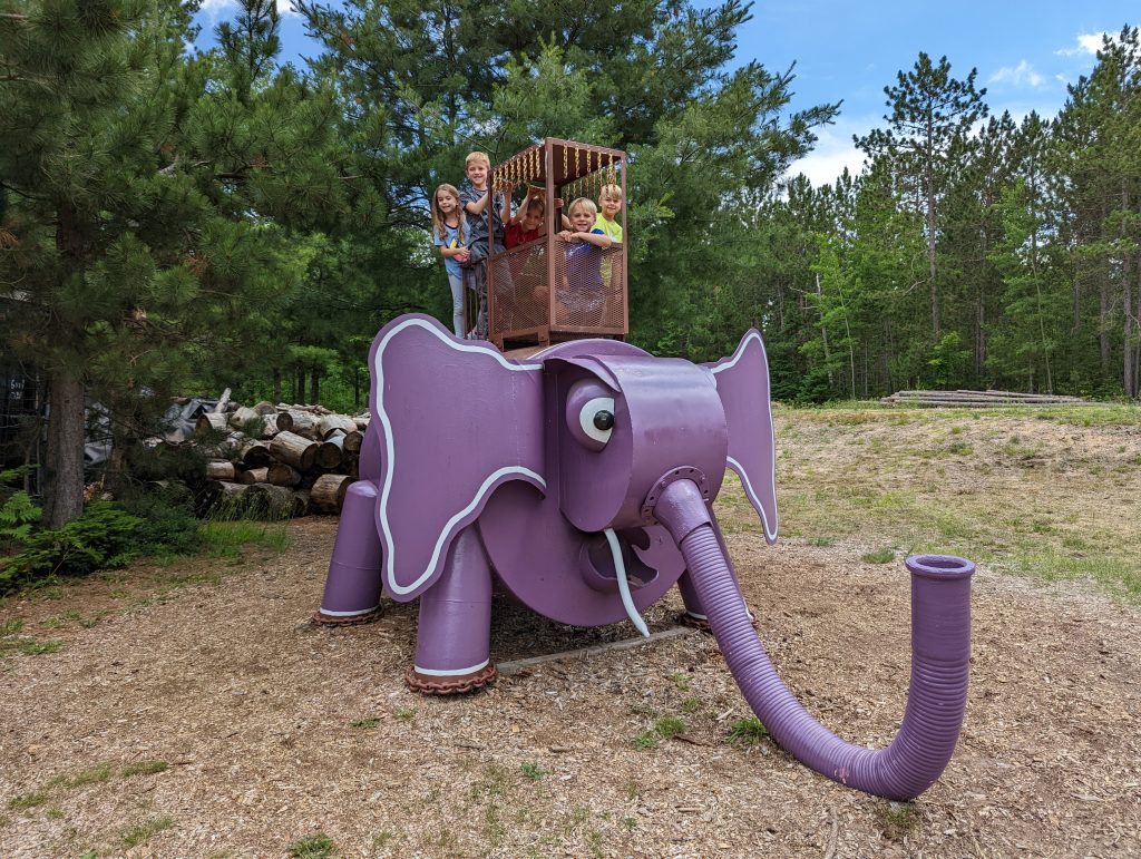
Marquette is about 45 minutes west of Munising and Lakenenland is on the highway to get there. This is a free sculpture park (donations welcome) in which the owner creates different things out of scrap iron. You can walk or drive through it and it is pretty neat. You could spend 10 minutes driving through or an hour taking your time walking and we all found it worth the stop.
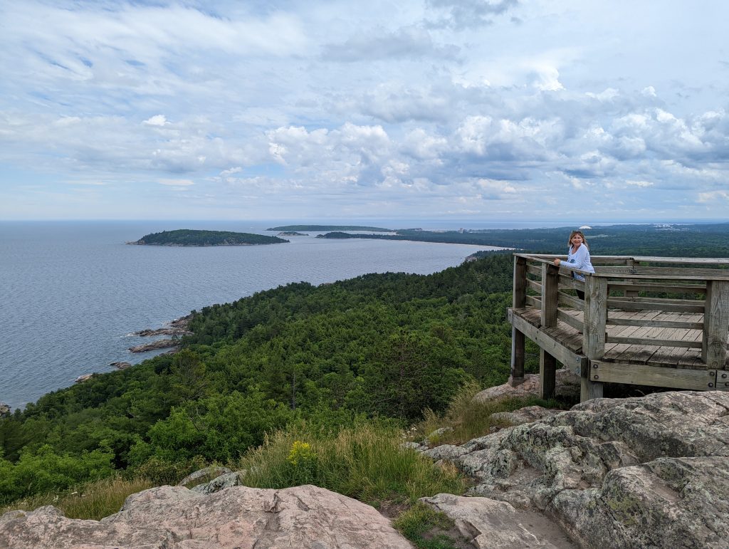
Next we drove through Marquette to the parking lot for the short hike to Sugarloaf Mountain (1.25 miles RT, 300 ft elevation gain). If you take the easy route (heading right from the first fork in the trail right by the parking lot – well marked and clear which way is which) you’ll have lots of stairs but can reach the top in around 15 or 20 minutes. I’d say anyone can do this hike as you can take your time and rest between the staircases. The 360-degree view from the top is great.
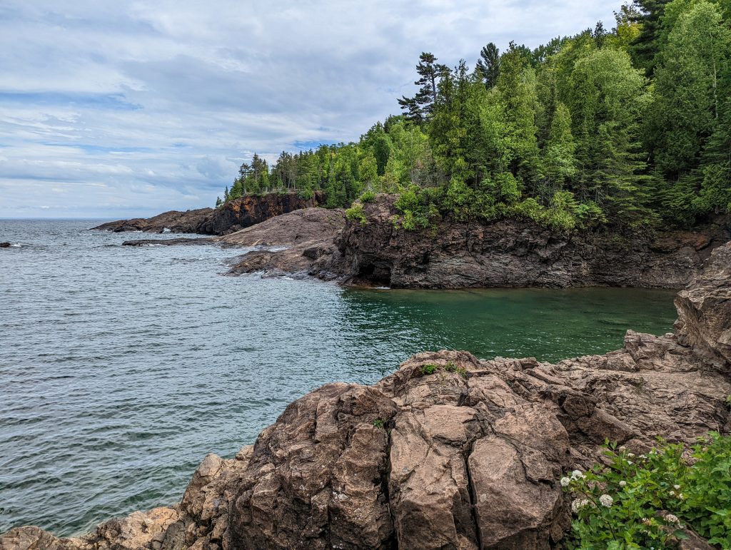
Next was a loop drive around Presque Isle State Park with a stop and walk along the coast at Black Rocks. This is an area where people jump into the water from about 15 feet; I had wanted to but the outdoor temperature was in the 60s and the water is always cold – didn’t see anyone jumping. This area reminded me of the rugged coastline at Acadia National Park.
Next was a stop at Ellwood A Mattson Lower Harbor Park to let the kids play on the playground. We then walked to Iron Bay Restaurant for dinner (some really good stuff, others just ok). After that we walked right down the street to admire the Ore Dock before heading back.
Day 3: Waterfalls
- Wagner Falls
- Munising Falls
- Miners Castle Viewpoint
- Miners Falls
- Scott Falls
Our first stop was Wagner Falls, which is right down the road from main area of Munising. You only need about 15 minutes here as there’s a short walk through the woods to the viewing platform. Definitely worth the stop since it’s so close and easy to get to.
Less than a 10-minute drive away from Wagner Falls is Munising Falls, which is another very short walk that starts at the Munising Falls Visitor’s Center. This one doesn’t have much flow unless it’s recently rained – hard to say that it’s worth it but it takes ~10-15 minutes total so might as well.
Miners Castle Viewpoint is about 15 minutes from the visitor’s center and another very short walk (basically across the parking lot). There is a short paved trail that goes down to the lower viewpoint – also not really worth it but you can get down and back up in less than 10 minutes. There is one road to Miners Castle Viewpoint and it ends at the parking lot to the viewpoint. Along the way, you’ll pass turnoffs for Miners Beach and Miners Falls. We didn’t go to the beach but did Miners Falls, which is the biggest and best waterfall in the area. Plan on 30-45 minutes for the 1.2 RT hike to the viewing area. Another easy hike with a great payoff.
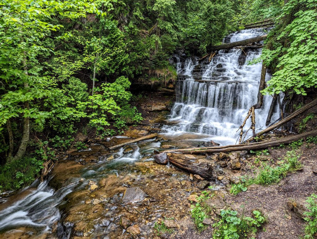
Lastly, we stopped by Scott Falls, which is only a few steps off the highway between Munising and Au Train. There’s a sign on both sides of the highway and you can see it while driving by. The neat thing about this one is that you can go behind it – I wouldn’t go out of your way to see it as it’s pretty small but you could stop, go to it, and be back on the road in 2-3 minutes.
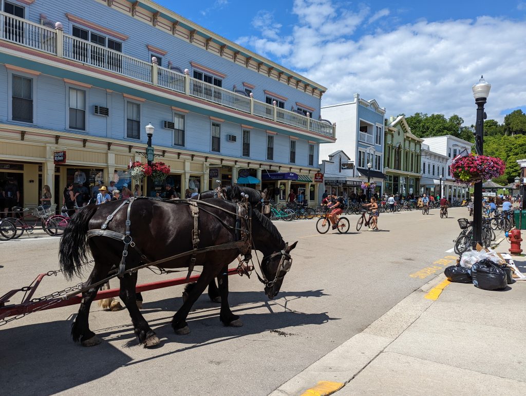
Day 4: Mackinac Island
- Wawatam Lighthouse
- Mackinac Fort
- Arch Rock
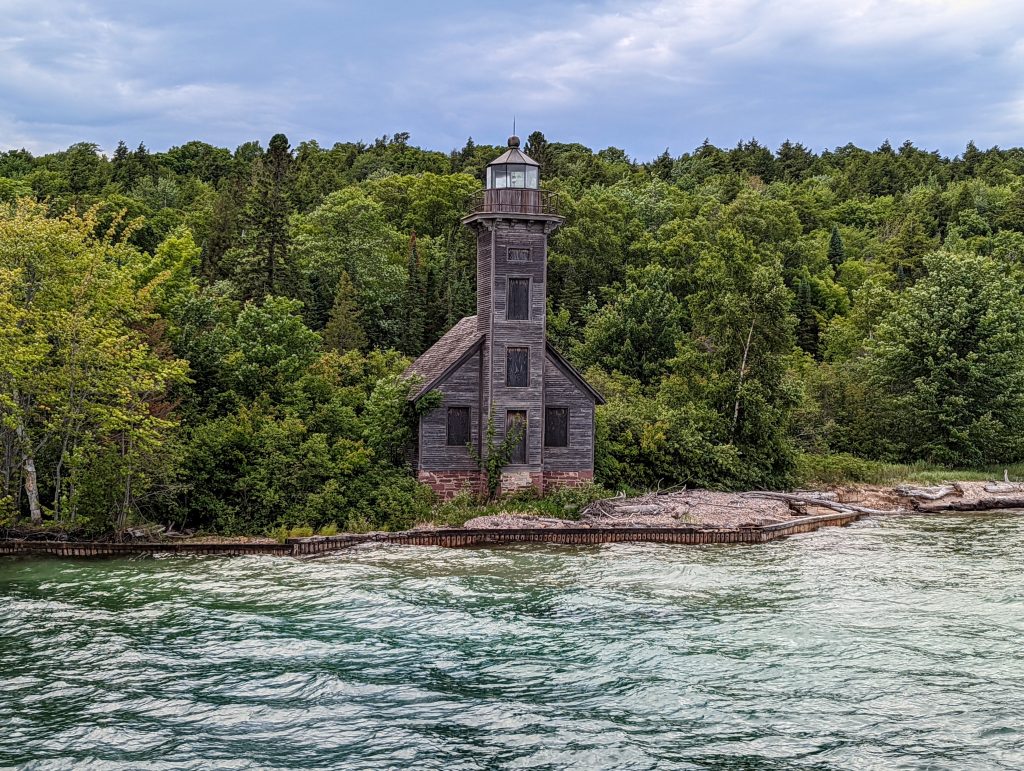
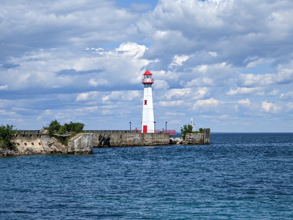
Had a late morning playing on the beach at our place and getting packed up, drove 2 hours to the Star Line St. Ignace Ferry Dock #1. This is the one that is right beside the Wawatam Lighthouse, which is a nice add-on if you’re trying to decide which ferry dock and company to take. You can’t go up in the lighthouse but it is picturesque.
Star Line and Shepler’s are the two ferry companies that go to Mackinac Island and they both have docks in St. Ignace (north side of Mackinac bridge) and Mackinaw City (south side of the bridge). It costs $4 per vehicle each way to cross the bridge, so if you don’t have to go across I’d choose the side you’re already on. They usually run every 30 minutes and take about 20 minutes to get to Mackinac Island. You can get tickets in advance or at the dock and park your car for free in their lots.
Mackinac Island has no cars, so you’ll have to walk, rent a bike, or take a horse carriage to get around. The main attractions are all within walking distance (1-2 miles away from the dock) and even though we didn’t have much time on the island since we arrived around 3:30 pm, we decided to walk.
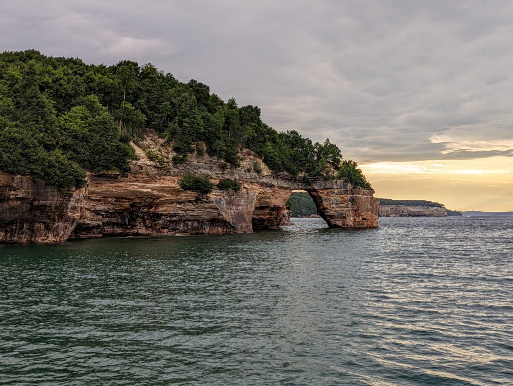
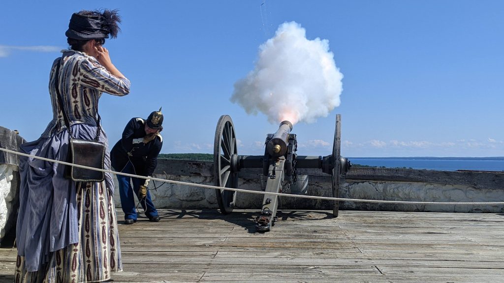
First stop was the Mackinac Fort, which most of the group opted for. It costs to go in and the kids loved it – spent hours there and could have spent more. A couple others walked a little over a mile to Arch Rock, which is a natural arch on the coast. We met back up, did some shopping, and ate at the Pink Pony – has great reviews but we all found it to be underwhelming.
Caught the last ferry (9:30 pm) back and drove another hour to our next rental house in Gaylord. We didn’t know this, but the ferry did not take us back to dock #1; it only went to dock #2, which is still on the St. Ignace side but further down the coast. They had a shuttle to take us back to dock #1 but it was pretty small and barely fit all the people who had to get to the other dock. It may be a good idea to confirm where the return ferry stops if you know when you’ll be coming back, as a fuller boat would have required multiple shuttle runs and an even later night.
Day 5: Torch Lake and Charlevoix
We drove to the Torch Lake Township Day Park, which has a small grassy area on a sandy beach. One of the most difficult parts of planning this trip was figuring out where to go to swim in Torch Lake. Most of the “amazing” pictures you see of it are from the sandbar in the southwest side of the lake. You have to take a boat or kayak to the sandbar, so we opted for the park as it made more sense since we wanted to stop at Charlevoix and/or Petoskey.
We spent a couple hours there then drove about 25 minutes north to Michigan Beach Park in Charlevoix. We’ve heard good things about Petoskey but Charlevoix was closer so we only went there. Spent some time looking for Petoskey stones – some locals found quite a few and gave us some but we didn’t find any ourselves. You have to look for them in the wet rocks, not the dry ones. Had a great dinner at the Railside Bar and Grill on the way back.
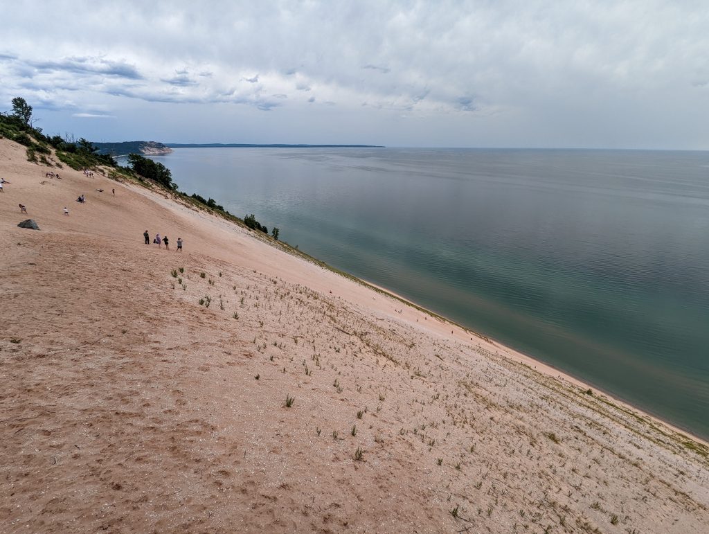
Day 6: Sleeping Bear Dunes and Traverse City
- Dune Climb
- Pierce Stocking Scenic Drive
- Sleeping Bear Dunes Overlook
- Phillip A. Hart Visitor Center
- Mackinaw Brewing Company
- Milk & Honey
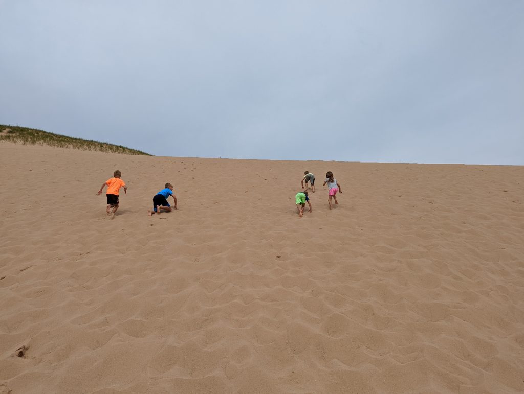
Drove almost 2 hours to Sleeping Bear Dunes National Lakeshore and our first stop was the Dune Climb. This is the most accessible area to climb the dunes and you’ll need to buy a pass or have a National Park pass to enter here (as well as the Pierce Stocking Scenic Drive). We climbed the dune but don’t expect to see Lake Michigan at the top – you’ll need to devote much more time if you want to continue all the way to the coast as it’s over 3 miles RT.
There are 2 “levels” of the climb and you can spend as much or as little time as you want there. We went up to the second level/top and back down, then the kids went back up to the first level a couple more times and played in the sand. Really fun area, should definitely do it when visiting the dunes.
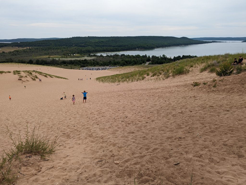
The Pierce Stocking Scenic Drive is a loop that has one entrance and exit. Both are at the same spot about 5 minutes south of the Dune Climb parking lot. There are 11 stops along the loop. It’d probably take you around 25-30 minutes to drive the whole thing without stopping.
We didn’t stop at most of them and the Sleeping Bear Dunes Overlook (stop 9) is the one you don’t want to miss. That has a short uphill walk in the sand. Most people ditched their shoes when the concrete ends. At the end is a platform that sticks over the steep descent into the water. You can descend the whole way down to the coast from here, but there are signs warning that if you can’t make it the 450 feet back up, a rescue can cost over $3,000. I did it but it is no joke. It could take you a very long time to make it back up, depending on your physical ability.
We had planned on doing the Empire Bluff Trail, about 10 minutes south in Empire, but it was raining at times and getting a little late so we skipped it. Stopped at the visitor center to get Junior Ranger badges for all the kids. We had asked for the booklets when we entered the Dune Climb. After that, drove about 30 minutes to Traverse City. We had dinner at Mackinaw Brewing Company (just ok) then walked around to shop and get ice cream (Milk & Honey – great). Drove back the next day.
Final thoughts
This trip was a lot of driving and we crammed a lot into a little amount of time. It would have been better to stay in Traverse City as our second location. However, there were no house rentals at all when we were booking (several months in advance). We liked the Pictured Rocks and Sleeping Bear Dunes the most. Traverse City and Mackinac Island were fine but not places we would visit again.
Things we didn’t do that you could add to a trip in this area:
- Sable Falls: the best waterfall in the Upper Peninsula, but 1 hour drive each way from Munising.
- Chapel Loop/Rock trail: between 7-10 miles along the Pictured Rocks shoreline. This is how you get the awesome view of Grand Portal Point and can see waterfalls, Chapel Rock, and beaches. Would like to have done this but too far with all the kids.
- Shipwreck Museum and/or glass-bottom boat tour: the museum is 2 hours from Munising but the shipwreck boat tour leaves right from Munising.
- Lots of other coastal towns like Petoskey, Harbor Springs, and Glen Arbor.
Traveled in July 2022
Leave a reply