
Map tips: each color represents a different day. Click a marker to learn more about the spot, and click the star in the map header to save the entire map under Your Places in Google Maps.
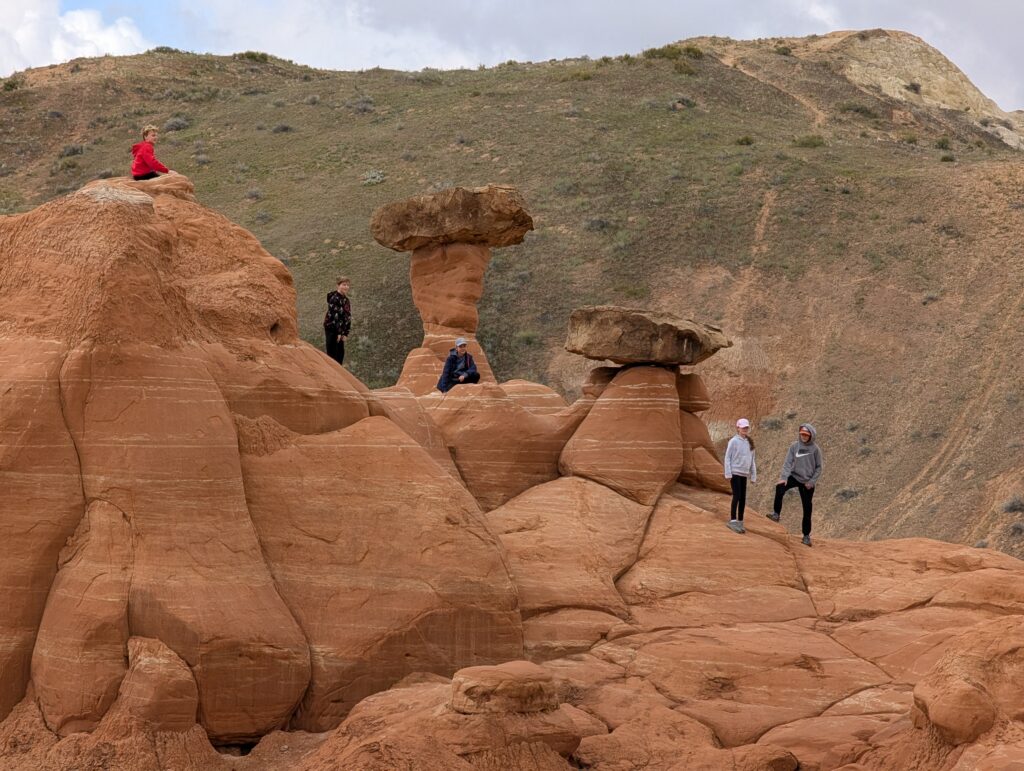
Day 1: Valley of Fire State Park, Nevada
We arrived in Las Vegas in the early afternoon and grabbed our rental car. Note that the rental car facility is about a 10-15 minute shuttle bus drive and there can be long lines to get on a bus.
We drove 1 hour 10 minutes to the North Shore Inn at Lake Mead where we were staying 1 night. The Valley of Fire State Park was one of the things I was looking forward to most on this trip and the North Shore Inn is the closest place to stay. We dropped our bags and drove about 30 minutes into the heart of the park. Note that the park is only about 50 minutes from Las Vegas if you’re going straight there. Plus, the North Shore Inn isn’t in the best of shape, so I’d try to hit the park on your way to somewhere else or do a day trip if possible. There is a $15 entrance fee.
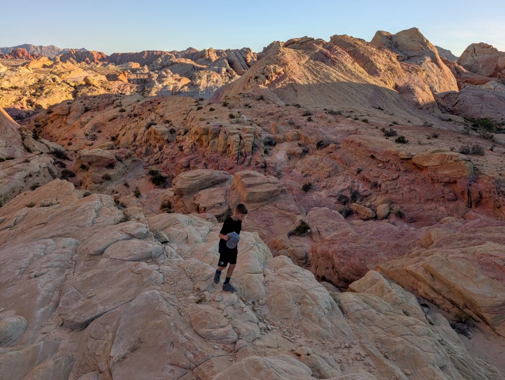
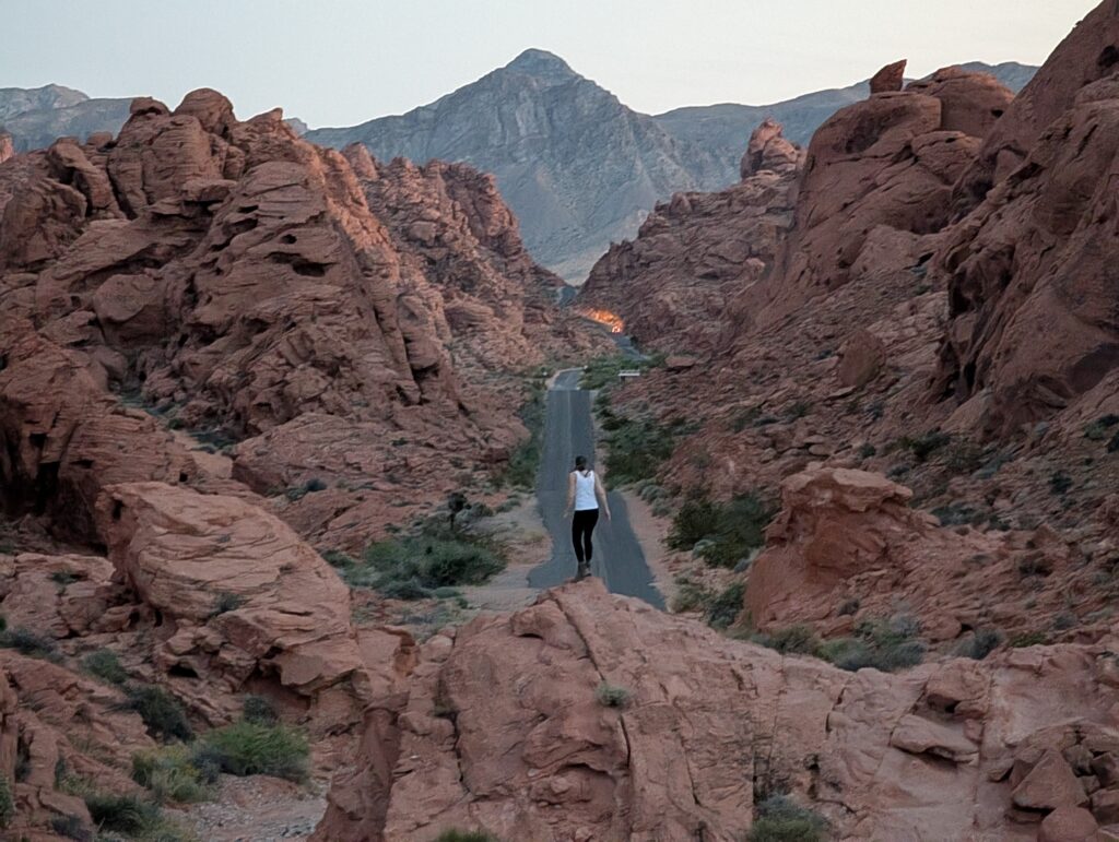
Fire Wave is the most popular trail in the park and the trailhead is almost at the very end of the dead-end road (called Mouse’s Tank Road) that runs through the main part of the park. The drive is spectacular. So many awesome rock formations and the road weaves up, down, and around them.
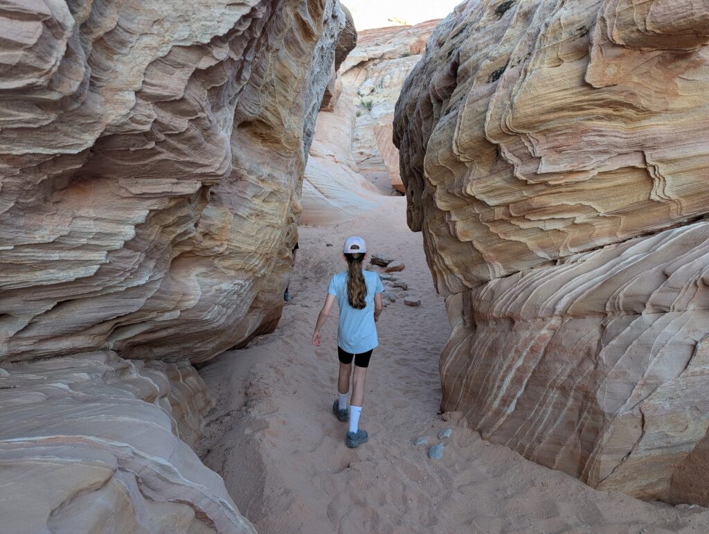
Many people get to Fire Wave by doing the 1.5 mile out-and-back trail (0.75 miles each way). A louder group of about 15-20 were just getting started and we didn’t want to walk with them. We planned on doing the Seven Wonders Loop trail, which includes Fire Wave and only adds about 0.3 miles total. We set out the opposite direction (counter-clockwise, away from Fire Wave) and had the first half of the hike almost completely to ourselves. I cannot recommend the loop hike enough. If you’re doing the Fire Wave, you must do the loop. We had a blast exploring the area, which varies from wide open spaces on multi-colored rock to narrow sections with sand. One of the spots had the pinkest natural rock we’ve ever seen.
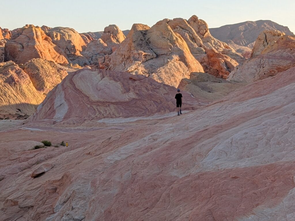
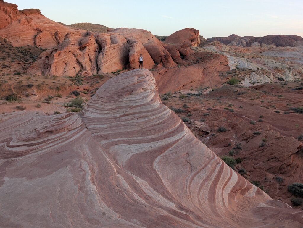
We approached the Fire Wave from the back side and many of the people, including that large group, were clearing out right when we got there. We didn’t have to wait very long to get pictures on the wavy section but there can be quite a line. Admired the landscape and headed back. The return is uphill but overall an easy hike. There are not too many hikes under 2 miles that are better than this one.
Heading back out of the park, the view looking down Mouse’s Tank Road is so cool. We stopped at Rainbow Vista Trailhead, crossed the road, and started walking south (the direction heading out of the park). In less than 5 minutes there are some awesome vantage points for really cool pictures. There were several groups further down the road, where there isn’t really parking, but I thought the elevated view we got was better.
We wanted to check out Elephant Rock, which we passed on the way in, and Atlatl Rock, but ran out of light. The White Domes Trailhead is just a little further than the Fire Wave Trailhead, at the very end of the road. That’s a 1.25 mile loop hike that also looked worth doing. Will have to do all those next time.
We’ve flown into Vegas multiple times to head to Zion National Park and never stopped at the Valley of Fire State Park. I’m almost mad at myself because it is such a unique and awesome place. One of my favorite stops on the trip and a fantastic way to start things off.
Day 2: Zion National Park and Coral Pink Sand Dunes State Park
Zion National Park, Utah
Our only real plan for this day was to meet up with the rest of our family, who arrived late the previous night, and eventually make it to Kanab, Utah. We had a rental house just outside town for the next 4 nights. We considered going back into Valley of Fire, but it was 30 minutes in the wrong direction so it would have added an hour of driving.
Our family’s timeline was late afternoon. We decided to drive about 2 hours to Zion National Park which was more in the direction of Kanab. We knew it was going to be packed on a Saturday afternoon during spring break and it was crazy. The visitor center and all public parking lots close to it were full. We barely got street parking further away in Springdale and had to walk a mile to the visitor center. There is a free bus that goes from Springdale to the visitor center. However, that would have taken longer than walking because there was a steady line of traffic wanting to get in to the park and it was moving at a glacial pace.
We grabbed lunch at Subway along the walk (almost $20 for a footlong. Crooks.) and started up the Pa’rus Trail which starts right by the visitor center. The trail is paved so you’ll be sharing it with lots of ebikes. There are several points where you can get to the river, however, and there are some awesome views at those points. One of the best is at the first footbridge that crosses the river, about another mile from the visitor center.
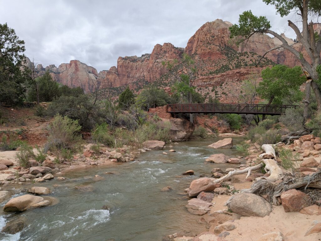
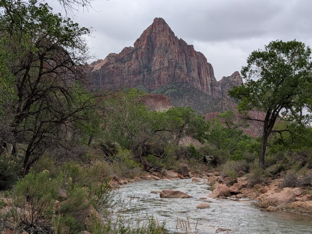
You may have seen one of the most famous images of Zion National Park: a looming, pointy peak called The Watchman with a winding river in the foreground. That vantage point is from the Canyon Junction Bridge but they no longer allow pedestrians there. The footbridge along the Pa’rus Trail is the most similar view you can get nowadays.
The kids played by the water for a bit as I hurried all the way back to the car, waited in the line to drive into the park, and picked them up at the Zion Human History Museum. That is one of the shuttle stops and is only about a 5-minute walk from that view from the footbridge. However, shuttles only stop there on the way down the canyon. Keep that in mind if you’re planning on getting off there for the view. You could either walk there from the visitor center; get off the shuttle at the museum on your way down/out of the canyon; or park at the museum and make the short walk from there.
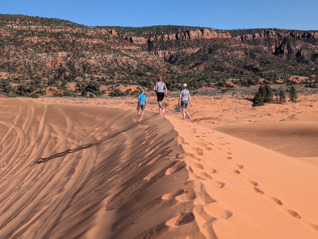
Coral Pink Sand Dunes State Park, Utah
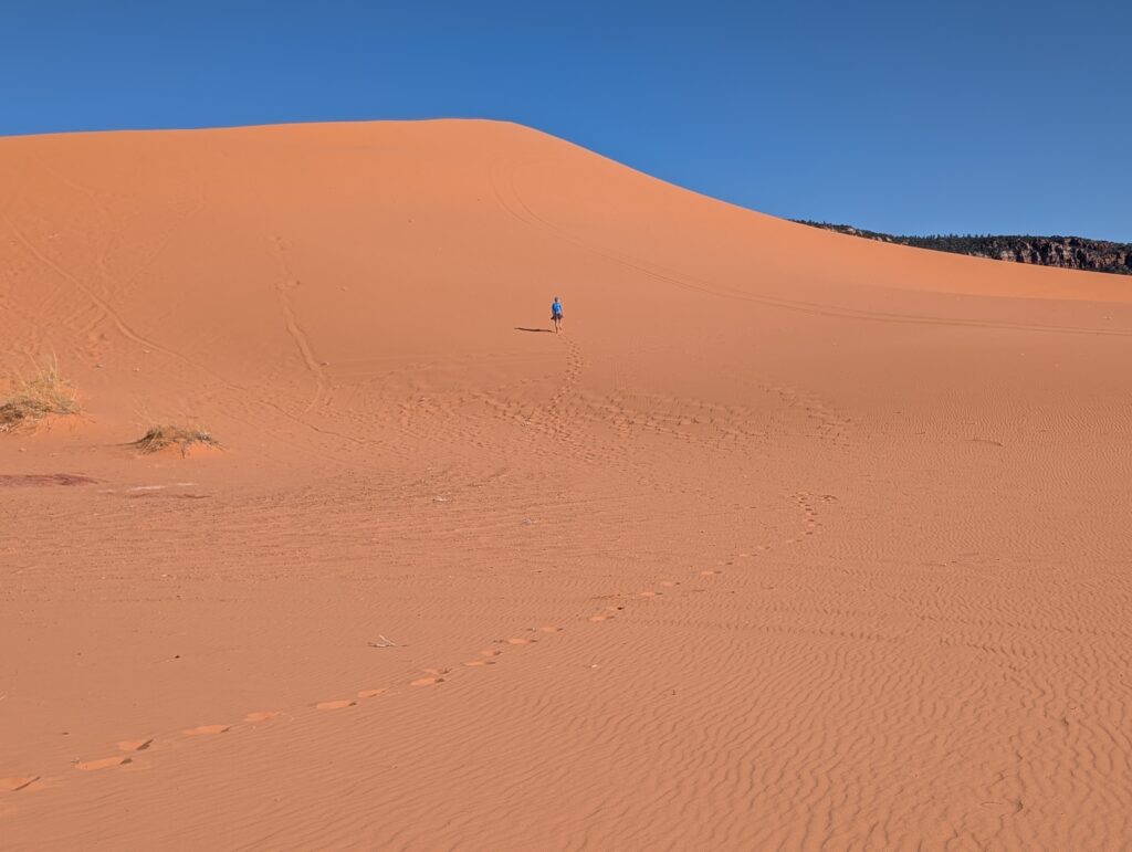
Continued on through Zion Canyon to Coral Pink Sand Dunes State Park, which was about an hour’s drive and where we were meeting up with the rest of our family. It’s $15 per vehicle to enter and they have sleds you can rent for $25 to sled down the dunes. We’ve been to other dunes before (Sleeping Bear Dunes in Michigan and White Sands National Park in New Mexico) and always have a blast. Played on the dunes for a couple hours before heading to our house rental in Kanab, about 30 minutes away. I didn’t think renting the sleds ended up being worth it. It was very windy so that may have contributed to us not sledding much.
We unloaded our stuff then a couple of us set out to get groceries and pick up pizza from Lotsa Motsa. Good stuff, they go heavy on the toppings.
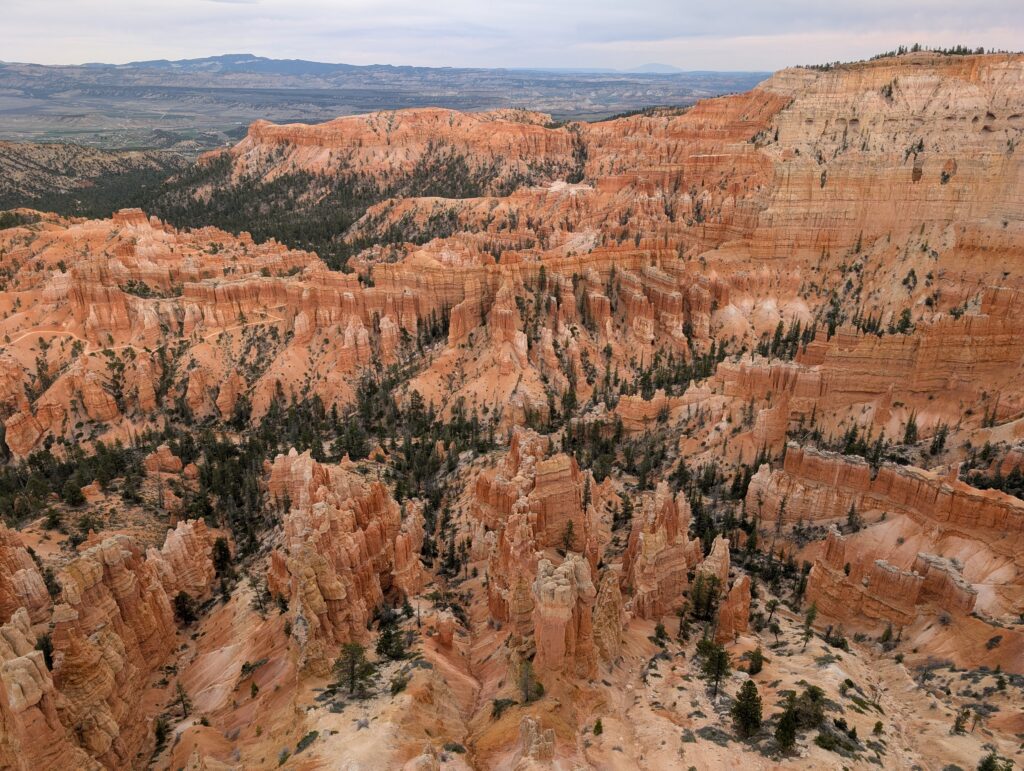
Day 3: Bryce Canyon National Park, Utah
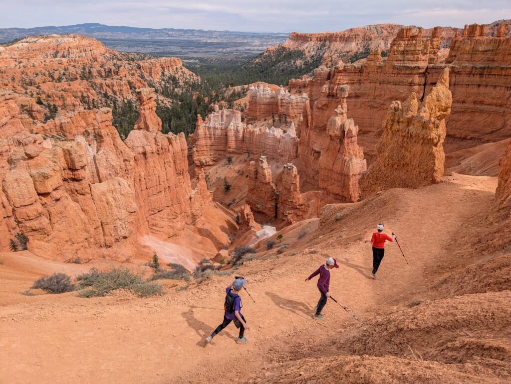
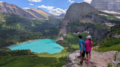
We set out around 10 am for the 1 hour, 20 minute drive to Bryce Canyon National Park. Figured it would be super busy, too, but it wasn’t nearly as crazy as Zion. We were able to park at the visitor center, do the Junior Ranger program, then find parking spots near Sunrise Point. Ate our packed lunch at the cars then set out to do the amazing 3-mile, 600 ft of elevation gain Queens Garden and Navajo Loop Trail (Hike Guide coming soon).
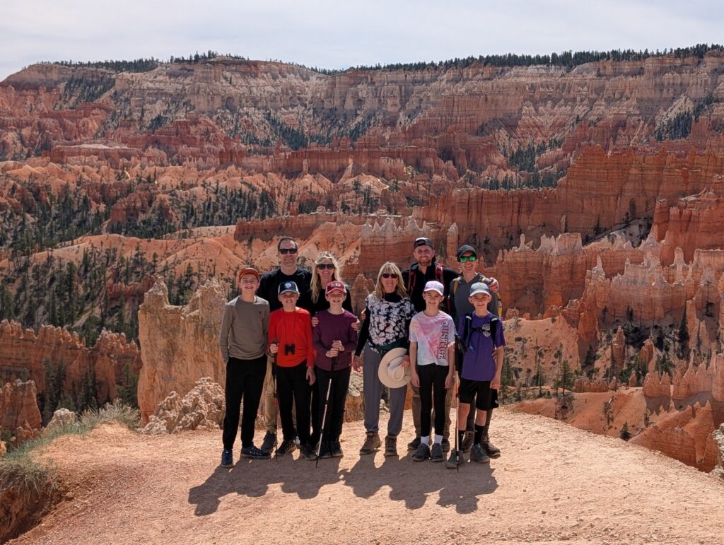
Amanda and I had done this hike once before, 17 years ago, and I’ve been looking forward to going back ever since. It takes you down into the canyon to walk among the hoodoos and other formations that look like a fairytale land. Getting to share it with our kids, and see their wonderment, was so great. I think Bryce Canyon is the most unique National Park I’ve visited.
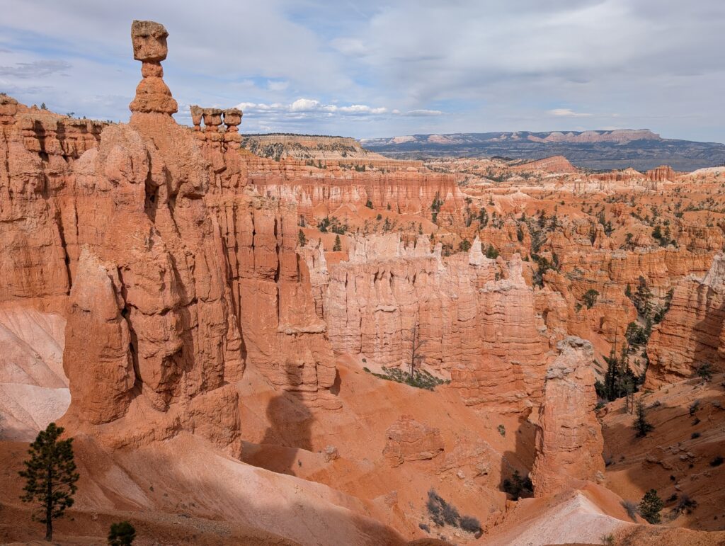
We drove further into the park to Inspiration Point. There are multiple viewpoints – the upper one, which is a pretty short but aggressive incline, is a must-see. The panoramic view from there gives you a true sense of how special and massive the canyon is.
Picked up some of the “famous” Ho-made pies from the Thunderbird Restaurant, which was on the way back. Had dinner at the house to cap a wonderful day.
Day 4
- Best Friends Animal Sanctuary
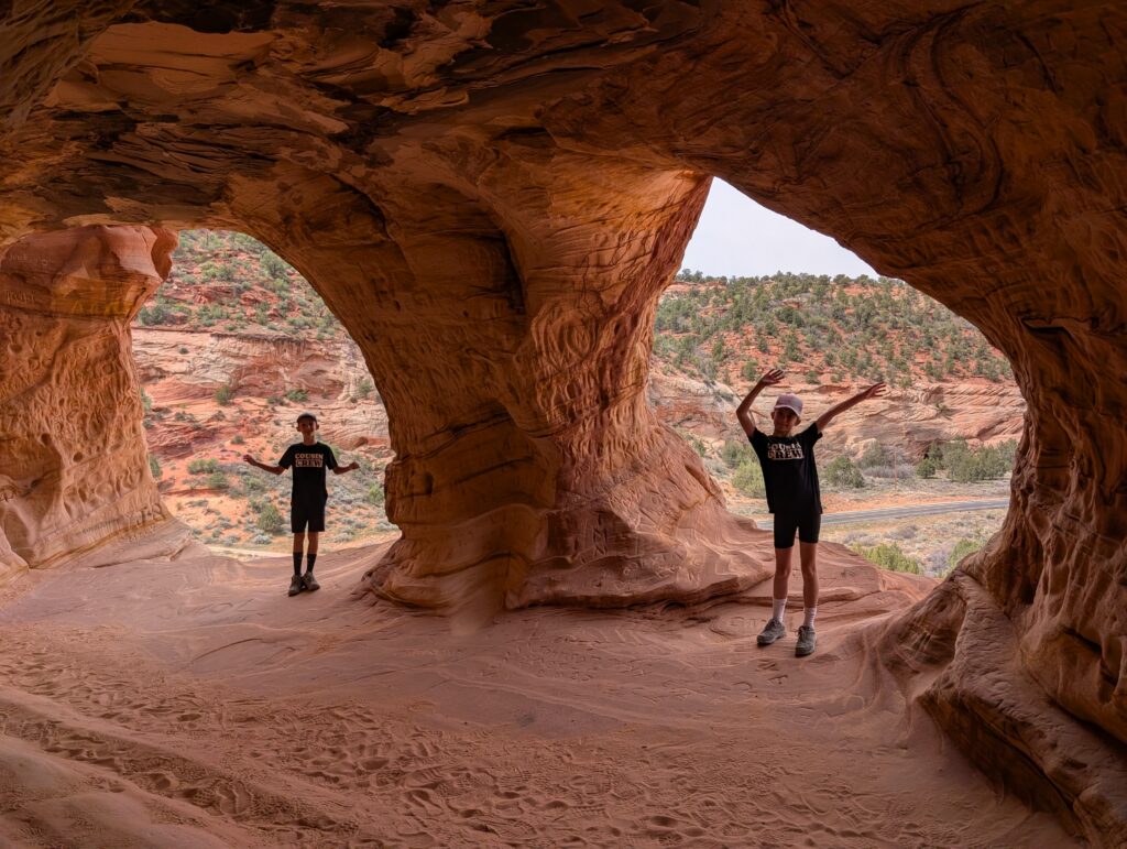
- Sand Caves
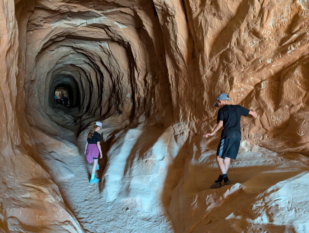
- Red Hollow Slot Canyon
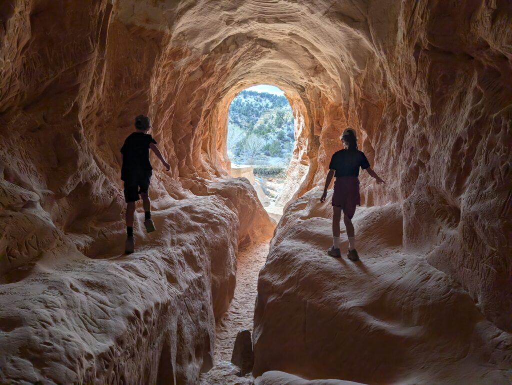
- Belly of the Dragon
We had passed all of these stops on the previous day on the way to Bryce. However, we had a flex day and decided to split them up instead of one very long day. Our first stop was the Best Friends Animal Sanctuary, only about 10 minutes north of Kanab. They have over 1,500 animals on almost 6,000 acres of land. They offer tours but you can visit some of the areas on your own. We went into the cat room and decided to move on to the other stops, as driving through the entire property would take some time.
The turn for the animal sanctuary is right where the parking lot is for the Sand Caves. Less than a mile north of this parking lot is the Moqui Cave. That’s a Native American museum and not to be confused with the Sand Caves. The walk to the manmade Sand Caves is maybe a little more than a mile total, there and back. There’s one part where you need to go up a rock face incline and then you walk straight across to the caves. It’s not a tough hike but I’d recommend shoes with good grip so you have an easier time going up and down the rock. Only need 30-45 minutes total here.
Next we drove to the furthest stop, the Red Hollow Slot Canyon. The trailhead is in Orderville, about 25 minutes from Kanab. There is parking for maybe 7 vehicles at the trailhead, which is down an unnamed but paved road that ends at a fenced-off water treatment plant. “Red Hollow Canyon Trailhead” is on Google Maps, but as of this writing there is no road on Google Maps to get there. It does exist and is directly across from a parking lot next to tennis courts. The trailhead lot was full when we arrived, so we parked right beside the tennis courts and walked about 3 minutes up the road to the trailhead.
The trail is very straightforward – head to the wash (dry riverbed) and follow it towards the rocks. It’s probably a little less than 1 mile total there and back. The slot canyon itself gets very narrow, though, and can take some time to navigate. You can stop and turn around whenever you want. Our kids wanted to go to the end and back multiple times and loved it.
Heading back to Kanab, we turned off at the signed parking lot for Belly of the Dragon. This is another manmade “attraction” that was used for drainage but pictures can make it look spooky. The parking lot is right beside the start of the tunnel so you could spend less than 15 minutes here. Neat place that the kids enjoyed, but more of a “we’re here, why not?” than a must-see.
Back to the house for dinner. All the stops today were unique and free! You could easily combine all of them with Coral Pink Sand Dunes State Park in the same day.
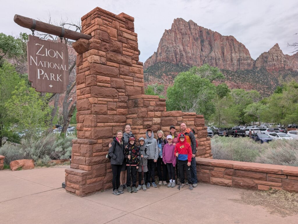
Day 5: Zion National Park
The east entrance to Zion is about an hour from Kanab. We set out at 6:30 am to see if we could get a coveted spot near the Canyon Overlook Trailhead. The parking lot right by the trailhead only has space for about 10 cars. Plus, you cannot turn into it when approaching from the west like we were. It is immediately by the tunnel entrance, so there’s really no place to turn around quickly as you’d have to go all the way through the tunnel, come back, and hope no one grabbed a spot in the meantime. However, there are 2 other pull-offs plus a bathroom with a few spots that are within walking distance. We knew we’d pass those before we got to the tunnel. Everything was full, unfortunately. There are no shuttles that go here so you have to get lucky with parking.
Continued down through the canyon (the drive in this direction is mind-blowing) and found all the free spots at the visitor center lot were full, too. Yikes. We found a spot at one of the closest public lots and had the honor of paying $40 to park there for the day. Then we had to wait almost an hour to get on a shuttle into the canyon. Gave us time to get the Junior Ranger booklets and do them while in line.
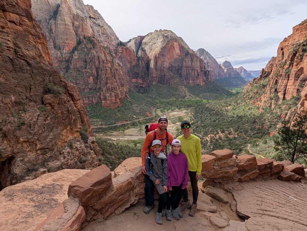
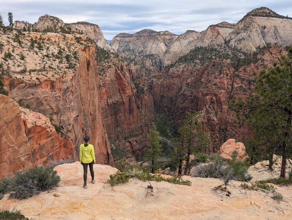
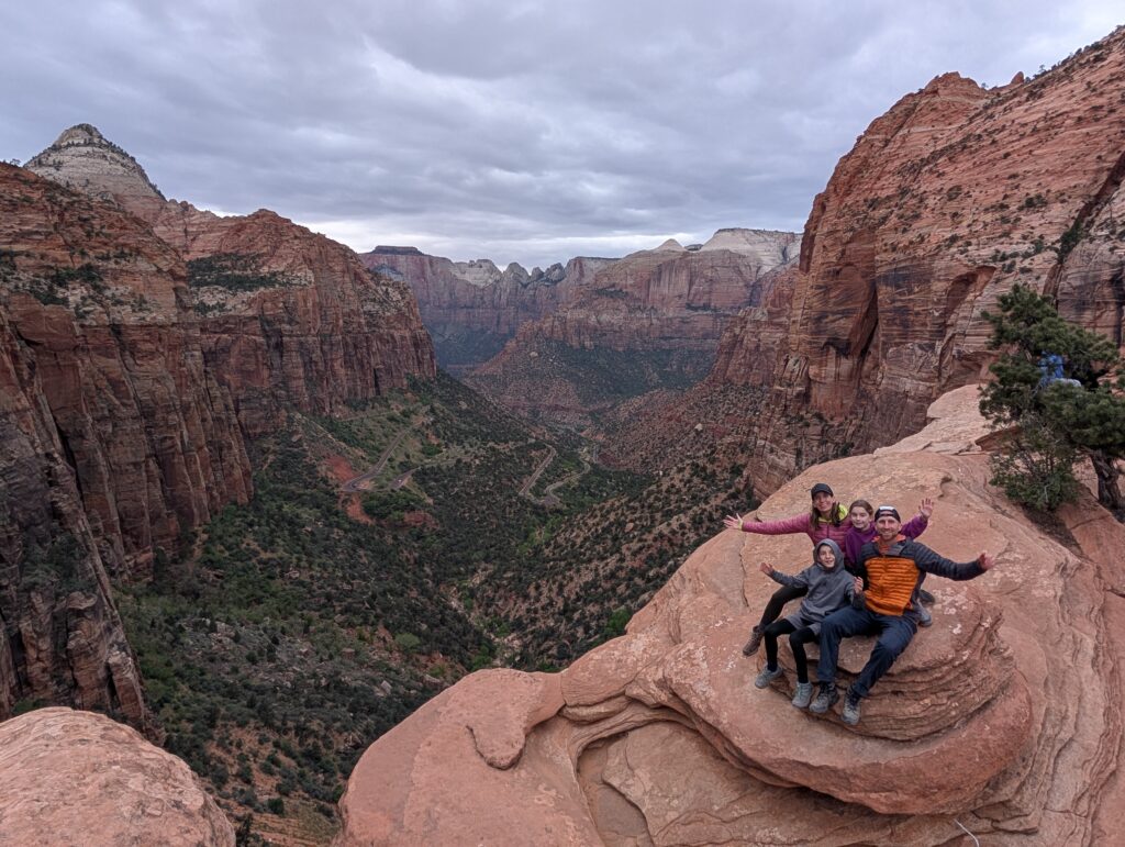
Once we got on the shuttle, we took it to The Grotto stop where the West Rim trail starts. This is the trail that goes to Angel’s Landing, which is one of the most famous hikes in the country. The last section, which leaves the West Rim Trail to get to Angel’s Landing, requires a permit.
Read my Hike Guide for Angel’s Landing here
Our plan was to take the West Rim Trail to Scout’s Lookout. That’s where the chain section for Angel’s Landing starts and rangers will be checking for permits. The trail to Scout’s Lookout is well worth it even if you’re not doing Angel’s Landing. It’s about 4 miles RT with a little over 1,100 feet of elevation gain. One of my favorite views in Zion is at a curve that heads away from the canyon, about halfway up.
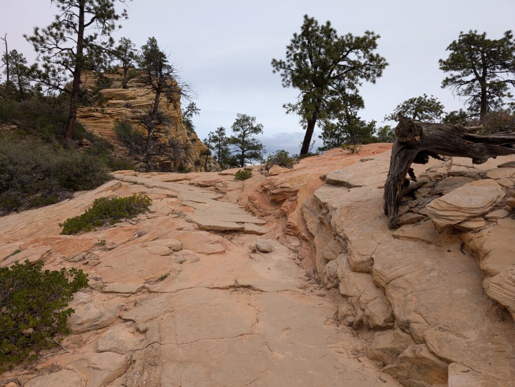
Most of the group found a place to sit and have lunch. I’d read that there are some awesome views about 0.5 miles further on the West Rim Trail so I wanted to give that a try. It wasn’t super easy to find but there is a great lookout where the trail curves to the left. There’s a dead tree and that’s where you leave the trail and head to the right. I know this isn’t a great picture but hopefully it’s helpful.
Thought it was worth the extra mile as we got to see a part of Zion we’d never seen before. Went back down to the Grotto stop, caught the shuttle back down the canyon to the museum stop. Our whole group went to the water along the Pa’rus Trail but rain cut our time there short. Next was dinner at Zion Pizza and Noodle, which is one of my and Amanda’s favorite places to eat in the world. We have such fond memories of hiking at Zion followed by a giant meal of pizza and/or pasta. Loved going there again with our family.
We were going to try our luck with parking for the Canyon Overlook Trail again on our way up and out of the canyon. All the spots were full again, unfortunately. It was getting close to sunset and we knew it was going to be crowded. We turned around to try one more time and finally found spots on our third attempt of the day. The Canyon Overlook Trail is just about 1 mile RT (roundtrip – this means total mileage) with less than 200 feet of elevation gain. The trail is pretty easy. However, there are some sections with railings and steep drop-offs, and the end also has areas with open cliff edges. The payoff is a great view of the canyon that you won’t get from anywhere else.

Day 6
- Toadstool Hoodoos
- Wahweap Overlook
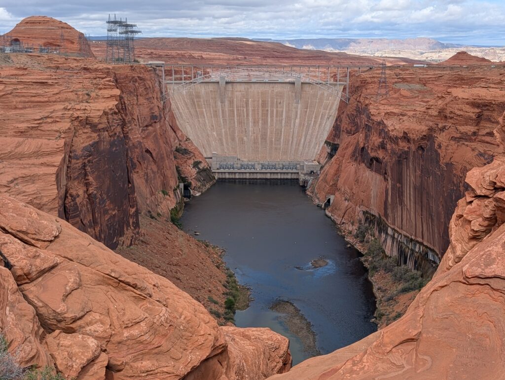
- Glen Canyon Dam Overlook
- Horseshoe Bend
- Biidi the Arch
- Lower Antelope Canyon
- Moran Point (Grand Canyon National Park)
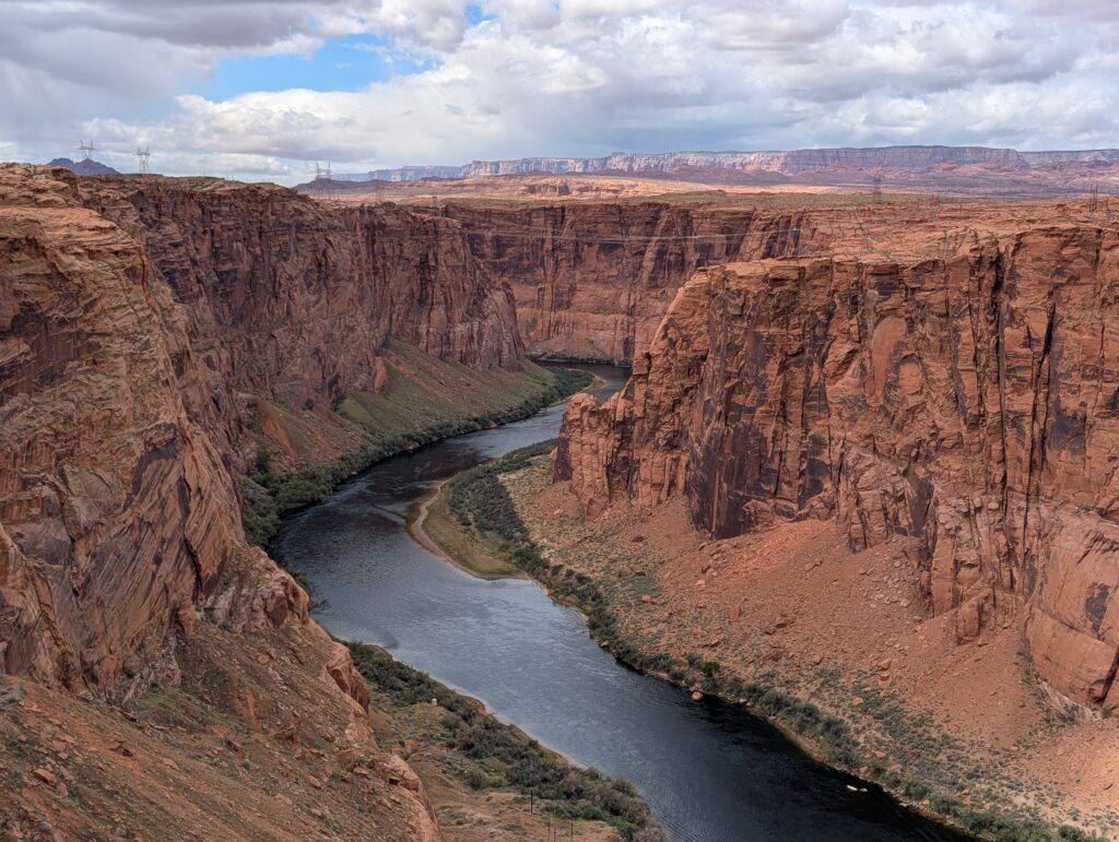
Checked out of our rental and hit the road at 10 am. We had reservations to tour Lower Antelope Canyon in Page, Arizona at 3:15 with Dixie’s Tours so our schedule was built around that. Planned on Horseshoe Bend (1 hour 20 minutes from Kanab) being our first stop. We learned on the way that we’d be gaining an hour, as Antelope Canyon is on Navajo Nation land. They do observe Daylight Savings Time even though the surrounding state of Arizona does not. Score! Make sure you’re aware of the time zones if visiting Antelope Canyon.
Toadstool Hoodoos
It rained most of the morning. As we approached the Toadstool Hoodoos trailhead, about 40 minutes away from Kanab, it stopped. This hike was on my radar, but I made peace with probably skipping it due to the rain and the previous day being so long. I am so glad we were able to do this. There is a free parking lot right on the side of the highway so it adds no driving time. The hike is around 1.5 miles RT and mostly flat – great for families.
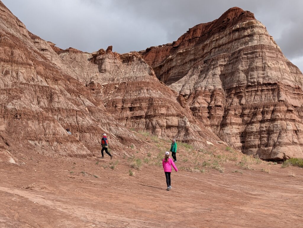
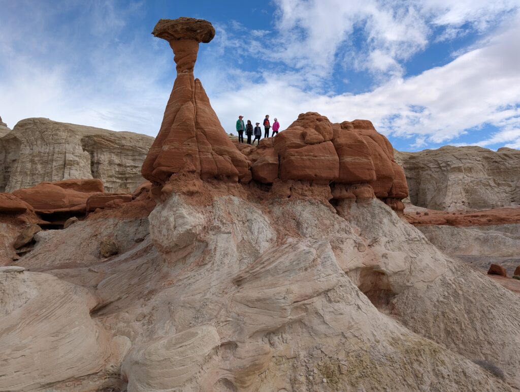
While the previous day had a ton of people on narrow trails and lots of lines, this hike had sections of wide-open land where the kids could run around and explore. We had a lot of fun in the hour we spent there.
Wahweap Overlook and Glen Canyon Dam Overlook
We made a couple unscheduled stops on the way to Horseshoe Bend. Turned at a pull-off for Wahweap Overlook on a whim. I can’t say was necessarily worth it but was free and only a 10 minute detour. You get a view of the water and that’s about it. Nearby, between Toadstool Hoodoos and Wahweap Overlook, is a trailhead for the Wahweap Hoodoos hike. It looks awesome but that hike is almost 10 miles so we did not have time for it.
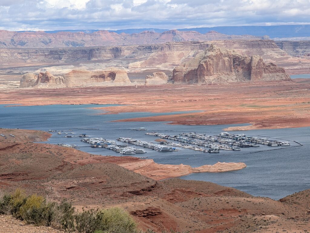
Next was Glen Canyon Dam Overlook. Another quick free stop, maybe 10-15 minutes total and worth it.
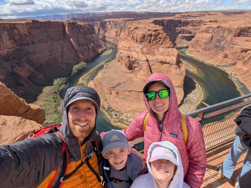
Horseshoe Bend and Biidi the Arch
Continued on to Horseshoe Bend, which has a huge parking lot and costs $10 per vehicle. There is a 0.75 mile trail (1.5 miles RT) to the overlook. This was my second time here – it’s crazy crowded and I’d consider it overrated. It doesn’t take much of your time and it’s less than 15 minutes away from Antelope Canyon. But, there are so many people everywhere. The wind was unbearably strong. We couldn’t stand by the overlook without getting blasted with sand coming up and over the side. While there are some guardrails, the majority of it is sheer drop-offs so we only stayed for maybe 5 minutes. Not a fun place to be with 5 younger kids and strong winds.
Behind the Shell gas station in Page is a “cave” called Biidi the Arch. It’s not really a cave but you can get a wide-angled photo that makes it look like one. Waaaaay neater in pictures than it actually is. Honestly, not worth a stop even though you can walk to it from the lot beside the gas station in 2-3 minutes. Lots of people there, too.
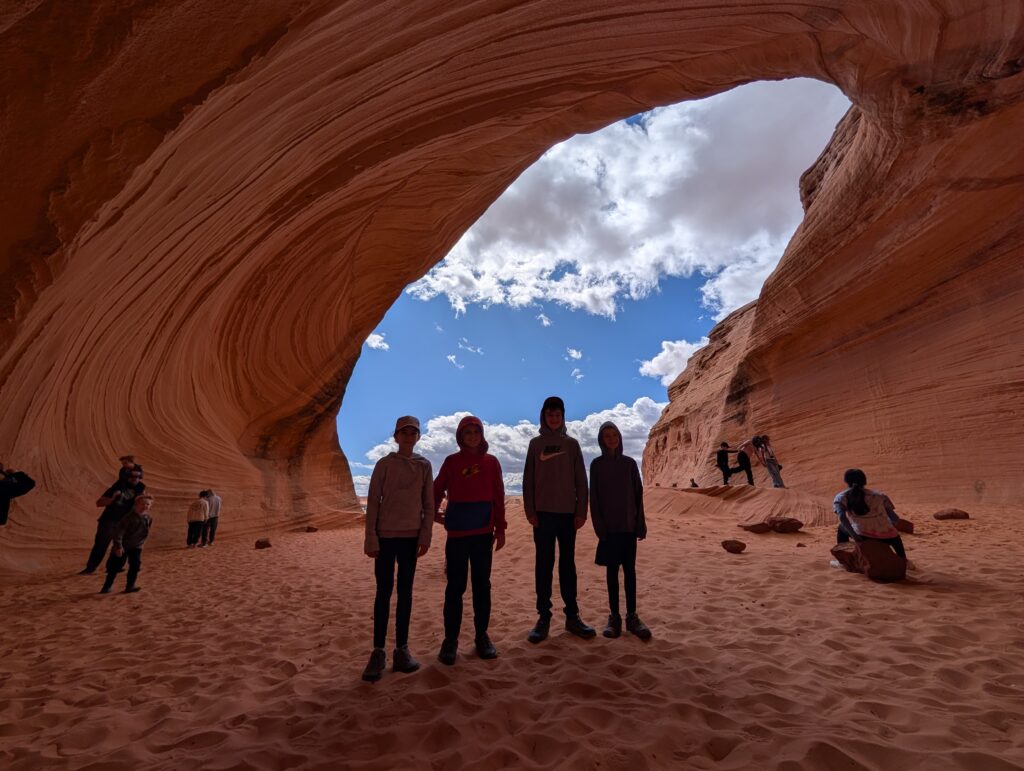
Lower Antelope Canyon
As mentioned, Antelope Canyon is on Navajo Nation land and everyone must pay for a tour to see it. Make sure you buy from the official websites. As of this writing, Ken’s and Dixie’s are the 2 companies offering tours of Lower Antelope Canyon. They’re both owned by members of the same Navajo family.
There are 2 Antelope Canyons: lower and upper. They’re almost directly across the street from each other. Upper is the one with the pictures of the light beams because it’s shaped like an A – wider at the bottom and narrower at the top. Lower is the opposite: wider at the top and narrower at the bottom.
The tour takes about 1 hour, maybe a little longer. This was the thing the kids were most excited about and it ended up being their favorite thing from the trip. It’s an other-worldly place, one of the most unique in the world.
Grand Canyon Nation Park, South Rim
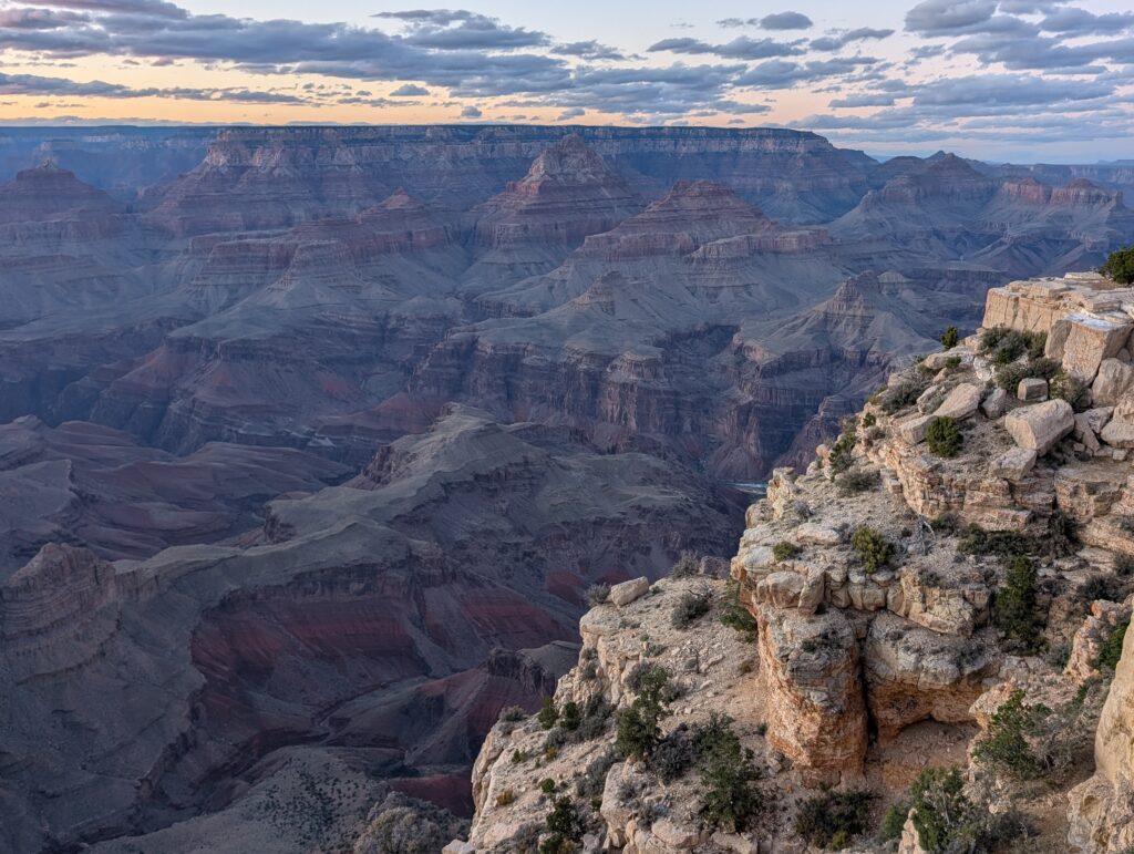
After that, we drove about 2.5 hours to the south rim of the Grand Canyon. This trip would be much easier and less driving when the north rim is open, from May 15 to October 15. But, we were in the area and wanted to see the Grand Canyon so we made the long drive to the south rim since it’s open year-round. We stopped at one of the first overlooks, Moran Point. Had about 5 minutes to look around before it got completely dark. Good preview of what was in store for the morning!
Checked in to our hotel, Grand Canyon Hotel & Suites. Had a great dinner at Plaza Bonita to close out the day.
Day 7
- Grand Canyon South Rim Trail
- Hoover Dam Overlook
- Bellagio Fountains
We had breakfast at the hotel as soon as it was available then got to the visitor center (15 minute drive) before 7:30 am. Tons of parking available. We walked to Mather Point, which is one of the most popular spots on the south rim. No surprise given its location right by the visitor center. The Rim Trail goes in both directions and we headed left (west) to Yavapai Point, about 0.75 miles away.
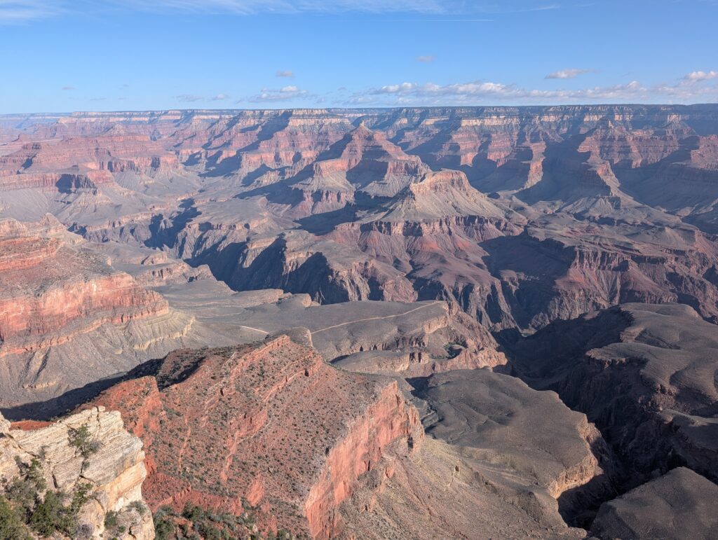
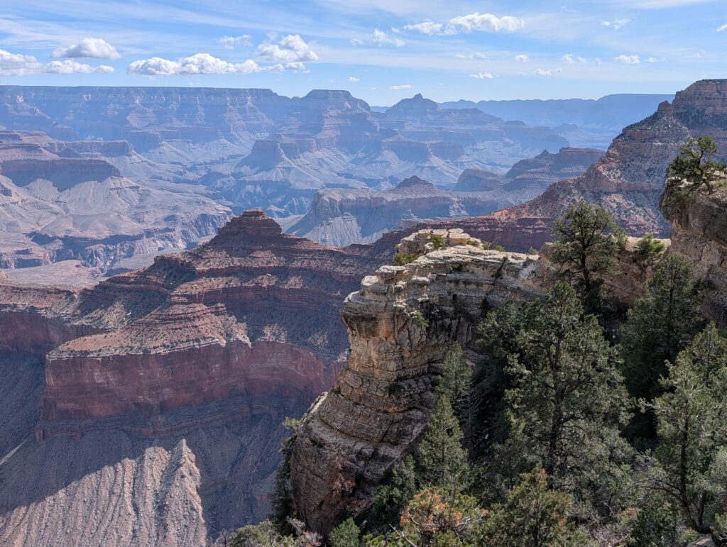
One thing about visiting the Grand Canyon: I had some difficulty figuring out which viewpoints we should focus on because there are so many. Trying to determine the best ones became impossible because every list of favorites was different. I eventually scrapped the idea of which one(s) to drive to and we made it easy by going to the visitor center and walking along the rim trail. That worked out great. I think the point of going there is to see the canyon and marvel at its immensity, and you get that appreciation from most, if not all, of the viewpoints.
I imagine there are some that are more dramatic and some that become personal favorites but I don’t regret only seeing it from a few different spots. The original plan was the 2-mile RT hike that descends a bit into the canyon to Ooh Aah Point, but that would have been too much on a day where we had more than a 4-hour drive plus an overnight flight.
Back to Las Vegas
We hit the road for the long drive back to Las Vegas for our flight around midnight. We stopped to look at the Hoover Dam from the Mike O’Callaghan – Pat Tillman Memorial Bridge. Our route took us along route 93 and over that bridge, not across the Hoover Dam. Right after you cross the bridge and enter Nevada there is a turnoff for Hoover Dam Parking. The road is called Hoover Dam Access Road and the parking spot on Google Maps is labeled “Mike O’Callaghan Pat Tillman Memorial Bridge Plaza.” There are placards detailing the construction of the bridge and stairs that lead up to the pedestrian-only section of the bridge that overlooks the dam. This wasn’t a must-see, especially after already seeing the Glen Canyon Dam the previous day, but it was a good opportunity to break up the drive and see something famous.
Continued into Vegas and parked at the Bellagio ($20) to see one of the fountain shows. Schedule here – every 30 minutes in the afternoon/evening then every 15 minutes from 8 pm to midnight. The 2 best spots on foot are on the sidewalk of Las Vegas Boulevard with the Bellagio in the background, or from the Bellagio grounds with the Vegas Eiffel Tower in the background. To get the tower view, exit the Bellagio’s main entrance and walk to the left along the sidewalk.
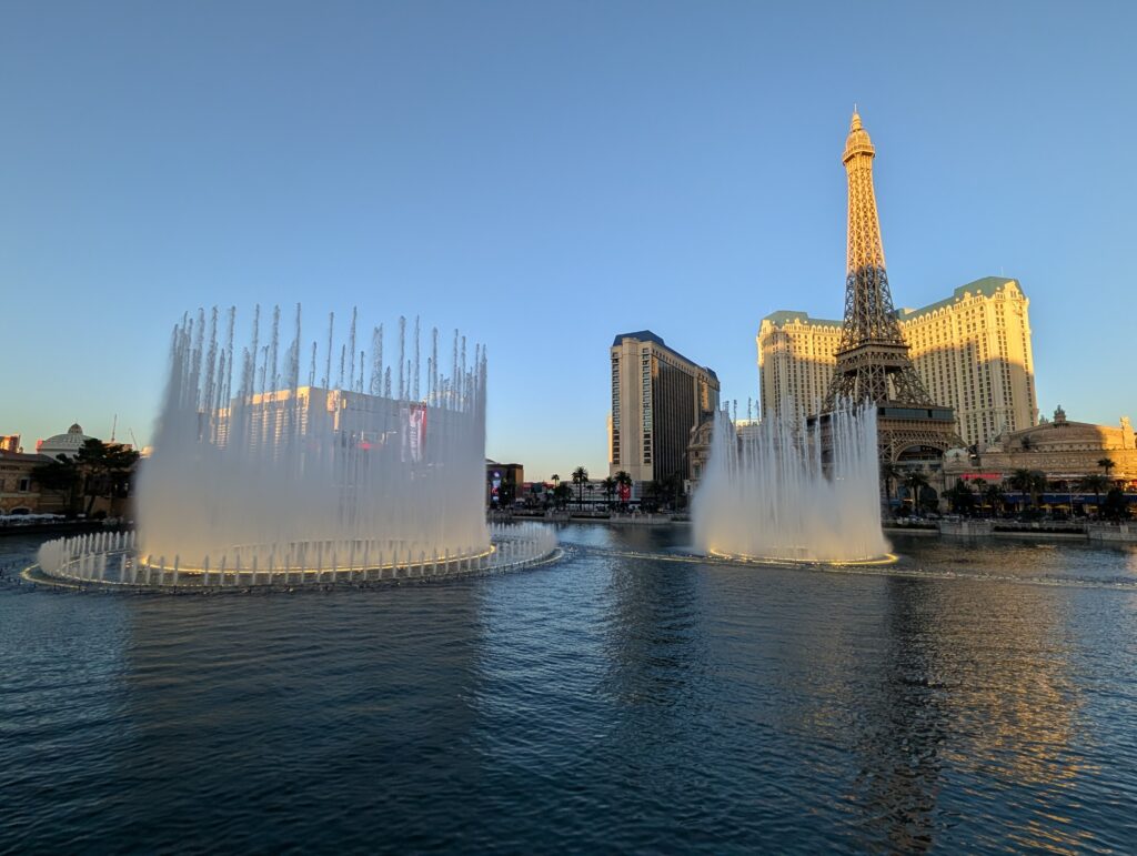
Not bad to see a Vegas show for what came out to be $4 per person
Returned the rental car and got to the airport for our flight back. What a trip!
Final thoughts
We did so many different things on this trip and one of the hardest things to figure out was where to stay. Kanab is a good, central location for most of the spots but it means a decent amount of daily driving. It would have been even more convenient if the north rim of the Grand Canyon was open. It’s around 2 hours each way and could be done as a day trip from Kanab. Overall, Kanab worked out great as a base for us. I’d recommend it if you’d rather not bounce around to a new place to stay every day or two.
Zion National Park is special. It’s the first place my wife and I ever went hiking together and what got me hooked on wanting to see the earth’s most amazing landscapes. It’s quite different from the first few times we went there, however. You have to deal with permits now for Angel’s Landing, have to get there probably before 7 am to get a free parking spot at the visitor center, and deal with long lines and tons of people everywhere. It’s still absolutely worth visiting (especially coupled with Zion Pizza and Noodle) but takes a bit more effort and patience than it used to. As do most of the National Parks.
This entire area is a fantastic destination choice for a family vacation. There are so many other things you can do:
- Lake Powell
- The Wave hike (permits required)
- White Pocket (need a tour or very high clearance vehicle)
- Many other slot canyons like Buckskin Gulch and Peek-a-boo (most require high clearance vehicles)
- Cathedral Gorge State Park in Nevada
Traveled in April 2026
Leave a reply