Guest post by JZWPhoto
Map tips: each color represents a different area of the trip. Click a marker to learn more about the spot, and click the star in the map header to save the entire map under Your Places in Google Maps.
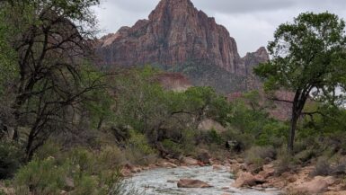
Days 1-4: Yosemite National Park
After purchasing a one-way flight using skiplagged.com I landed in San Francisco on a Thursday afternoon where my friend, Gavin, who lives nearby, picked me up and took me to his place in Oakdale, CA. Oakdale is a farming town with ranches; almonds and walnuts abound. I stayed overnight at Gavin’s, and the next day we made our way to Yosemite after joining a mutual friend, Eric, from San Fran. It was a fairly boring two hour commute into Yosemite, but as soon as we were close the views became incredible.
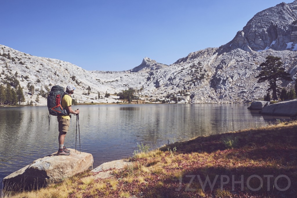
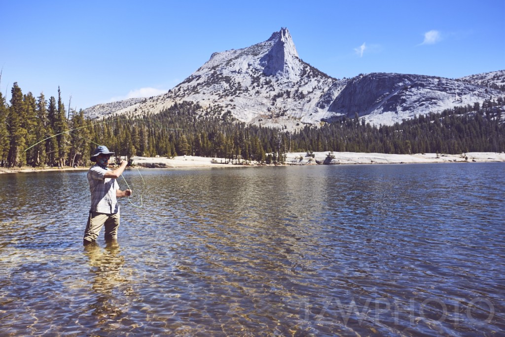
My friends and I are terrible planners. We didn’t account for Yosemite being so heavily traveled, and we neglected to get wilderness passes. Luckily we were able to obtain the only passes left in the park for Cathedral Lakes. We pulled into Tuolumne Meadows on Tioga Road and met yet another friend, Dave, making our group a total of 4. After catching up by our cars, dividing up weight amongst our packs, and taking photos, it was nearing later afternoon. We headed off into the woods onto the John Muir Trail which would take us to Cathedral Lakes Trail. It’s a fairly short hike out to the lake, only around 6 miles, but it was getting dark fast. The initial climb on the trail was pretty difficult for me, with little experience carrying 30lbs of gear on my back. The elevation gain is around 1500 ft overall, and the majority of it was within the first couple of miles. After taking a slight right onto Cathedral Lakes Trail, we arrived at one of the lakes after complete darkness and decided to go ahead and set up camp. We promptly ate and had ourselves a beer and a smoke before taking to our tents. Dave and I woke early to take a hike and catch the sunrise as it crept over Cathedral Peak. The surroundings were absolutely jaw-dropping. It was kind of nice to hike in the dark and be pleasantly surprised by what the morning light revealed. We hung out at camp for a bit and had a leisurely morning with a good breakfast, coffee and some fishing.
Around 1:00 pm we decided we would try and make it to another lake that a ranger told us about. We hiked back a little ways to the John Muir Trail and made a hard right to pass by Echo Peaks. Upon realizing how late we had waited to leave, we decided to go off trail and make a shortcut to our lake destination. We took a left off the John Muir Trail and climbed a gravelly hill for what felt like forever. This is when I regretted the decision to not bring trekking poles, which I now strongly recommend for hiking in Yosemite. When we made it to the top, we had just a little way to go before we reached the bottom of Echo Peaks where we stopped to grab a snack and hang out after that grueling hill. I’m not sure of the elevation gain, but I think it was 1700 feet in just a couple miles, and of course I have to point out that it was all loose terrain! After chatting for a bit and thinking about our hike out the next day, we decided to ditch our plan to make it to the lake. We decided that we would make the summit of Echo Peaks today and then summit Cathedral the following day. We ditched our packs in a recognizable bush at the bottom of Echo and started making our way to the top. Without all the weight on my back I felt as if I could run up the mountain, and it became sort of a race. We reached the summit and overlooked the park from 11,100 feet above as the sun set. It was incredible! We made our way down into the dark and set up camp nearby.
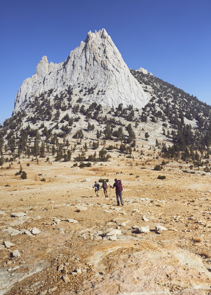
The next morning I woke with a view of Cathedral to my left and Echo to my right. It was pretty spectacular, especially since I am from the east coast. After everyone was up and ready to go, we made our way towards the base of Cathedral, trying to figure out the best possible way up. Once again we ditched our packs in some trees and started the ascent. We reached the summit after a short while and our thighs were very thankful! We hung out and crawled around on the rocks for awhile before making the descent and hiking out to Budd Lake. We were in dire need of water after walking for almost two days away from a supply, so stopping at Budd Lake on our way out was a good chance to refill and take a rest. We arrived at the lake around mid afternoon and quickly filtered some water. We had a snack, made coffee, and I went for a brisk swim just to say I did.
We hiked out late Sunday afternoon when it was still daylight, so I got to witness the beauty of the woods that I had missed in the darkness on the way in. It was an awesome but quick weekend trip with a few lifelong friends. We dropped Gavin off in Oakdale and the remaining three of us headed to San Francisco for Sunday night.
Things I would have done differently:
– Less Food in my pack (I took entirely too much food for just a couple days)
– Brought trekking Poles which are extremely helpful in the rocky terrain
– Less Clothing in my pack (I didn’t change nearly enough to justify extra boxers, socks, and t-shirts)
– Better camera pack such as a strap or waist holster offered by peakdesign.com
Days 5-8: San Francisco to Big Sur
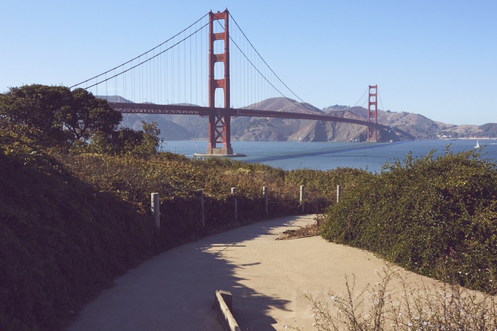
After the tiring weekend, we slept late on Monday morning in San Francisco’s mission district. Dave and I grabbed a pricey cup of coffee at a hip coffee spot, Ritual Coffee Roasters, and then hit the road headed south to Big Sur, planning on meeting up with Eric along the way. Of course we had to do a quick drive by the Golden Gate Bridge since I had never seen it before. We hit the famous Highway 1 with our first stop to be Ano Nuevo State Park in search of a rare San Francisco garter snake and to see some elephant seals. We arrived at the park about an hour or so before sunset only to find that most trails were closed due to construction. Of course, with closed trails, we had no luck spotting the snake or the seals. Eric met back up with us here and all three of us headed to Big Basin Redwood State Park. It was dark when we arrived, but the self serve camping wasn’t full so we were able to get a nice spot that was just a short walk from the car. We spent the evening goofing off and taking pictures. We woke early Tuesday just as the sun was rising and decided to go on a hike through the forest. We took the Berry Creek Falls trail backwards and it was absolutely incredible. It was a fairly difficult hike; however, we took our time, stopping to check out numerous things and to take photos along the way, which made the 10 mile loop with nearly 3000 feet of elevation change seem fairly simple.
Once we arrived back at our cars, we headed south once again. While driving we decided it’d be nice to get our camp set up before dark for a change. We stopped at Sunset State Beach and got a walk-in spot right on the edge of the dunes. We set up camp, got some firewood from the camp host, and headed down to the beach. It was a short walk down the dunes to get to a fire pit where we cooked our dinner as it faded from day to night. Wednesday morning we woke to the sound of crashing waves, a nice treat. Dave and I walked down to the beach for a foggy morning stroll and to snap some pictures before breaking down camp and having a quick breakfast.
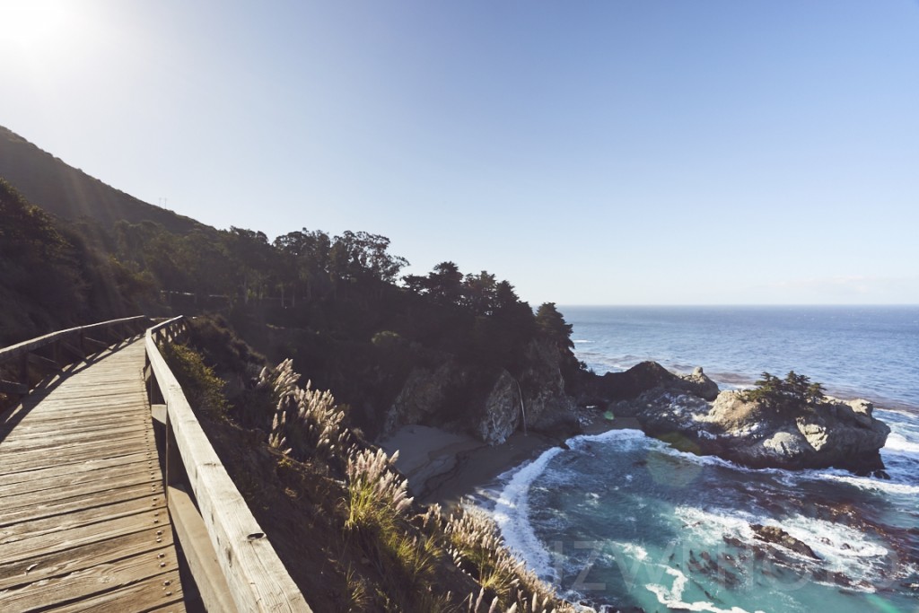
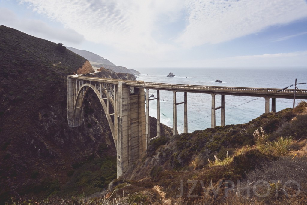
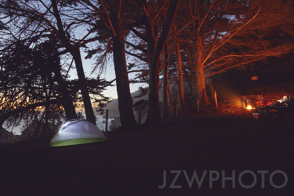
We packed our car amongst a massive crowd of people coming in. We were lucky to find a deserted campground the night before! Our destination today was to grab a campsite and explore the coast of Big Sur. We made a quick stop in Monterey to gather ingredients for a good hearty dinner that night. The further south we got from Monterey and the closer we got to Big Sur, the highway became more and more crowded as everyone was taking caution around all the curves or looking out their windows at all the fantastic views of the Pacific. Due to the major wildfire in Big Sur that summer, a lot of the state campgrounds were closed and those signs started popping up everywhere. We got nervous we wouldn’t find a spot, so we whipped into the next private campground that had availability. We paid for our spot and bought a satchel of firewood and headed south towards Partington Cove. With an entrance not easily seen, we missed the turnoff and ended up at McWay Falls, so we decided to hop out and take a look. I waited near the top of the trail to ask a ranger about Partington Cove and was pleasantly surprised when he informed me of an availability of a campsite just above the falls. I had no idea there were any campsites there and was very intrigued. I walked over to the Visitors Center, and they told me that I would be lucky to get the spot as normally it is reserved 7 months in advance. Due to the fire and the park deciding to open the two lone campsites a day earlier than planned, we nailed one of the best rated campsites on the coast of California. My buddies and I rushed back to the private campground to cancel our reservations and then we actually made it to Partington Cove where we had the opportunity to explore, and we witnessed a sea otter swimming around. We left after a short while so we could see what this top-rated campground was like and what all the fuss was about. A short hike, maybe a half mile or so, down to the campsite revealed a secluded space with only two camp-spots and a breathtaking view. We met our camp neighbors, an awesome couple from Florida who also stumbled upon the spot out of sheer luck, and we set up camp, took some photos and prepared our best meal of the trip: grilled fresh caught fish, fresh California strawberries, bananas, and avocados all mixed together as a chutney. Later in the night we walked the boardwalk out towards the falls and into the darkness for a late night smoke and one of the best night skies I have ever seen.
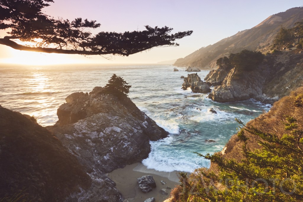
Thursday morning I woke early and headed back to the boardwalk to watch the sun break over the mountains of Big Sur. I was all alone watching a waterfall crashing onto the beach with no sounds but the pattering of the water on the sand and the waves breaking below. It was perfect. I sat alone for nearly 2 hrs with only the company of the birds, and I witnessed a Condor flying around the cove in search of its morning meal. The fires of the summer had pushed the Condors out of the mountains to nest down near the coast. It was an awesome sight and moment, one I will cherish for a long time.
I made it back to camp to find my buddies awake and preparing a quick meal. We packed the car shortly after and headed further south down Highway 1.
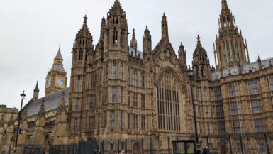
We drove for a few hours, made some sightseeing stops along the way, and reminisced about the previous days of the trip. We were sad that the end was coming, for the next morning my return one-way flight was scheduled out of Los Angeles. It was then I made the decision to call my boss and extend my vacation for another week. We talked about where else we might travel and hike, and we all agreed on the change of plans as we headed back on a 6-hour drive to San Francisco to get a shower and finalize our trip for the coming days. Once we had a plan I booked a flight for the following Friday out of Chicago, IL to return to Charlotte, NC using skiplagged.com once again.
Things I would have done differently:
– Planned stops and time frames before the trip. We had a blast with our spontaneity, but I feel as if we missed some important sightseeing because we weren’t sure exactly what we wanted to do.
– Next time I will book the amazing camp spot 7 months in advance and not just count on luck.
Days 9-15: Yellowstone National Park
Friday morning Dave and I woke in San Fran and found another fancy coffee shop, Cafe Lataza. We sipped our coffee and chatted about the possibility of making it to Yellowstone National Park, a 15 hr drive, before sunrise on Saturday. We decided it was doable with some stops to resupply and a stop to get Dave’s car a quick tune-up.
We drove I-80 to I-93 to I-84 which merges into I-86 and then turned north onto I-15 which merges with I-20 and eventually brings you into Yellowstone on 1-91. Driving almost entirely in the darkness, we didn’t see much scenery, but around 6:00 on Saturday morning, while Eric slept in the back, Dave and I spotted a moose on the side of the road and quickly pulled over to take a closer look. This was our sign that we were nearing the entrance of the park.
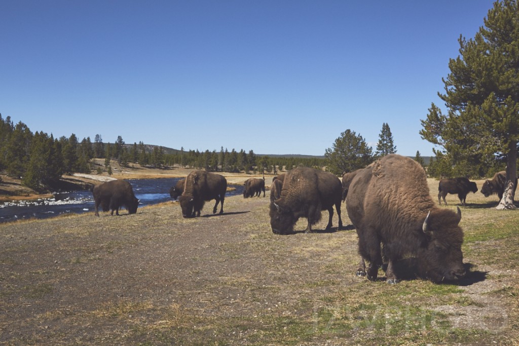
An hour after our moose sighting, we made it to Yellowstone’s West entrance and into Madison Junction Campground. There were tourists everywhere! We immediately envisioned the horror of sleeping sandwiched between 2 large RVs with their generators running all night long! Fortunately, we got some info from the camp host about another “more secluded” campground on the northeast side of the park that might have some spots open, so we drove 45 minutes to see what we would find. On the way we drove through some light snow flurries and saw a bunch of vehicles stopped on the side of the road. We pulled over to see what the fuss was about and it turned out to be three or four black bears playing around in the evergreens below Mt. Washburn. Very cool! And then, sure enough, luck was on our side and we scored one of the best camp spots in the entire park at Slough Creek Campground! We set up our tents at our prime location right next to the creek and stashed our food in the bear lockers. We had a little time before dark, so we hiked a quick trail along the creek that led us into a recently burned forest. We were trudging through muddy ash up to our knees in some places, looking for an easy way to cross the rushing water. With some sketchy rock skipping, we finally made it across and the ground transformed almost instantly. It became luscious green grass that was heartily welcomed after all the mud we had just been through. There was a slight mist in the air and it felt as if we were in the middle of nowhere, even though we were relatively close to camp. We found a foot path heading in the right direction back toward camp, and following it for a bit we came across tons of bison hoof prints and bones. But then we reached another creek crossing. We searched again for a decent place to cross without getting soaked until we all went our separate ways to find our own path. I crossed in a shallow section hoping that I could manage to walk on rocks under the water just enough to keep my boot tops peaking out. About halfway through the creek I lost my balance and both feet ended up fully submerged. I got back to camp and removed my boots to dry, waiting for Dave and Eric who both arrived shortly, carrying soaked boots as well. We built a fire to help with the drying process and cooked our dinners and called it a night.
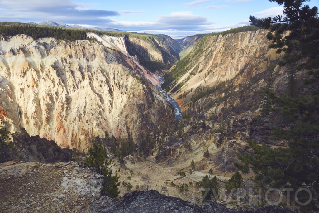
Sunday morning came, and once again Dave and I woke early and left Eric sound asleep as we took a quick drive to check out the scenery. We drove into the Lamar Valley and spotted a caravan of vehicles parked on the side of the road. Of course we stopped, and there were two bald eagles and a coyote feeding on an elk carcass. Pretty incredible! Back at camp, we woke up Eric and cooked breakfast, and after a leisurely morning, we drove south to find a Visitors Center so we could figure out where to hike. With a park map and little bit of info we headed to a nearby 8-mile trail. We started at the Howard Eaton northern trailhead and followed it to the Clear Lake/Ribbon Lake loop where eventually we would make a left to cut over to the South Rim Trail that would lead us all the way back to our car along the cliffs of the Grand Canyon of Yellowstone. This trail has a lot to offer as we ran into “wild” hot springs and mudpots, bison, and some amazing views of the Yellowstone River and the painted earth of the canyon. It was nearing dark on our way out and we still had to make the 30 minute drive back north to our campground. Along the way we spotted tons of wildlife: big horn sheep, antelope, elk and a fox. Arriving back at camp after dark, we built a fire, ate dinner and took to our tents after researching our next big hike for Monday.
I woke first in the morning before daylight and made tons of noise in getting ready for the day, and it was also my trick to wake up Dave and Eric! With everyone up within 30 minutes or so, we filled our water containers and lightened out packs for a long day hike. Once again we started at the Howard Eaton Trailhead, but this time we continued on the trail south for the 16 mile trek through bear and wolf country. This trail caught my eye as I was searching for hikes on the internet (when the rare bit of service in the park permitted it). It was described as walking through the middle of all the “action” of wolves, grizzlies and some herbivore species. We walked and walked by creeks, the prints of elk, bison and wolves, wolf scat, bear scat, bear fur and bones, but to no avail did we see wolves or bears themselves. It was an incredible hike with lots of interesting sections through fields and forests. We ended the trail with plenty of daylight left but it was a one way hike, so we had to hitchhike back north to our car. It took a while for someone to stop, but eventually a Chinese couple stopped to ask for directions and we talked them into giving us a ride. I’m sure it was exciting for them to go home and tell their friends they picked up three dirty American hitchhikers! After the long day and our venture back to camp, we were entirely exhausted and crashed pretty early.
On Tuesday morning we decided we would spend the day doing typical tourist activities. We drove south to cook breakfast along the edge of the Yellowstone River with hopes of getting a chance to see some carnivorous activity in Hayden Valley where we had walked through just the day before. Unfortunately it was an extremely foggy morning so we didn’t see anything but grey across the river; however, it made for some great photographs. After breakfast we drove down a little further to Yellowstone Lake where we were blessed with the sight of a family of river otters fishing. Once the otters swam far enough out of sight to justify leaving, we headed up to all the tourist attractions, stopping at different geothermal boardwalks along the way. The attractions were really impressive but they were also incredibly crowded with people from all over the world. We also made a stop at Old Faithful because it would be crazy to be in Yellowstone and not scratch that one off the list. We watched the geyser spew its mist into the air and then made the trip back to camp. I was exhausted so I decided to stay at camp and relax with Eric while Dave went out to try and catch some more wildlife off the main road.
Wednesday we woke up and packed all of our gear as we were headed out for South Dakota to stay overnight with a friend of Dave’s. On our way out of the campground, I was feeling bummed that we didn’t get to witness any wolves or grizzlies. But as we neared the main road we saw another crowd of people with their long lens cameras and scopes out. We stopped and quickly realized that everyone had their lenses pointed at a group of three wolves in Lamar Valley. Dave and I merged in with the crowd of people and cameras. We talked with a couple who were yearly Yellowstone visitors and shared their scopes as well as all their knowledge about the wolves. Two hours and two cups of coffee later, the wolves disappeared into the brush and we knew it was time for us to hit the road.
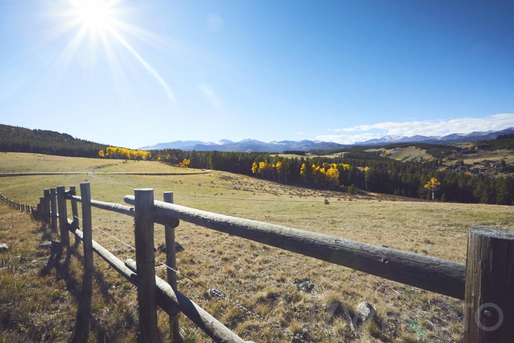
We spent the remainder of the day driving I-90 East through Wyoming and into South Dakota. We stopped a couple of places to take photos and admire the yellow aspens that were plentiful, and eventually we landed just south of Black Hills at Dave’s friends house in Custer, SD. We spent the evening talking about our trip and dreading the drive to Wisconsin the next day.
Things I would have done differently:
– Brought a long lens (My trip was planned mainly for the views of Yosemite so I only brought short lenses. For all the wildlife photo opportunities in Yellowstone a long lens is really a necessity.)
– Brought Binoculars (Dave had a nice pair but we were constantly passing them back and forth. I suggest all parties have their own decent set of Binocs for Yellowstone)
– Spotting Scope (If possible I think a spotting scope would be a great addition for a trip to Yellowstone.
Days 16-17: Badlands National Park
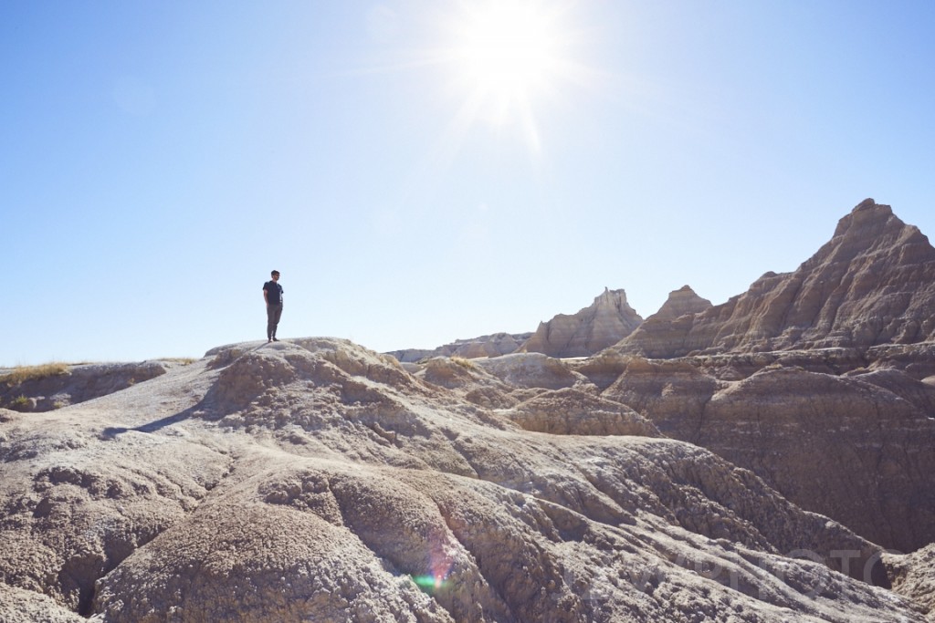
With a good night’s sleep and a shower we were all up pretty early and ready to move. We decided to make a quick detour to drive past Mt. Rushmore. The park seemed pretty empty and because of the $15 dollar entrance fee, we kept on trucking and were able to catch a quick glance of the monument from the 244, the road we were driving on. Pressed for time, we kept going but ultimately decided to make another detour to drive through Badlands National Park. We took the exit off of 90 East and made the short drive south into the park but only making a couple quick stops to check out the scenery. This is definitely a place I would like to return to and spend some time. With the necessity of making it to Wisconsin by nightfall, we pressed on. The speed limits were incredible and we were driving 85-90mph the majority of the way. Once we were into Wisconsin, the roads became much different: small and winding through countryside with old barns scattered throughout. We made it to our destination, Token Creek, a small park/fishing destination just north or Madison where Dave’s uncle was on a weekend fishing trip. We crashed there for the night after drinking beers by a fire and sharing stories.
Friday morning we rose and took a quick walk around to see the sights with Dave’s uncle but had to cut it short in order to make it to Chicago so I could catch my flight back to Charlotte, NC. We drove the 3 or so hours with only a stop for fuel and lunch before we arrived at the airport where I left my two friends. They would spend the night in Chicago, and Eric would fly home to San Francisco the next day as Dave would continue his journey alone back to Virginia.
Traveled in September 2017
Leave a reply