If you take away nothing else from this page: please follow the 7 principles of Leave No Trace whenever hiking (and all the time, actually – most are pretty good general life tips, too):
- Plan ahead and prepare
- Travel and camp on durable surfaces
- Dispose of waste properly
- Leave what you find
- Minimize campfire impacts
- Respect wildlife
- Be considerate of other visitors
Now, on to Thompson Peak. Here are the quick facts:
- Where: Sawtooth National Forest, Idaho
- More specifically, where: the Redfish Trailhead at Redfish Lake, 10 minutes south of Stanley, Idaho
- Distance and elevation: 13 miles (21 km) with 4,200 feet (1,280 meters) of total elevation gain
- Highest point: 10,750 feet (3,2750 meters) at Thompson Peak
- Why you should hike this trail: summit the highest peak in the Sawtooths with a class 3 scramble – no equipment needed, but caution is
- Fee or permit? Yes – free self-issued permit when entering the wilderness area
- Best time of year: June-September
Tips
- This is not an official trail – take a GPS
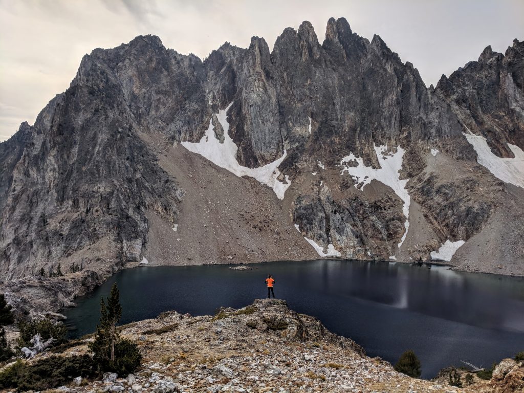
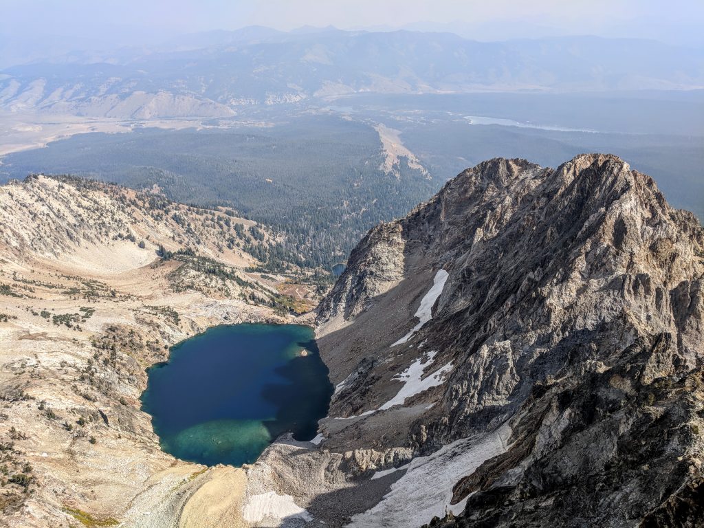
- There is an unnamed lake at the foot of Thompson Peak sometimes called 9000 Lake (also referred to as Goat Lake, but there’s another “actual” Goat Lake). This is a beautiful destination on its own. While the trail to get to the lake is easy enough to follow, there is no real trail past the lake. Consider turning around if you’re unsure where the trail goes.
- You’ll need all 4 limbs to get to the summit. You don’t need a rope or helmet, but it is a steep climb to get to the top. No shame in turning around!
- The Redfish Lodge, right by the trailhead, books up far in advance. Plan at least 6 months in advance for high season bookings if you want to stay there.
The details
Stanley, Idaho, the heart of the Sawtooths, is about a 3 hour drive from Boise and 1 hour drive from Sun Valley. If you’re coming from Sun Valley, you’ll be heading north on Route 75 and will look for Redfish Lake Road on your left, which leads to Redfish Lake Lodge.
If you’re come from Boise or staying in Stanley, you’ll be coming south on Route 75 so the road will be on your right.
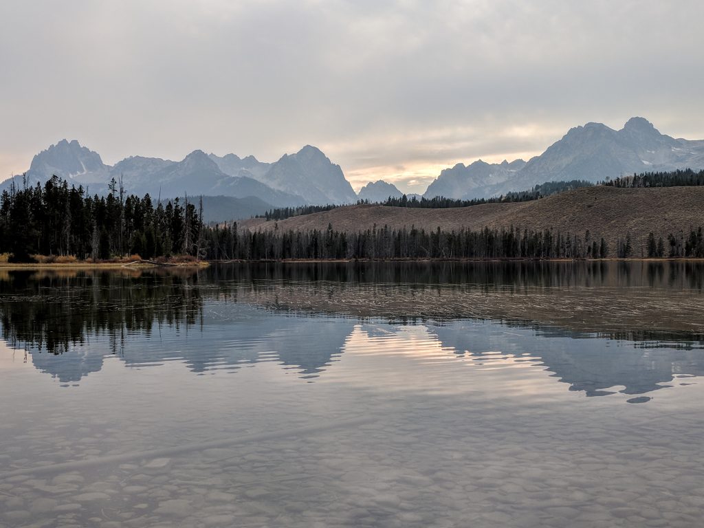
Once you turn on Redfish Lake Road, you’ll first pass Little Redfish Lake, which is worth a quick stop either on the way in or way out.
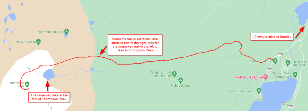
The Redfish Trailhead is before the Lodge and there is a dirt parking lot on your right. Park here and take the trail to Marshall Lake. There are a few intersections early on as you go through an aspen grove – keep following the signs for Marshall Lake.
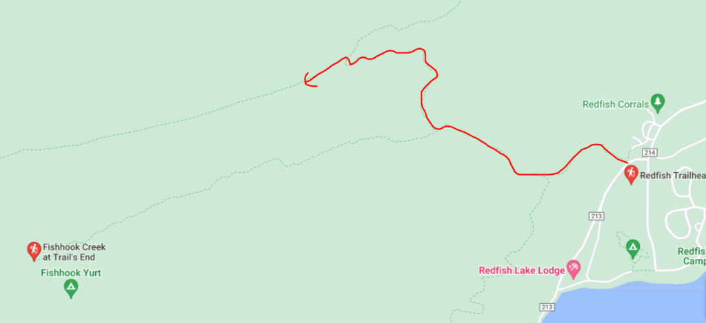
While navigating the first part with all the trail splits, you’ll pass through an aspen grove, gain some elevation, and then have a flat stretch along a ridge when you get to the long straight section by the arrow above. There are some fantastic views of the Sawtooths from up here – enjoy it on the way because this part is kind of a slog on the return when there’s not as much to look at.
So far this is a well-established trail with signs pointing you to Marshall Lake at every turn. About 3.8 miles total from the trailhead, and 2.5 miles from the last trail intersection, the trail will turn to the right. While there is no sign here, it is a noticeable turn to the right and there is a fainter, but still noticeable trail that shoots off to the left:
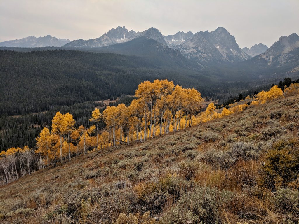
Take the trail to the left. You’ll still be in the woods for a little while, but the stellar views return when it opens up as you cut across and around a slope:
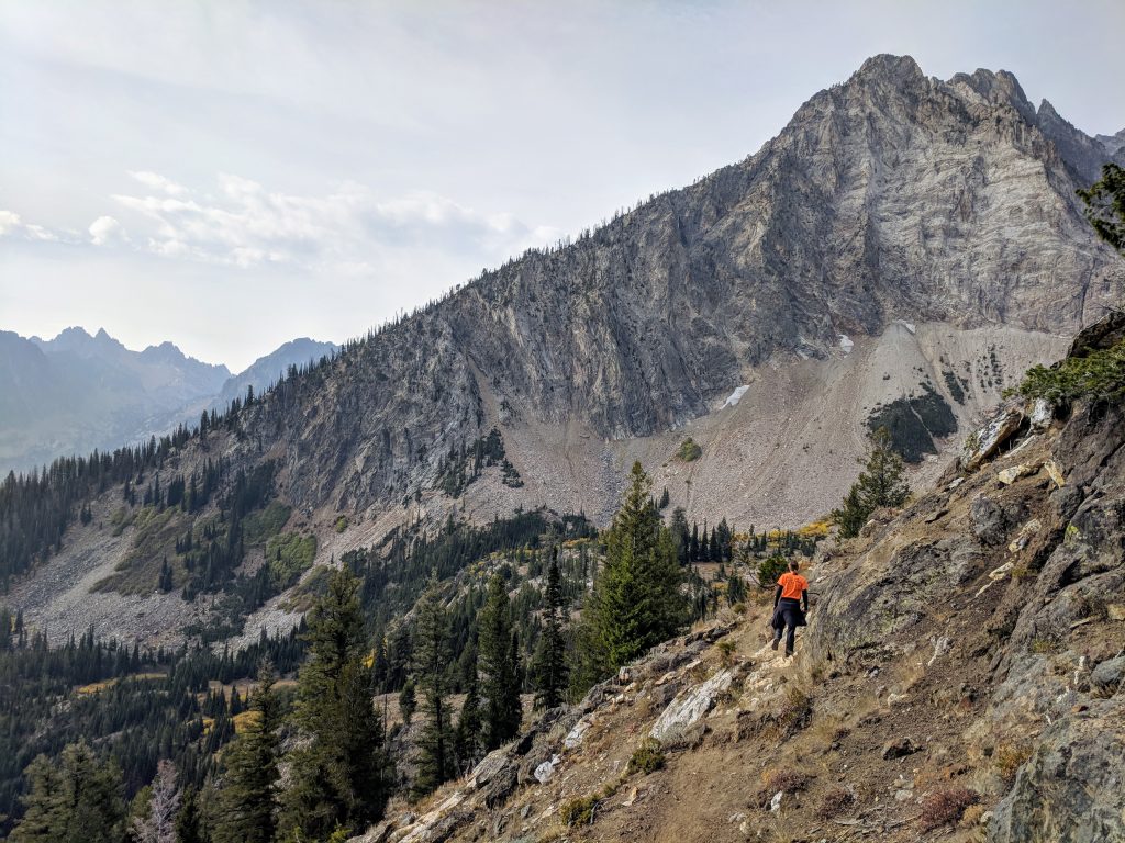
From the position in the picture above, you’ll curl around clockwise and Thompson Peak will come into view.
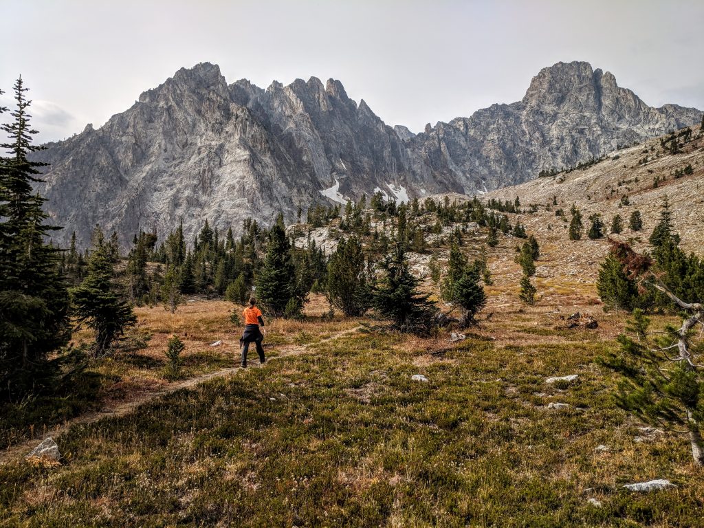
You should be able to follow the trail all the way to the lake, which is just under 1 mile from the unmarked turn to the left when you leave the Marshall Lake trail. If you lose the trail at any time, just head straight for Thompson Peak. The lake won’t come into view until you’re right by it and it is quite the scene. This is an excellent spot to have lunch and prepare for the final ascent up to the peak. If this is your final destination and turn around after admiring the lake, it’ll be about 9.5 miles RT.
To continue to Thompson Peak, you’ll have 1,700 feet of elevation gain to go in less than 2 miles. Once you’re ready to tackle that, head counter-clockwise around the lake and go up the steep incline over the saddle on the right side. You may be tempted to head for what looks like a trail around the front side of Thompson Peak – do not head this way. We were warned by a local that people get into trouble there and to always go clockwise around the mountain and summit from the backside.
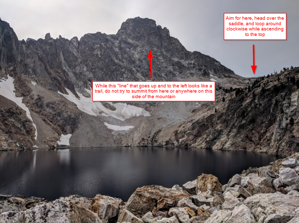
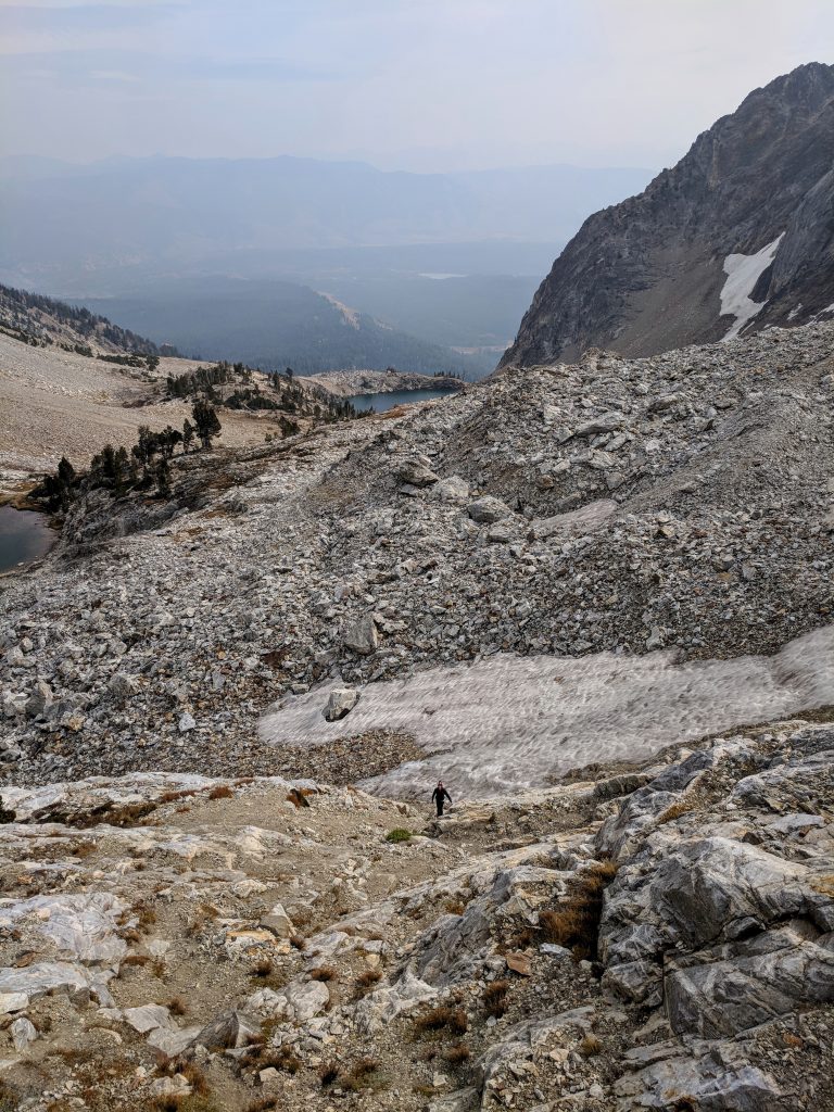
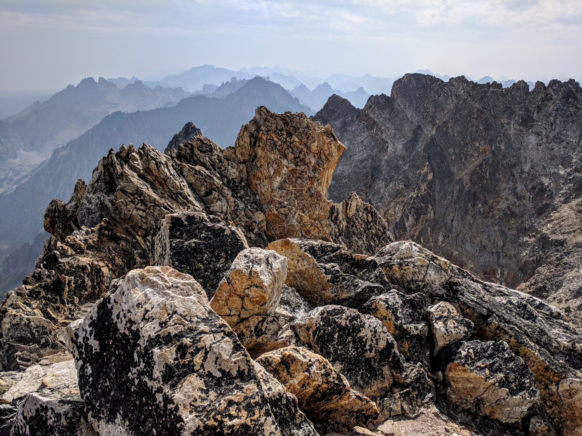
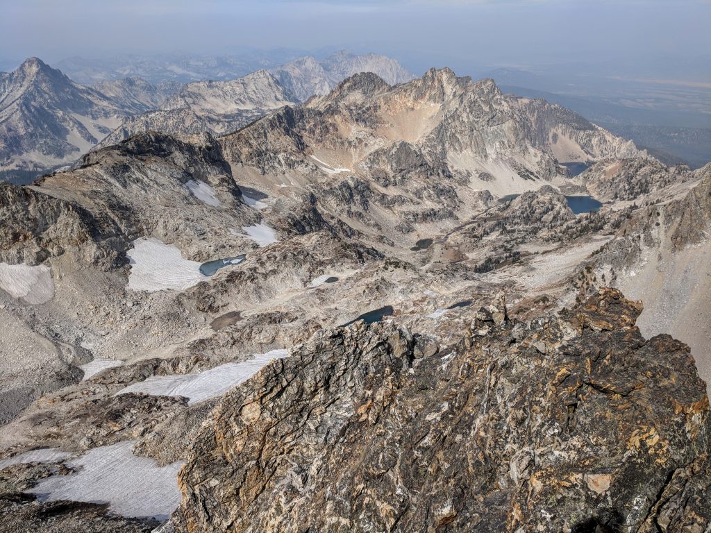
You may need to go over some snow – crampons and/or poles could be helpful. Once you get up and over the saddle, the toughest part of the hike awaits. It’s a steep climb and scramble to get to the summit. There’s no real trail and it’s very rugged, rocky terrain. There might be cairns at some spots but you can just head for the highest point. I remember stopping to assess the approach multiple times, and towards the very top I had to backtrack a little and take a different route. There are times when you might need all 4 limbs but you’re not faced with major exposure until the actual summit (and only if you choose to – there’s enough room so you don’t have to go to the edge). The views from the top are spectacular in every direction.
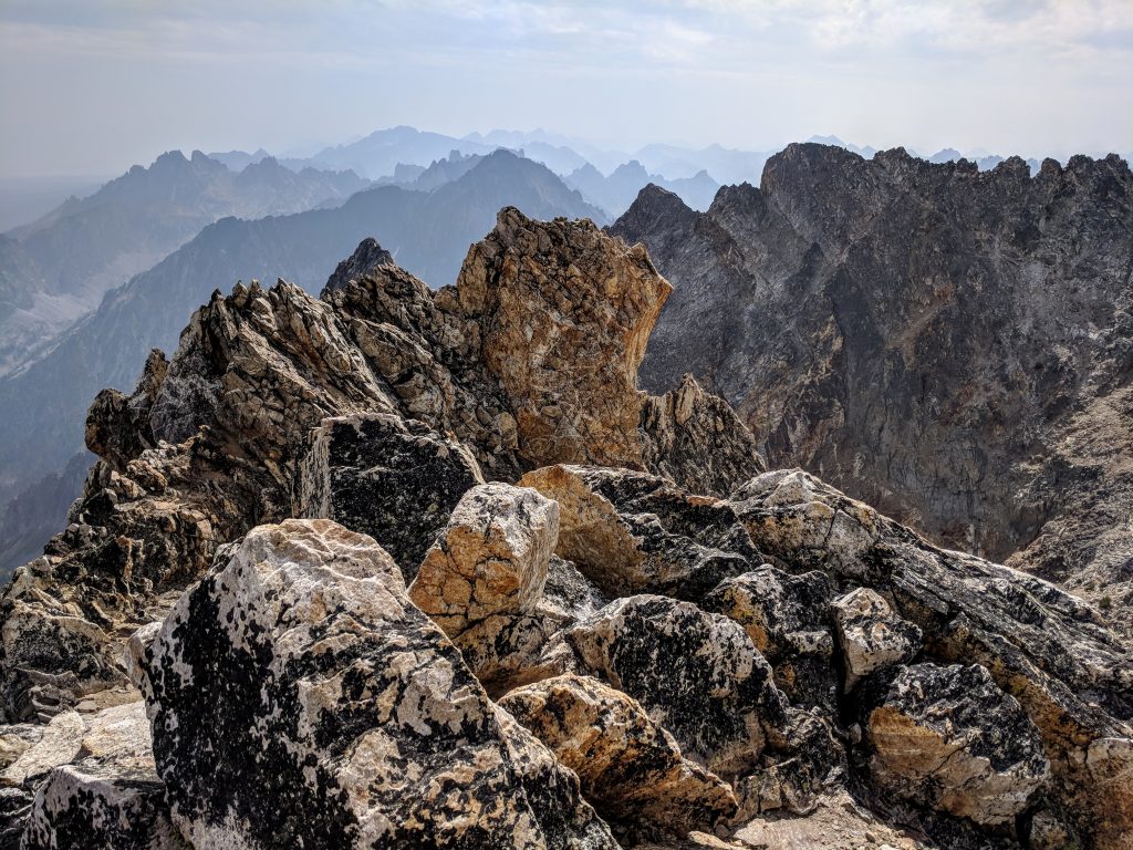
There is room for a couple people on the summit but any more than that would be very crowded and potentially unsafe. Retrace your steps for the return hike, taking care on the initial descent from the summit and when coming down the steep saddle. Remember you’re going down 1,700 feet in less than 2 miles so it might take a little longer you’d like. It’s a very easy walk back from the unnamed lake, but the long, flat stretch along the ridge can feel like it takes forever. Make sure to turn around at times to admire the views.
Have you ever done this hike, or have questions on it? Please leave a comment below!
Leave a reply