Map tips: each color represents a different day. Click a marker to learn more about the spot, and click the star in the map header to save the entire map under Your Places in Google Maps.
Day 1
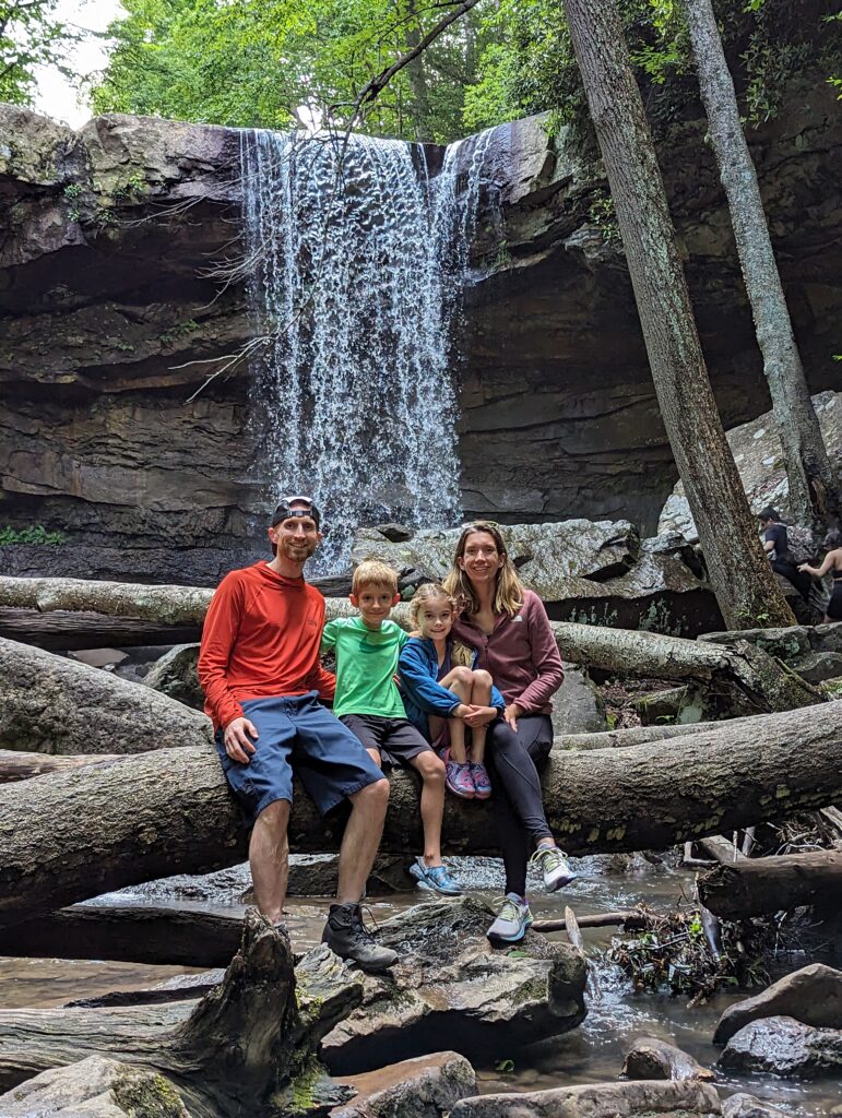
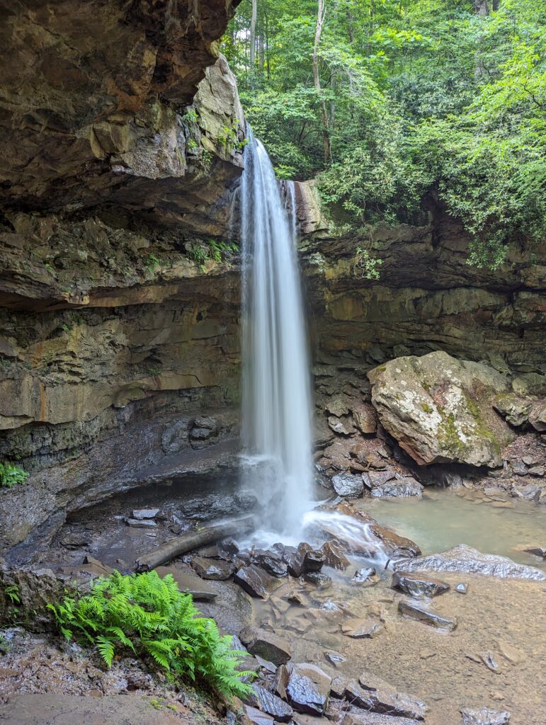
- Cucumber Falls, Ohiopyle State Park
- Hermitage Inn & Taphouse
We drove 3 hours from Cleveland to Ohiopyle State Park in Pennsylvania. We used the 5-minute walk to Cucumber Falls as a good spot to break up the 5-hour drive. There is a parking lot that holds about 20 cars and lots of side-of-the-road parking nearby, too. It’s a year-round, easily accessible waterfall so expect crowds if you’re going during peak times. Be prepared to get your feet wet and do a little boulder hopping if you want to get right to the bottom of the falls, too. We spent about 30 minutes total exploring around the water. Right down the road is the natural rock waterslide, which I imagine we’ll do someday in the future.
We drove the remaining 2 hours to Petersburg, West Virginia, where we had booked 1 night at the Hermitage Inn & Taphouse. We had dinner at the taphouse and thought the food, room, and service was great.
Day 2
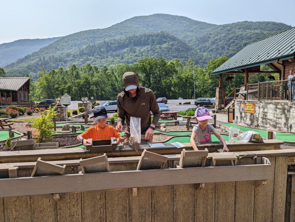
- Smoke Hole Caverns
- Mallow’s Roadside Cafe
- Chimney Top hike
After the small but ample continental breakfast at The Hermitage, we drove 15 minutes to Smoke Hole Caverns. They have cavern tours, mini golf, and gemstone mining. We did the gemstone mining (kids loved it) and browsed through their huge gift shop.
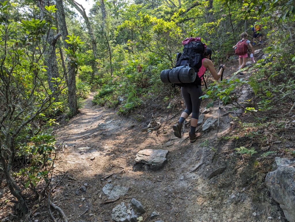
Had a quick lunch at Mallow’s (cheap and very standard food, what you’d expect) and drove to North Fork trailhead on Smoke Hole Road for the hike to Chimney Top. I’ve seen the distance reported as 4.7 to 6 miles RT, but every source is consistent about the ~2,000 feet of elevation gain. I use the Gaia app and it has it about 4.8 miles RT.
There is a small lot for about 6 vehicles right at the trailhead; side-of-the-road parking on the opposite side; and a smaller lot less than a minute before the trailhead, too. If there’s nothing available by the North Fork trailhead, you can continue down Smoke Hole Road to the Landis Trailhead. You can that trail up to the ridge and approach Chimney Top from the opposite direction. It seems similar to starting at North Fork trailhead but with less elevation gain and maybe a little more mileage.
Back to the North Fork trailhead, there’s a trail map for the 24-mile North Fork Trail but Chimney Top is not represented. Luckily, the beginning of the route it is as straightforward as it gets. There are blue trail markers on the way up and the entire hike is in the shade. It’s a steady climb the whole way and there are a couple places to pop out to the ridge for a rest while enjoying in the views. None of them are more than 30 seconds off the main trail so you might as well check them out and take a breather.
After ~2.2 miles and 1,800 feet of elevation gain there is a trail that shoots up and to the right. It’s relatively easy to miss but there was a cairn when we were there. This is where having an app like Gaia with offline navigation is extremely helpful.
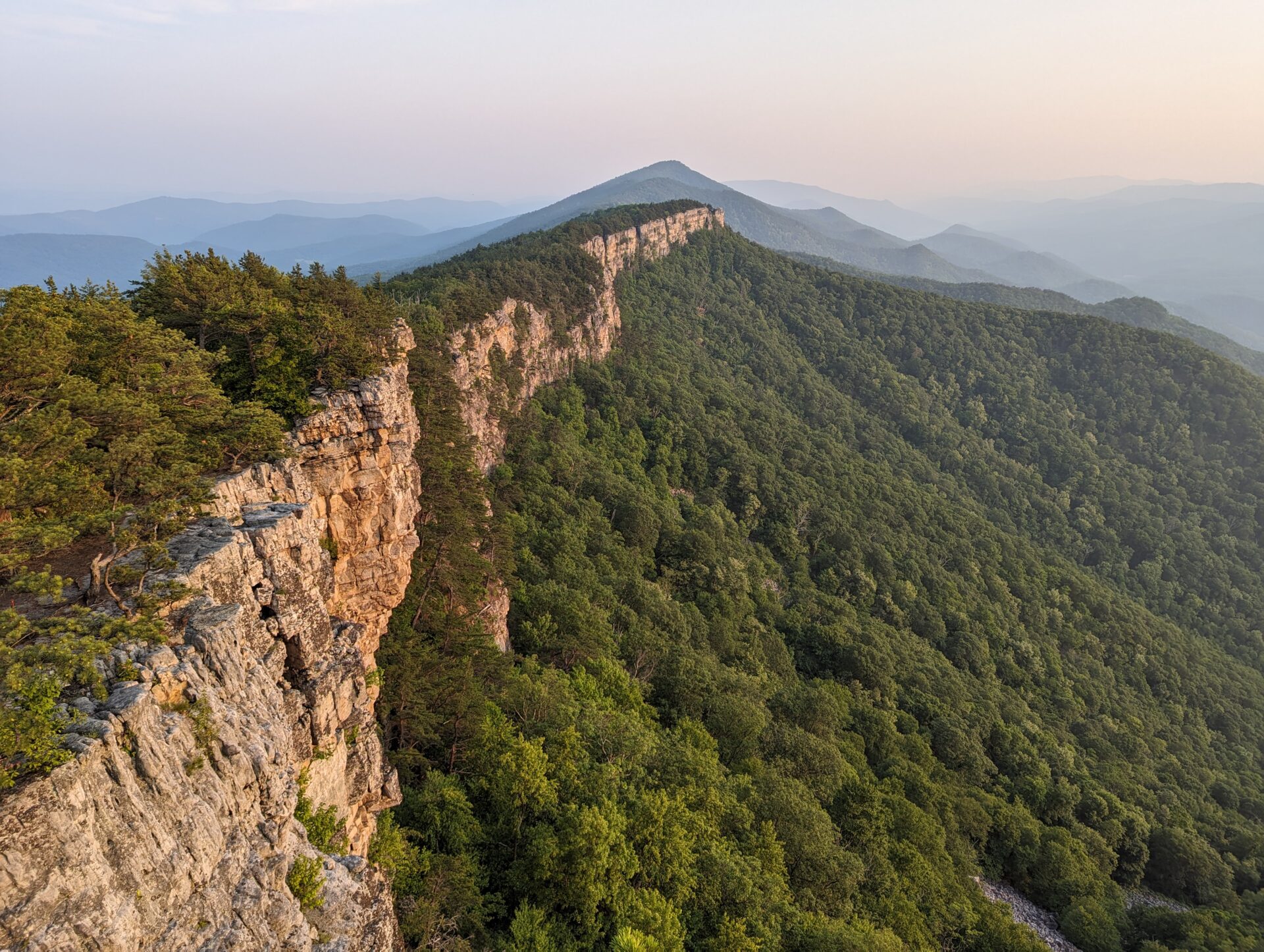
The final stretch to Chimney Top is less than a quarter mile and ~150 feet of elevation gain so it is the steepest part of the hike. Once you’re at the top, explore the different views and rock outcroppings. Be careful as there are sheer drops where a fall would be fatal.
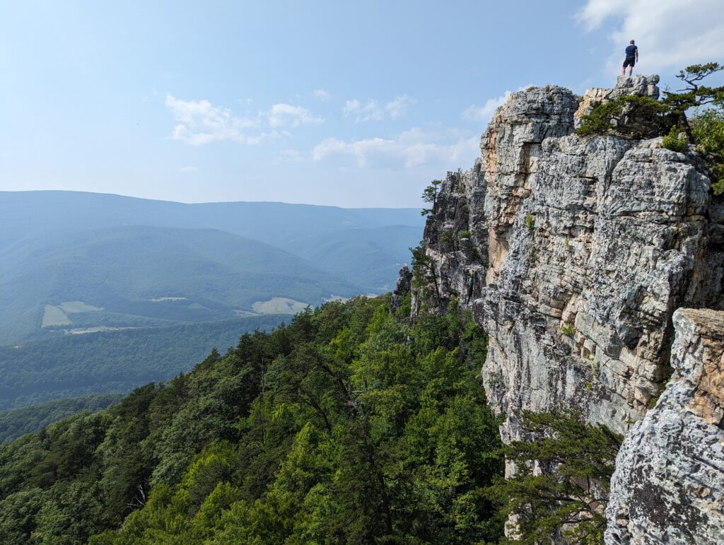
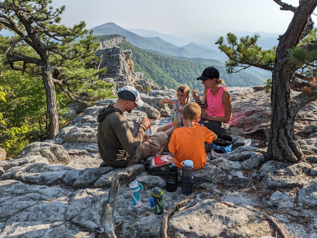
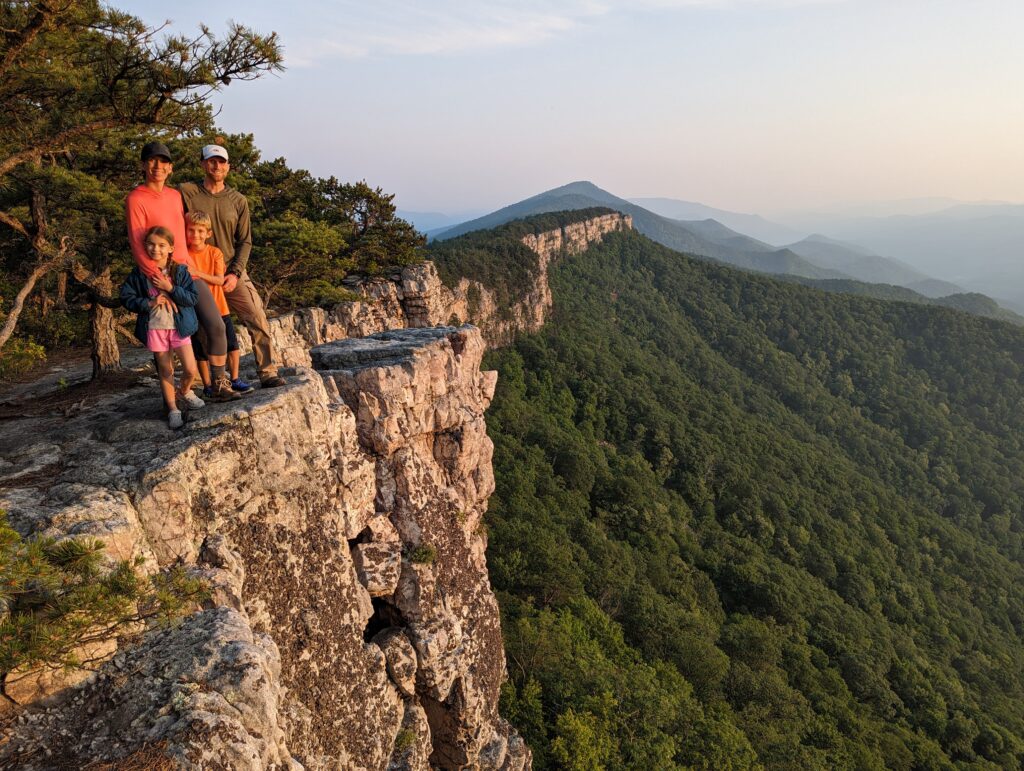
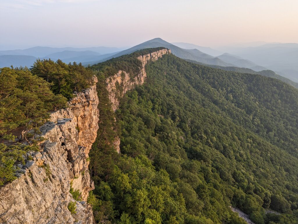
It took us 2 hours 45 minutes on the way up with plenty of stops. This was the hardest hike our kids have ever done and thankfully they did great. There were about 10 other people up there but everyone cleared out by 5:30 and we had the whole place to ourselves for the rest of the evening. We set up camp, had dinner, and called it a night after the sun went down.
Day 3
We packed up, headed down (2 hours), and stopped back at the Hermitage to pick up luggage we left there. Grabbed some blizzards from DQ as a post-hike treat for the kids and drove straight back home.
Traveled in June 2023


Leave a reply