Map tips: each color represents a different day. Click a marker to learn more about the spot, and click the star in the map header to save the entire map under Your Places in Google Maps.
Day 1
- Cathedral Falls
- Long Point Trailhead
- Pies & Pints
- New River Gorge Cabins
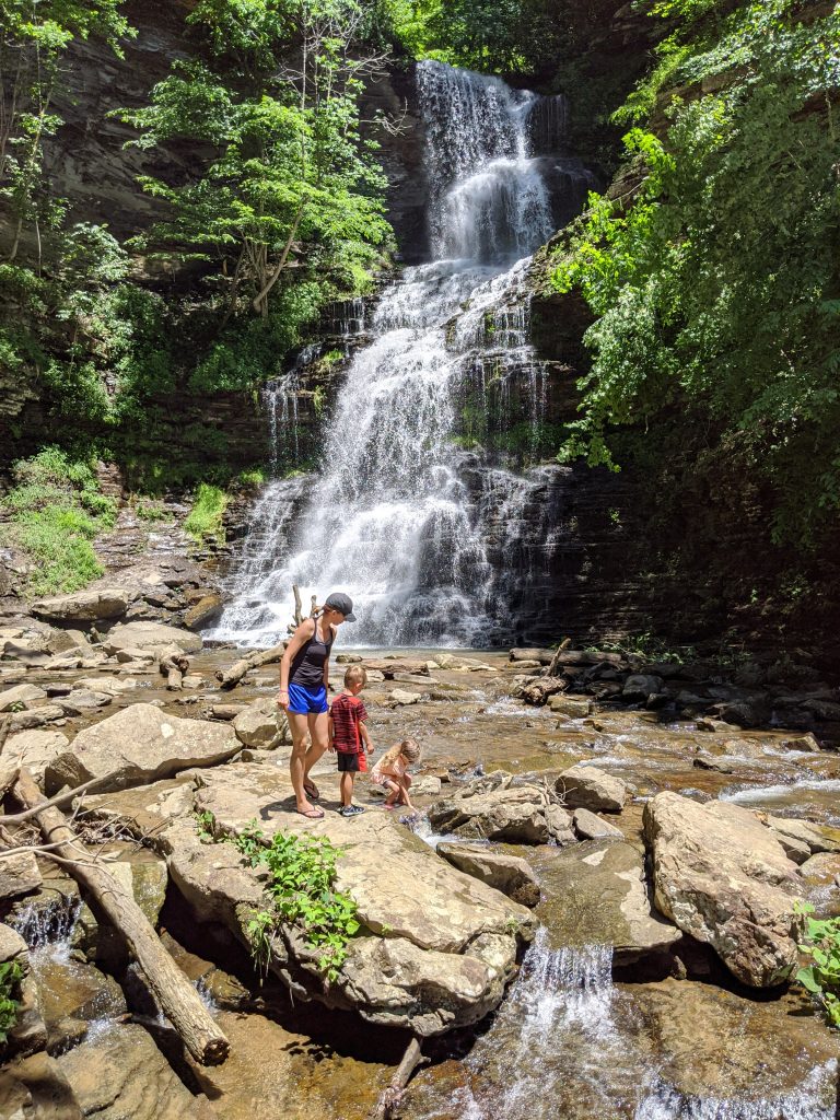
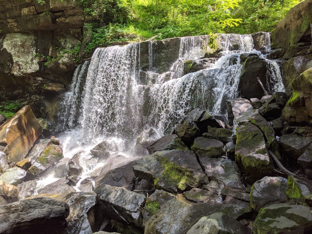
The New River Gorge National Park, the newest National Park in the country (as of this writing), is in West Virginia. It’s a 5-hour drive from Cleveland and we got to Cathedral Falls in the early afternoon. This is an awesome, roadside waterfall and you can take a very short walk to go as close to the falls as you want. Could spend 5 minutes or an hour, but definitely worth seeing.
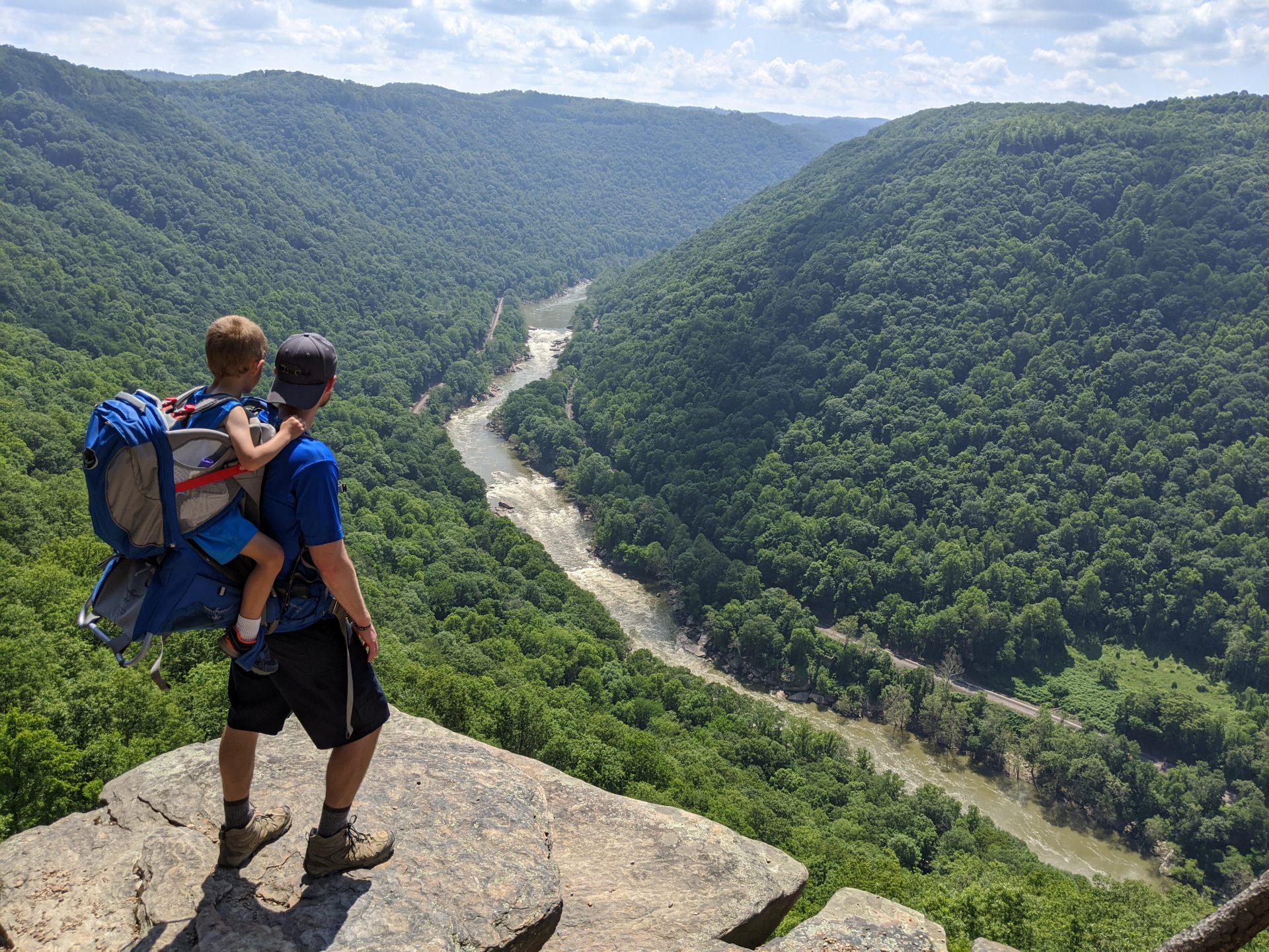
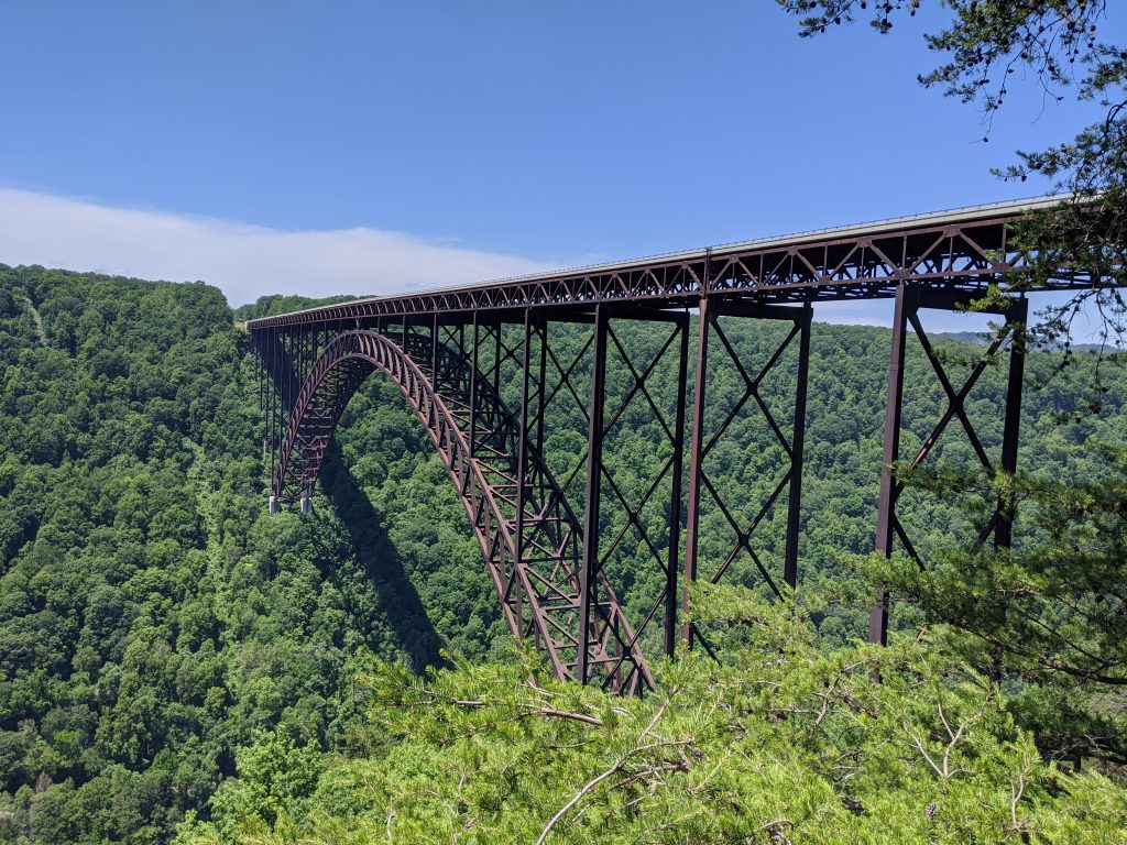
Next we drove to the Long Point trailhead and did the 3.2 mile RT hike. It’s pretty flat except the end and there are some steep dropoffs on both sides at the viewpoint. It was a fine view but since the bridge kind of gets lost against the backdrop of all the trees, I wouldn’t say it’s a must-do. It was cool to look across the gorge as we were driving over the bridge and see where we were, though.
Grabbed pizza from Pies & Pints (fantastic) and went to our cabin a few miles down the road (https://newrivergorgecabins.com/) – staying here worked out great.
Day 2
- Kaymoor Miners Trail
- New River Gorge Visitor Center
- Nuttallburg
- Beauty Mountain Trail
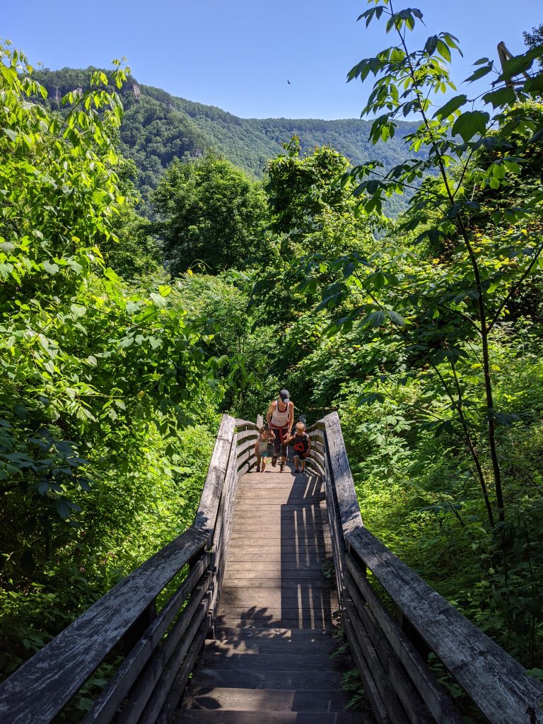
The Kaymoor Miners Trail is close to Long Point, so it might make sense to do these on the same day but it wasn’t inconvenient. This is a 1-mile down to the bottom and 1-mile right back up hike with the first half mile being through the woods and the second half mile being 821 wooden stairs. There are some fenced-off ruins at the bottom and even though you can’t get too close it was still worth it. Very neat experience to see what remains of the city and operation.
We drove over to the visitor’s center for a picnic lunch on the grass and then took the short boardwalk to see the bridge spanning across the gorge – worth a quick detour.
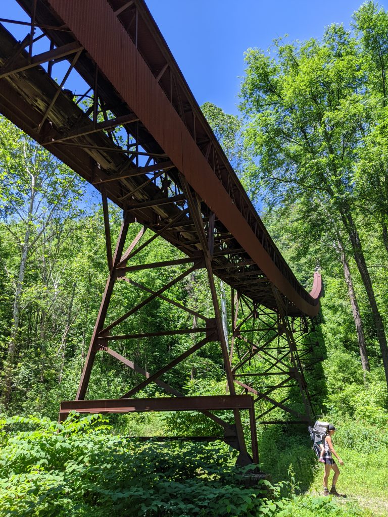
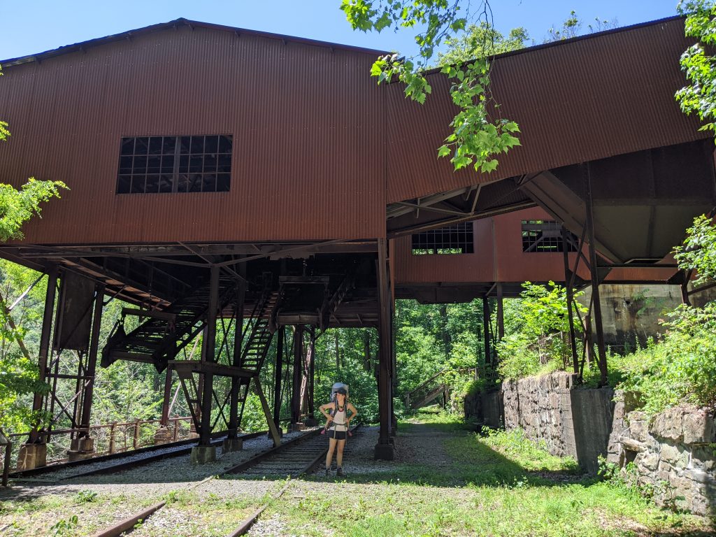
Next we headed to Nuttallburg, which you can get to down a long, slow, out-of-the-way, one-way road or a top-down hike from the Headhouse Trailhead (close to the Endless Wall Trailhead). We drove – I wouldn’t say an SUV is necessary but parts of the road are a little rough, especially the closer you get. This is also an abandoned coal tipple/town but much more intact and I’m glad we went here. I don’t think you need more than 30 minutes or so but there are hiking trails you can explore.
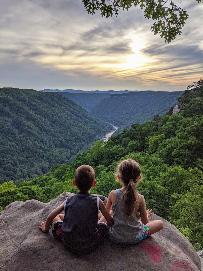
Back to Pies & Pints to pick up dinner at the cabin again. So good. Then drove to Beauty Mountain for sunset. This isn’t an official trail and seemed to be popular with locals. You can park at the intersection of Beauty Mountain and Buckhorn roads, and the views start just steps from there. There’s an easy-to-follow path that goes along the ridge. It’s worth going down it for at least a few of the viewpoints. This turned out to be our favorite view of the trip.
Day 3
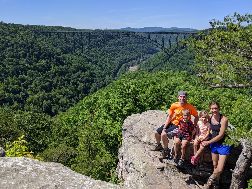
- Endless Wall Trail
- Fayette Station Bridge
- Wolf Creek Trail Head
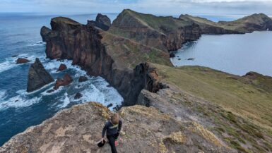
View my in-depth Hike Guide for the Endless Wall Trail here
Packed everything up and drove to the Fern Creek parking lot for the Endless Wall Trail. You can park there or at the Nuttall parking lot about a half mile down the road. FYI – that is not where you can get to Nuttallburg. The trail is a loop that you can finish by walking on the road back to wherever you parked. The trail is easy and just about 3 miles if you do the loop.
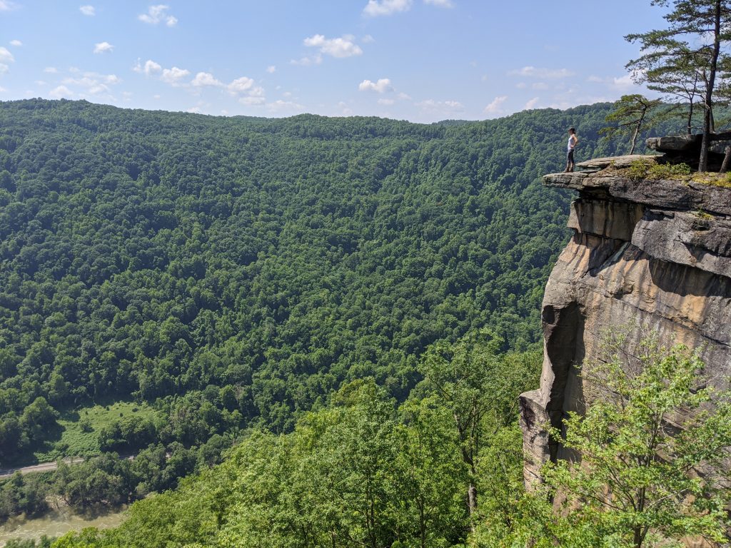
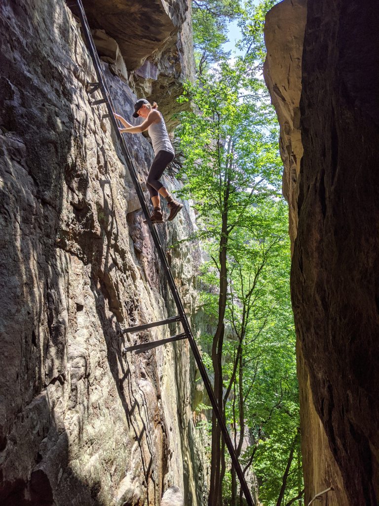
The best viewpoint is Diamond Point, which is marked with a sign and you can’t miss it. There are lots of trails that divert out to the ridge for different views, but only a few of them are marked. The 2 that are closest to the Nuttall parking lot and say “climber’s access.” They have awesome metal ladders that you can climb down. Definitely worth exploring if you’re ok with heights.

We drove down to the bottom of the gorge. Traffic is one-way and you have to start on the side by the visitor’s center. We crossed the Fayette Station Bridge at water level.

Just across that bridge is a parking lot. We had another picnic lunch there by the water and watched white water rafters go through the rapids. Heading up and out of the bridge, there is a small pulloff at the second switchback for the Wolf Creek Trailhead. This is a longer hike that has a real trail. If you park and start walking downhill maybe 25-50 yards along the railing back down the road, though, you’ll see a faint, steep trail that does down to a clear view Wolf Creek Falls. Might as well do it. You can see the falls from the road if you’re really looking for them, but they’re mostly obscured by the trees.
Additional thoughts
We had a great time – even though temperatures were in the high 80s, every single hike we did was under the canopy and we were in the shade pretty much the whole time. There’s a lot of other stuff to do in the area like white water rafting, bungee jumping and ziplining, so it’s a great destination for anyone.
Traveled in June 2020

Leave a reply