
Map tips: each color represents a different day. Click a marker to learn more about the spot, and click the star in the map header to save the entire map under Your Places in Google Maps.
Day 1
- Stanley Lake
- Stanley Pioneer Park
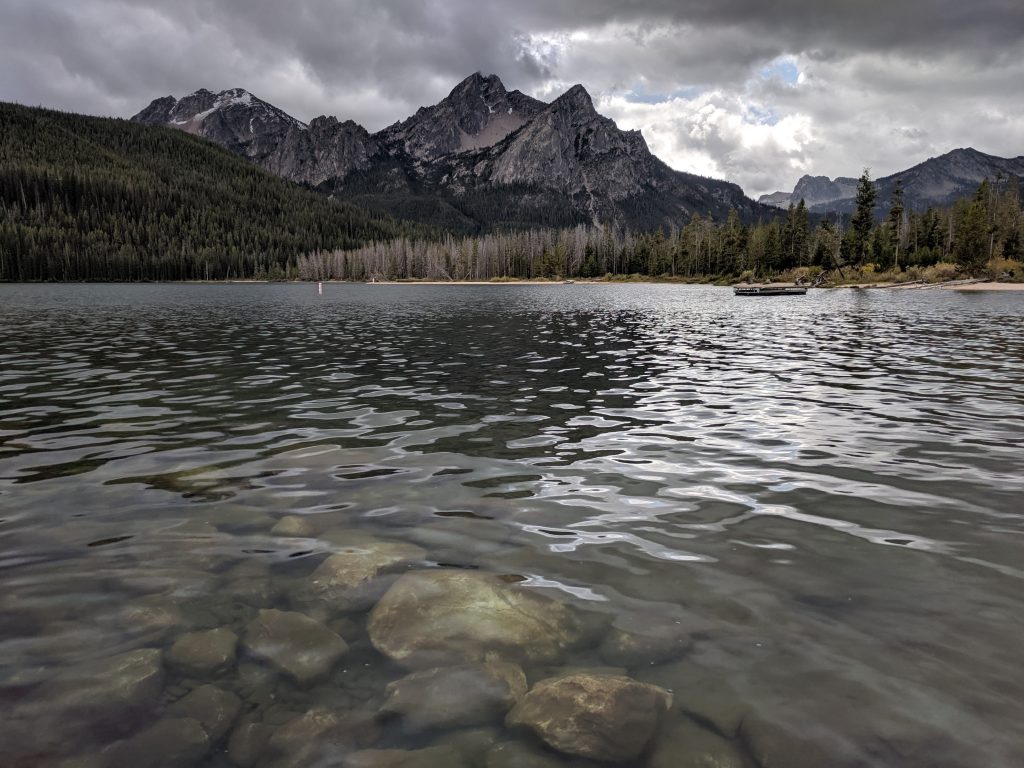
Had 1 night in Stanley, Idaho which is about a 3 hour drive from Boise. My flight arrived around noon and I took the fastest way to Stanley, up Route 21. I stopped at Stanley Lake on the way, a few miles off the highway. Stunning lake – the best views are at the end by the boat access area, but it’s also worth checking out the campground area. There are some trails for hiking, but they were closed due to construction. 30 minutes is enough to get there, walk around, and get back to the highway. Could spend all day if you have a boat or kayak, however.
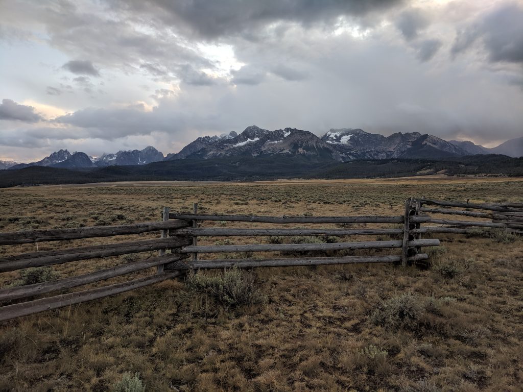
Drove about 10 minutes to Stanley and checked in at Stanley Town Square. Walked up Airport Road/Wall Street to Pioneer Park and the Meditation Chapel at the top of the hill. The view of the Sawtooth Range is fantastic from there and you have a fence in the foreground for nice pictures.
Great pizza at Papa Brunee’s for dinner, called it a night.
Day 2
- Tin Cup Hiker Trailhead
- Alice Lake
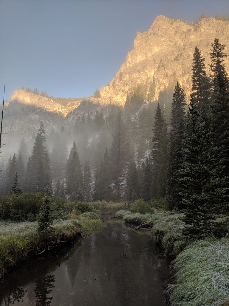
Drove about 25 minutes to Pettit Lake where the trailhead for Alice Lake starts. I wanted to do the whole Alice-Toxaway loop (around 19 miles) but had a work meeting in Hailey at 3 and couldn’t risk being late. I just went to the divide above Twin Lakes and came back the same way. About 15 miles, and I started at first light (6:55 AM). Stanley is one of the coldest places in the country, and it was in the 30s when I started out in early September.
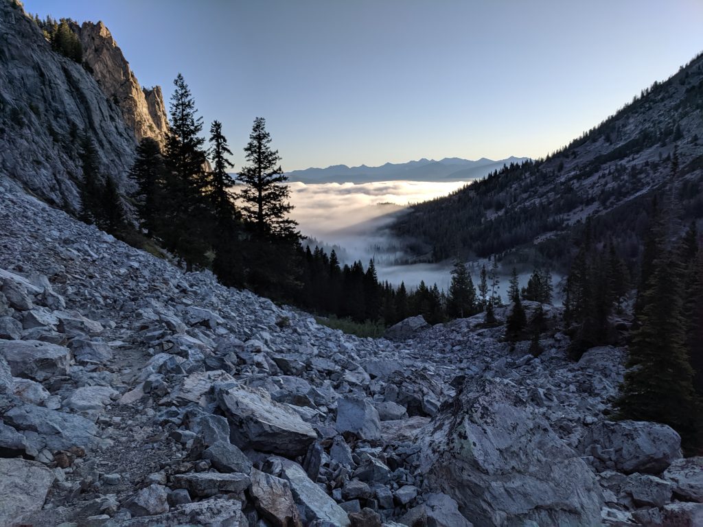
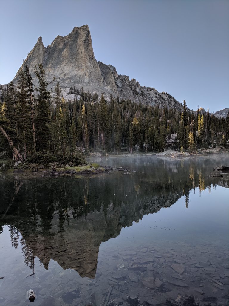
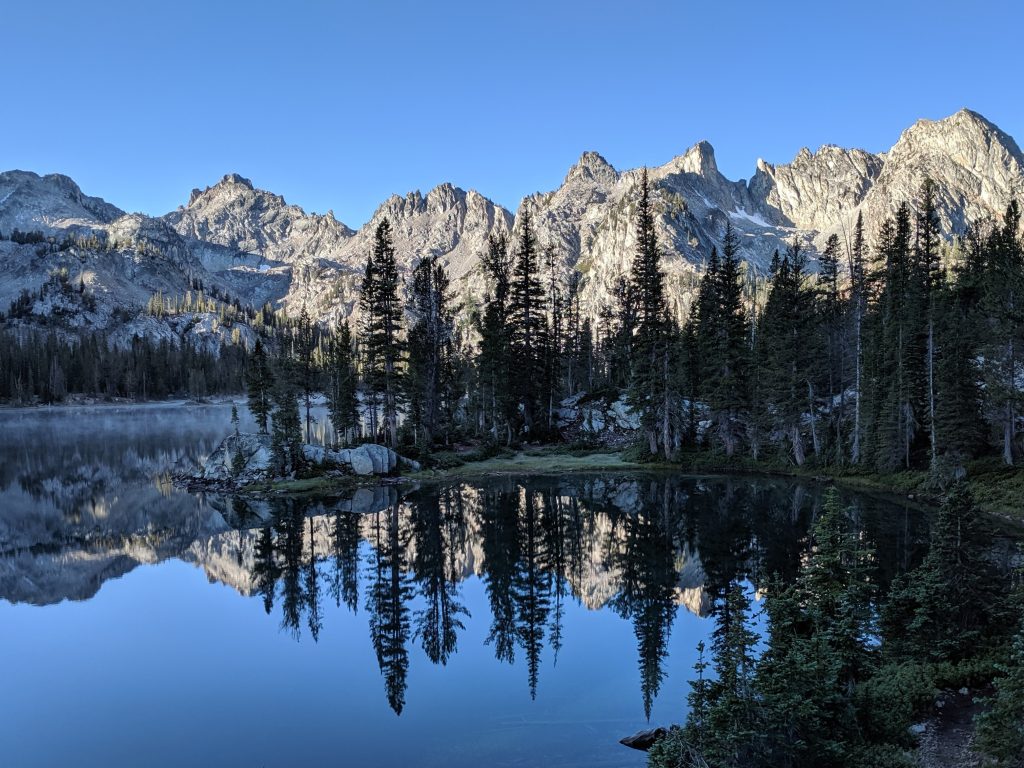
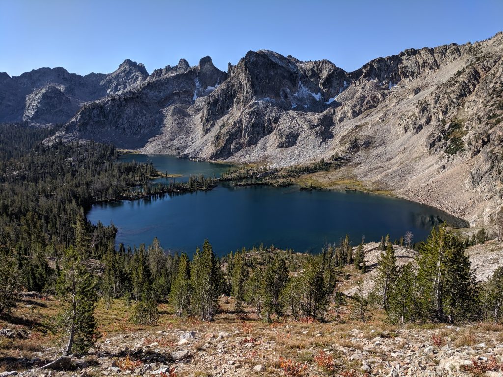
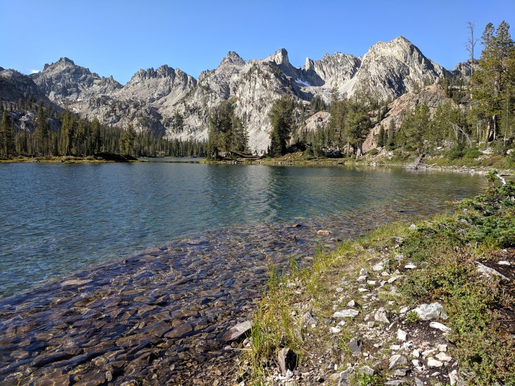
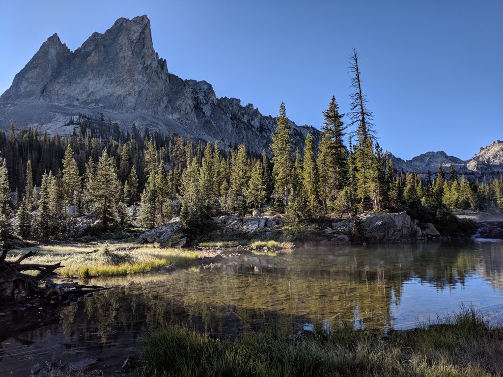
The trail is very easy to follow, and it took just under 2 hours to get to the the small body of water just before Alice Lake. This is where you get a perfect reflection of El Capitan, and can look at the other peaks across Alice Lake. This is well worth the hike and many people turn back here, about 12 miles RT. Twin Lakes are further up, and it’s not worth going to the lakes themselves. There’s a sign where the trail splits off to go to the lakes, or keep heading uphill. They look best from above, and it’ll take you probably 30-60 minutes and a bit more elevation to get to the divide for the best views. Had a snack and headed back down, back to my car in just under 6 hours. Pettit Lake was completely covered in fog on my way up, but it had lifted and revealed another stunning lake with mountains right behind it. 4 absolutely gorgeous alpine lakes in one hike, with lots of jagged mountains all around – one of the best day hikes in the country.
Took Route 75 back and wow is that much more scenic than Route 21. It’s about an hour more than taking Route 21, but I think it’s worth it one-way.
There is still so much more to see in the Sawtooth Mountains – I’ve been lucky enough to have 1 day each of the past 2 years on work trips to knock out my top hikes, but this is one of my favorite places I’ve ever been and see myself returning here quite a few times.
Traveled in September 2019

Leave a reply