Guest post by dzr1107
Map tips: each color represents a different day. Click a marker to learn more about the spot, and click the star in the map header to save the entire map under Your Places in Google Maps.
Day 1
- Whiteside Mountain
- Dry Falls
- Hamilton Gardens at Lake Chatuge
- Brasstown Bald
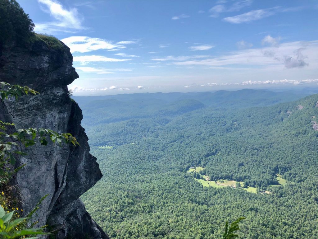
This was a scenic “driving” day. We started by driving almost an hour to Whiteside Mountain in North Carolina. We arrived just before 10 and only encountered a few people, but the parking lot was completely full by the time we left, around 11:30. The parking lot is also off to the left as you’re driving up the mountain with only a small forest sign marking it. Our GPS took us past it so we had to turn around. It costs $3 to park and is on the honor system. There’s a signboard and outhouses in the parking lot. The trail is slightly tricky at the beginning. Several sites talk about how the right is steeper in the beginning and left is more of gradual incline, but this split isn’t at the end steps, despite a right and left option. Go left at the top of the steps, and then a short ways up you’ll see a side trail/natural stairs that go to the right. This is the split referenced in other sites. We went right, and while it was an elevation gain, it was very doable. There are several side trails that go to the edge and provide views, do these at your own risk. If you keep going there’s designated views of the valley and mountains to the south. They’re all slightly different but overall the same views. The trail gets quite narrow rounding the loop, but is fine when it’s not crowded. The left descent (or ascent depending how you go) is very wide and gradual with limited views. Overall, it’s a nice little hike with long range views. I’d do it if you have time, but I wouldn’t be devastated if the parking lot was full and you couldn’t.
We then drove 20 minutes to Dry Falls. On the way, Route 64 passes by a pull off where you can drive under Bridal Veil Falls, which is pretty clue. Due to all the rain we’ve had, it was blocked off to traffic but you could still get close on foot. We were excited to visit Dry Falls, where you can actually walk behind a giant waterfall, but when we got there around noon the parking lot was completely full. We circled a few times, but decided with Covid we’d continue on. It’s on our list to re-visit.
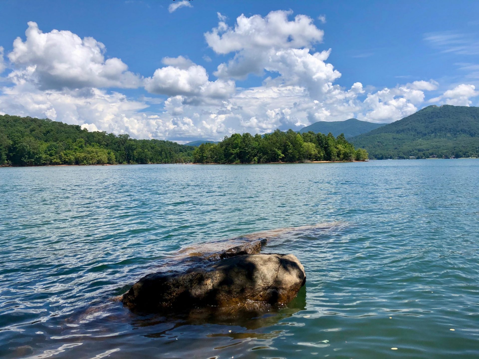
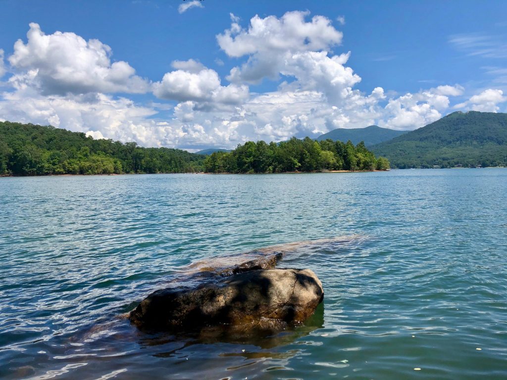
We drove another hour to the Hamilton Gardens at Lake Chatuge. This was not quite what we were expecting, but was a very quiet spot with short trails. The highlight for us was sitting on a rock on the shore of Lake Chatuge taking in the small hills and lake. It’s also part of the Fairgrounds, has $5 parking (honor system), and legitimate restrooms. It was a good stop, but I do not expect we will be back, although we’d like to explore Lake Chatuge more.
From here, we drove 30 minutes to the top of Brasstown Bald, the highest peak in Georgia at 4784’. You are able to do a hike from a lower parking lot to the tower at the top – 7 miles round trip. We chose to drive to the upper parking lot ($5 per person to a toll gate during hours). They have restrooms and a visitor center/store at the parking lot. I believe they usually have a shuttle to the tower, but it is currently not running. There’s a short .6 one way (1.2miles RT) trail with 425ft elevation gain. It’s doable, but you’ll feel it in your legs. At the top, there’s a three-tiered tower. The first level has restrooms, and indoor space, and rocking chairs. The second level, accessible by stairs or elevator, has a large circle (one way traffic currently) walking platform that lets you see 360 degree views of the area. The top tower was closed, so we didn’t go to the top but we were very pleased with the views from the second platform. It has gorgeous long range views, and we were able to see several thunderstorms in the distance despite blue skies above. If you’re in the area, I highly recommend.
Day 2
- Mud Creek Falls
- Black Rock Mountain State Park
- Warwoman Dell
- Minnehaha Falls
Due to the weather, we stayed a bit closer to Clayton.
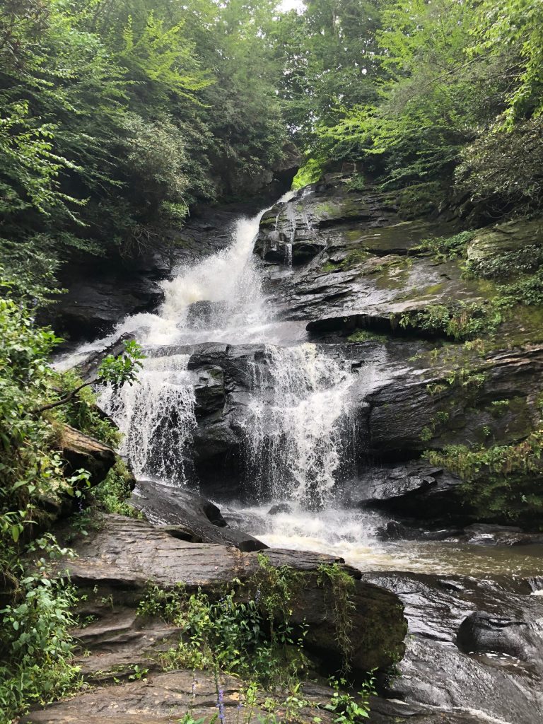
We started by driving 20 minutes to hike Mud Creek Trail to Estatoah Falls. This was a little tricky to find, since the GPS dumped us at the side of the road with no trailhead and no reception. However, you go back into a golf community and drive down Tahoe Rd before it dead ends. There’s not a lot of parking, but this was mostly deserted while we were there. At end of Tahoe Rd there’s an amazing waterfall. This is probably the highlight of the trail, but it’s an easy 2.2 mile RT to take you to an abandoned shelter over the river. The shelter is secure, but has been washed out so you have 4 feet on a board to get into it. It was a nice morning stroll.
Afterwards, we drove up to the top of Black Rock Mountain State Park. There’s a nice overlook at the visitor center, and two places to pull off and look out. This was a nice view, but it was hard to beat Brasstown Bald the day before.
After lunch we drove to the Warwoman Dell in Clayton. It’s a cute park and ties into the Bartrum trail, but we only walked a short distance to the waterfall and back due to the weather. It’s a good local stop, but nothing you need to go out of your way to see.
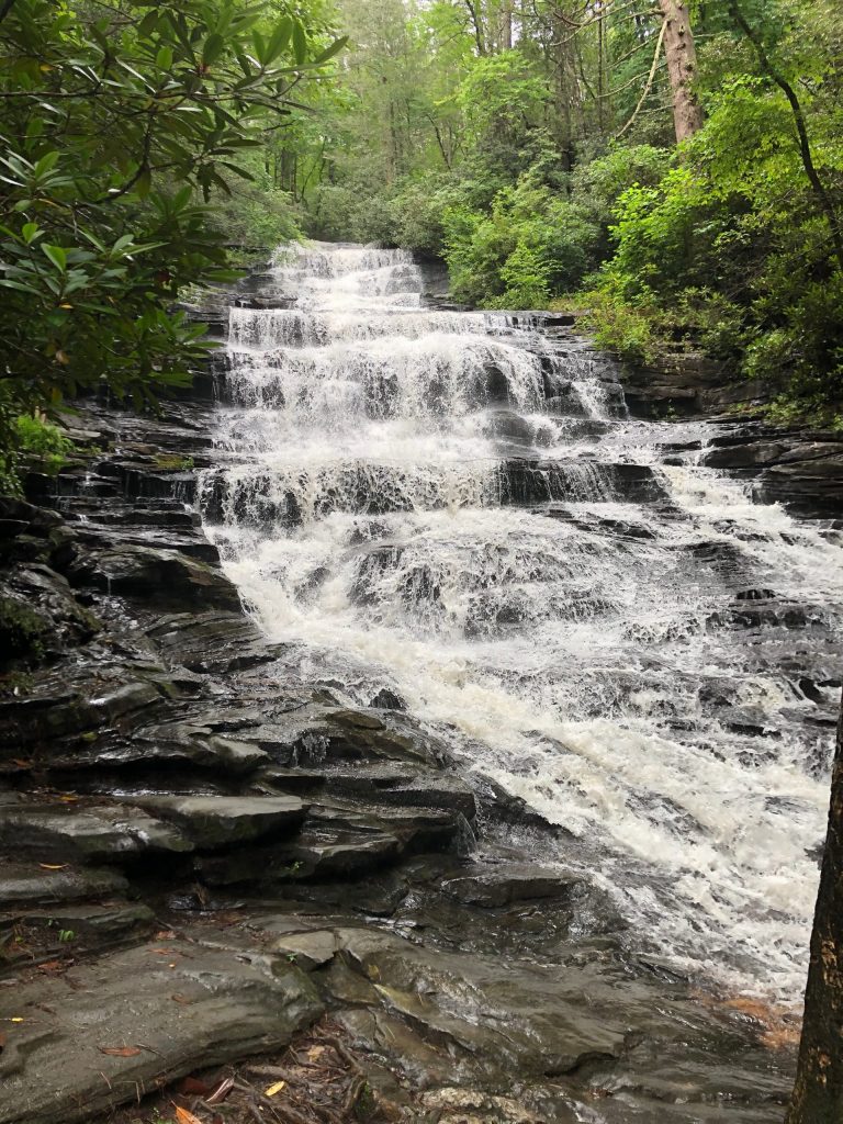
We then drove 30 minutes south to Minnehaha Falls. I highly recommend this stop – you’ll need to go on some gravel roads. There is just a little widening of the road for parking, but it is a very quick trail to see some amazing waterfalls.
Traveled in August 2020
Leave a reply