Map tips: each color represents a different day. Click a marker to learn more about the spot, and click the star in the map header to save the entire map under Your Places in Google Maps.
Day 1: Waterfalls on the way to Cle Elum
- Snoqualmie Falls
- Twin Falls
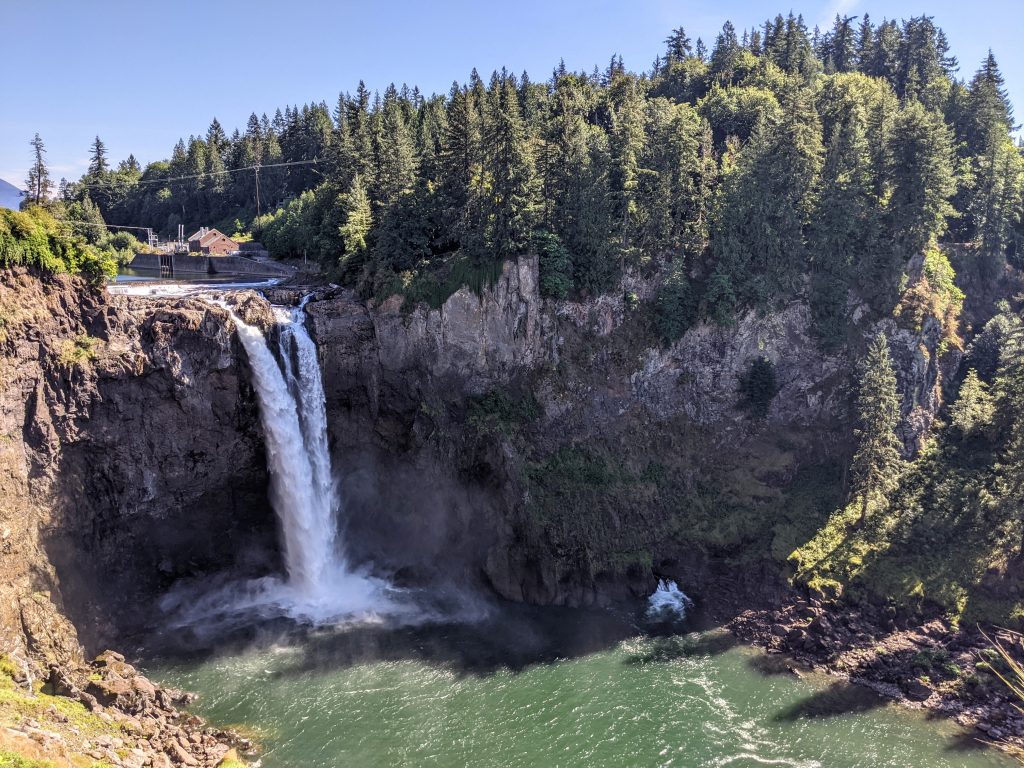
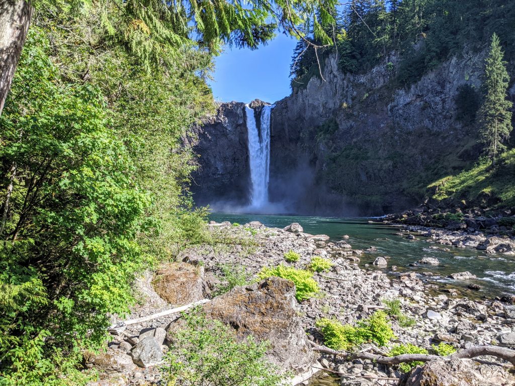
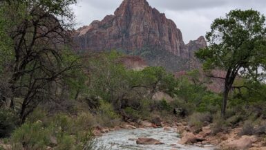
Alpine Lakes Wilderness is a large area directly east of Seattle and has some of Washington’s best hikes. It takes a couple of hours by car to get to the good stuff, and after arriving in Seattle we got our rental car and drove 45 minutes to our first stop at Snoqualmie Falls.
There is no fee to enter but there is paid parking closer to the falls – I’d save the money by parking across the street and walking just a short bit. The waterfall is huge and worth a look from the top and bottom. There’s a 1.5 mile RT trail that heads away from the falls and loops down and around. You may need to look for it…once you see a path that heads downhill, that’s it. Pleasant walk through some really neat trees. You can drive to the bottom, too, if you don’t want to climb back up the 250 feet.
Drove another 15 minutes to the Twin Falls Trailhead. Make sure you get directions to the south side of route 90 – our phone originally took us north to 146th street and you’ll have to turn around. You’ll need a Discovery Pass, which can be purchased at the trailhead (credit cards accepted).
Twin Falls is 2.5 miles RT with around 600 feet of elevation gain and the absolute best view is heading down an unmarked (but obvious) staircase on the right side of the trail before you get to the Twin Falls Bridge. That’s the view of the long, almost sideways waterfall and it ends at a viewing platform where you can’t go any further.
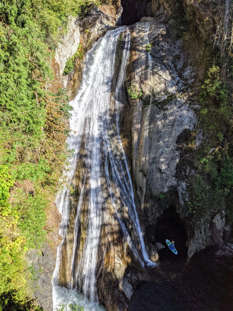
The view from the Twin Falls Bridge is of a different waterfall and just ok – you don’t need to go past the bridge (the view from further up above is not worth it).
Drove almost an hour to the Best Western in Cle Elum, which worked out great.
Day 2: Hike to Jade Lake
View the step-by-step Hike Guide for Jade Lake here
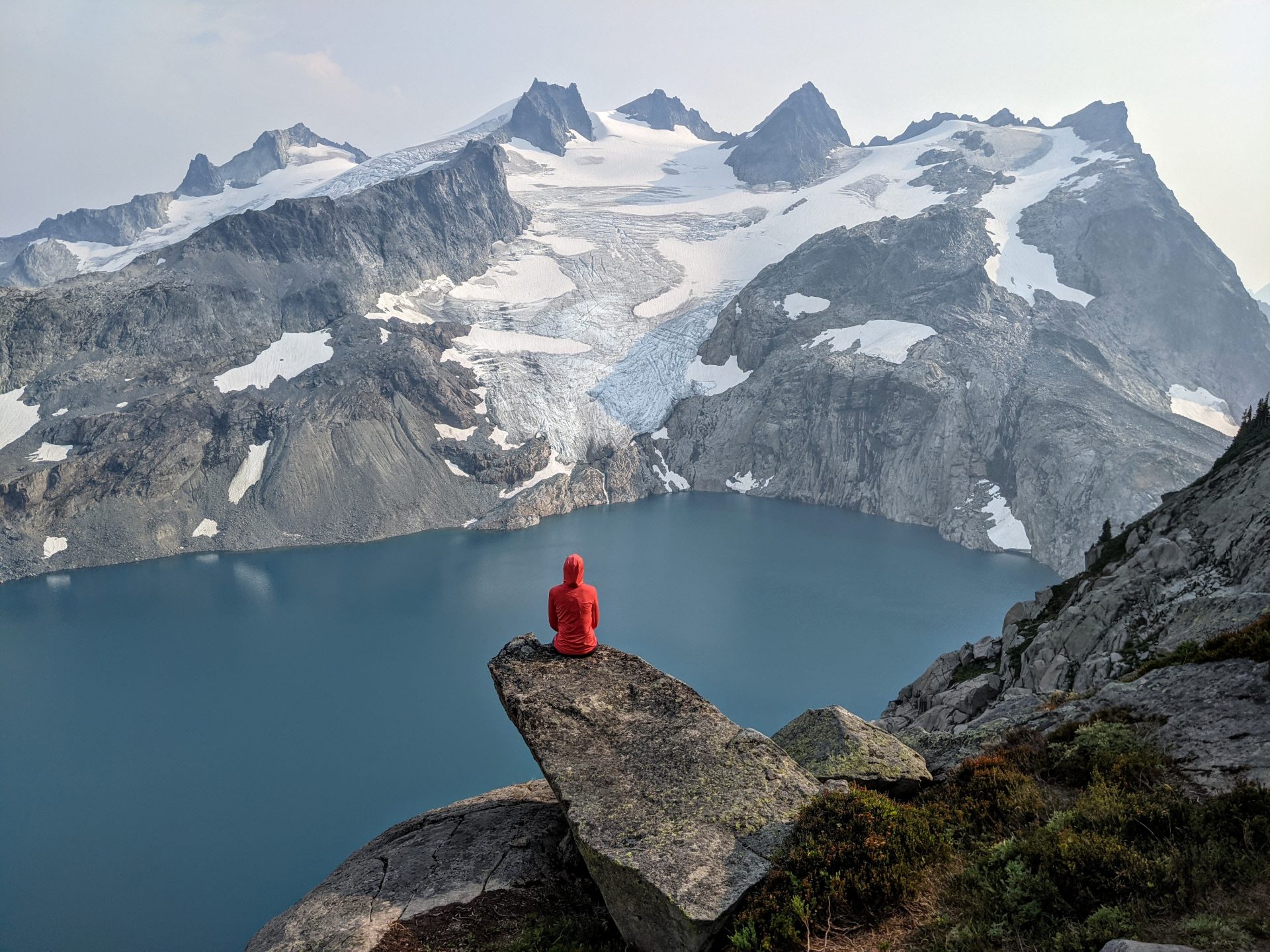
Jade Lake is one of the most stunning lakes in the world – unreal water color and flanked by awesome peaks. It’s a challenging hike, however, especially with a full pack: just over 10 miles one-way with about 4,000 combined feet of elevation gain (you lose and re-gain on the way). Luckily there are some great views along the way and the payoff is amazing. Make sure you get a Northwest Forest Pass in advance.
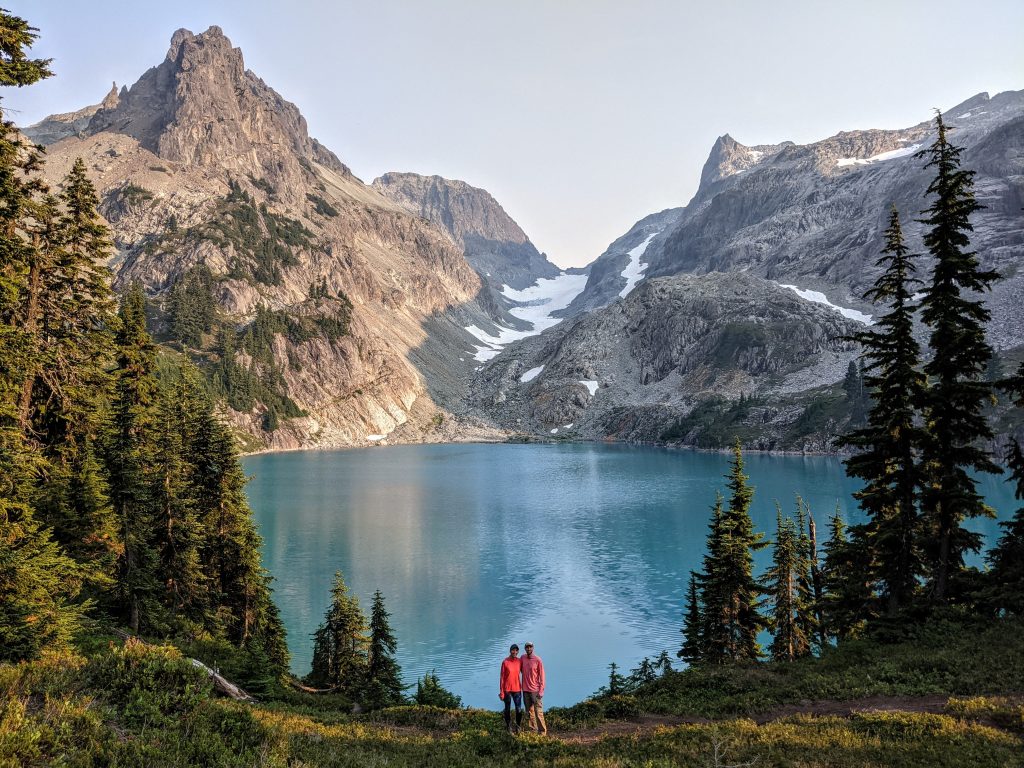
It took us 7 hours total with a stop for lunch at Marmot. We set up camp, went swimming, and relaxed for the rest of the day.
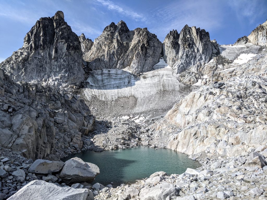
Day 3: Hike to Dip Top Gap to see Pea Soup Lake
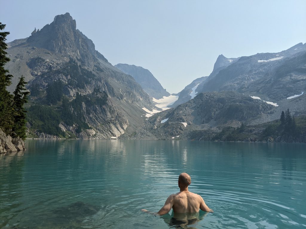
We had a very relaxing first half of the day. The water is freezing but feels great to swim or wade in on a hot day.
We headed up to Dip Top Gap in the afternoon, which is the area between Lynch and Dip Top peaks (details in the Hike Guide). It took us about 2 hours total, including time to explore around the gap (we did not climb Dip Top Peak nor go down to the lake).

Having a mosquito-free dinner (thank you Thermacell) at the edge of Jade without another person in sight was one of our favorite moments.
Day 4: Hike out and drive to Leavenworth
We packed up early and headed back down to the trailhead. Took us just over 5 hours and we drove 2.5 hours to Leavenworth, where we were staying 2 nights at the Village Inn as a base to do the Enchantments hike. It was a decent place – there are certainly more expensive places but we thought it worked out well and it’s within walking distance from all the restaurants and shops.
The wildfire smoke was horrible when we arrived and we were pretty despondent. We had some great beer and pizza at Blewett Brewing followed by ice cream at Whistlepunk (excellent). Went to bed with an alarm for 4 AM to head to the Stuart Lake trailhead. We figured we would hike to Colchuck Lake and turn around because the views would be poor.
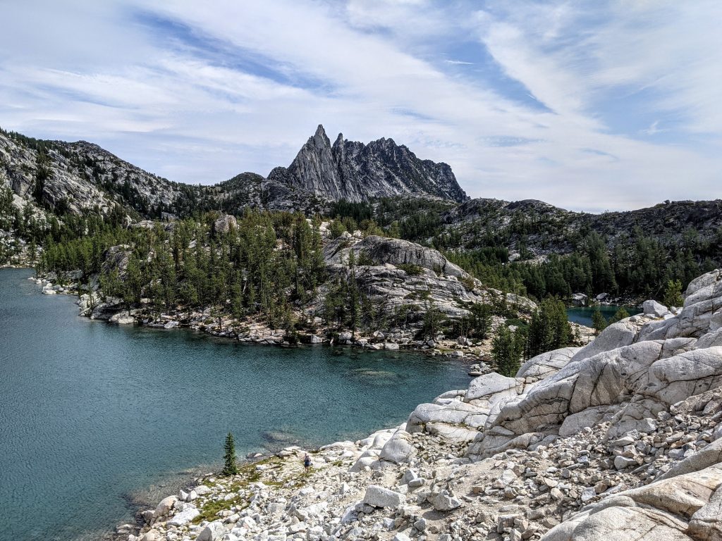
Day 5: The Enchantments day hike
View the Hike Guide on The Enchantments for an in-depth look at one of the world’s best hikes
Since we figured we’d only do Colchuck and turn around, we drove to the Stuart trailhead and parked there. We did not arrange transportation for the other trailhead. At just after 5 there were plenty of spots on a Sunday. However, we’ve read reports that the lots were full earlier than that. I’d say you can’t get there too early. In the off-chance that we did the whole thing, you can call the Leavenworth Shuttle when you’re in view of the Snow parking lot to see if they can pick you up or hitchhike.
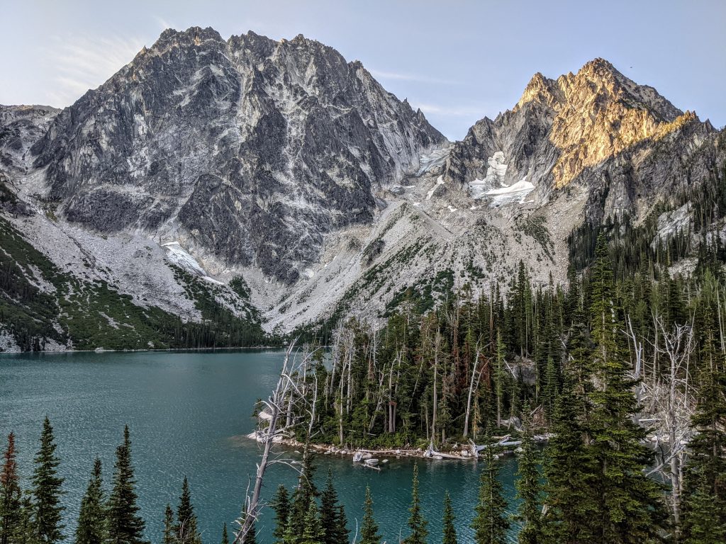
We set out at 5:30 in the dark and were stunned/elated to see all the smoke was gone. We got to Colchcuck Lake (4 miles, 2,300 feet of elevation gain – a great hike on its own) in 1 hour 45 mins at a really good pace and decided there was no way we weren’t going to do the full hike.
Aasgard pass is next: another 2,000 feet of elevation gain in less than a mile. It’s a slog but it isn’t too bad. The views on the way up are stunning and when you get to the top, you’ve made it to the core! If you have the Gaia (which I recommend) or AllTrails app, make sure to look for Mist Pond. It’s very easy to miss, but is a very picturesque glacial pond right at the foot of towering peaks that looks like it’s out of Patagonia. Check out the Hike Guide for more details.
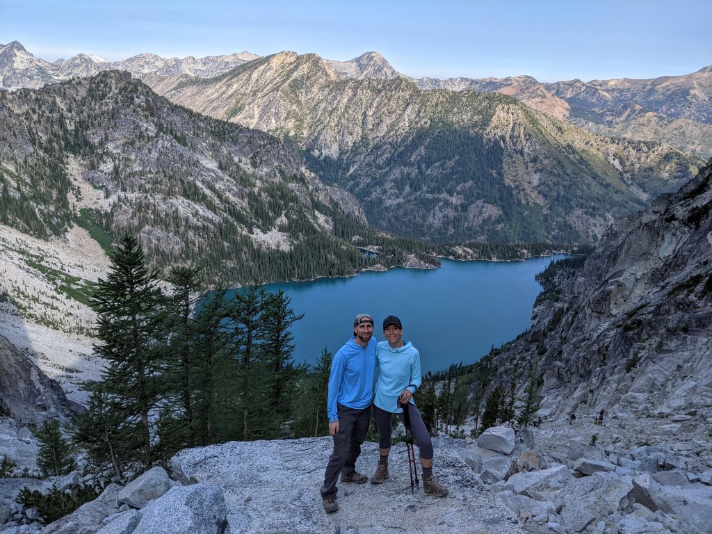
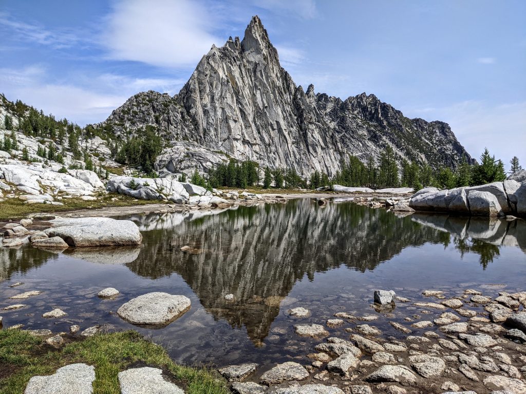
Walking through the core zone should take a few hours. It’s basically lake after lake after lake with stunning mountains all around. I took about a one-mile detour to Gnome Tarn, which the Gaia app led me to. There’s no way I would have found it without the app. This is a very small body of water that yields a perfect reflection of Prusik Peak. That is the coolest looking peak in the entire Enchantments. Arguably one of the coolest in the world.
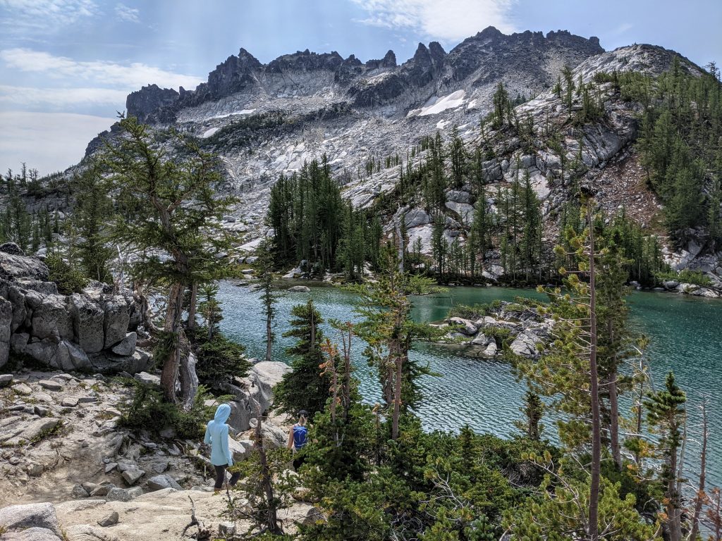
Heading down from Lake Viviane, the last lake in the core zone, took us almost 5 hours. The Snow Lakes are very pretty, but considering what you’ve just seen the only thing on your mind is getting to the parking lot as soon as possible. You lose 7,000 feet of elevation, which is why most people start at Stuart and end at Snow. The last stretch takes longer than you think. The first mile is pretty technical and slow-going and then it’s about 10 more miles to the parking lot. Have some conversation or headphones planned and try to stay positive.
We got a ride back to the Stuart Trailhead (thank you so much Dave and Jess), showered, and walked to dinner at Rhein Haus (pretty good). Keep in mind that most restaurants close at 8 or 9 if you’re planning on eating out when you get back to Leavenworth.
The longest and hardest hike we’ve ever done was well worth it. It took us just under 12.5 hours with several stops to eat and rest by several of the lakes.
Day 6: Back to Seattle
My wife may have killed me if I tried to fit in another hike. I walked to get breakfast at Louie’s (great food) and brought it back to the room. We spent the rest of the morning shopping, walking around, and having one last great drink and meal at Icicle Brewing Company. We really enjoyed Leavenworth. It’s a superb mountain town that’s also popular in the winter when it turns into a big German Christmas market.
We drove about 2.5 hours to Columbia City, a suburb of Seattle. We stayed with friends as we had a flight out the following morning.
Alpine Lakes Wilderness has some of the best mountain scenery I’ve ever hiked through. I think Jade Lake and the Enchantments are the 2 best areas from what I know. However, there are so many others that we could go back every year and not run out of places to go. There are world-class views here and it’s so unfair and awesome that Washington has so many great areas to hike.
Traveled in August 2021

Leave a reply