The most important thing on this page: please follow the 7 principles of Leave No Trace whenever hiking (and all the time, actually – most are pretty good general life tips, too).
- Plan ahead and prepare
- Travel and camp on durable surfaces
- Dispose of waste properly
- Leave what you find
- Minimize campfire impacts
- Respect wildlife
- Be considerate of other visitors
Please, don't ruin the beauty of Jade Lake. This is one of those places that will require permits very soon if people don't reverse the current trend and hike responsibly.
Now, on to Jade Lake. Here are the details:
- Where: Cle Elum, Washington is the closest city
- More specifically, where: the Tucquala Meadows Trailhead at the end of road NF-4330
- Distance and elevation: ~20 miles (32 km) roundtrip with 4,000 feet (1,220 meters) of total elevation gain to Jade Lake. Add ~2.5 miles (4km) roundtrip and 1,100 feet (335 meters) of elevation gain if you go to Dip Top Gap.
- Highest point: 5,500 feet (1,675 meters) at Jade Lake. 6,600 feet (2,010 meters) if you go to Dip Top Gap.
- Why you should hike this trail: one of the most beautiful lakes in the US. Add on Dip Top Gap to see Pea Soup Lake and I’d put this up against any mountain scenery in the world.
- Fee or permit? yes – get a Northwest Forest Pass before heading to the trailhead
- Cell service? no
- Best time of year: late June – September
- Closest commercial airport: Seattle, Washington is 2 hours 45 minutes from the trailhead. About half of that is the rough road from the city of Cle Elum to the trailhead.
Tips
- The best tip I can give you is to be prepared for the mosquitos with long sleeves, pants, and head net. They were AWFUL in August, the worst we’ve ever experienced. Maybe you’ll have a different experience, but best to be prepared.
- If you go to Jade Lake, you have to go to Dip Top Gap to see Pea Soup Lake. Absolute must-do.
- This is best done as a 2-nighter. You could consider camping at Marmot Lake but Jade is better if you can get a spot (first come, first served).
- There are also some camping spots at No Name Lake, the very small body of water just before Jade.
- There are pit toilets at Marmot and Jade but please pack out everything. Yes, including your used toilet paper.
- Make sure you build in the time it takes to drive from Cle Elum to the trailhead.
- There is a water crossing to get to the trailhead that can be impassable for a regular car early or late in the season. In early August it was no issue in an SUV and any car could have done it.
Getting there
First, have a Northwest Forest Pass before heading to the trailhead. You can buy one at a lot of trailheads and locations in Washington and Oregon and it’s a good idea to get an annual pass if you’re going to be hiking in the region often. We purchased and printed day passes from our hotel in Cle Elum the night before we drove to the trailhead and you can do the same here.
Since it’s a long drive from Seattle, it’d be a challenge to make the long drive to the trailhead from there and the long hike to Jade Lake in the same day. Doable, but you’ll get there late and the good camping spots will likely be taken. They may be taken anyway, but your best chance will be getting to Jade Lake as early as possible to catch people who have recently left or are leaving. Staying in Cle Elum the night before worked out perfectly for us.
Once you have your pass and get to Cle Elum, head north on NF-4330 for what seems like forever. The last 12.5 miles are unpaved and it will likely take 1 – 1.5 hours to get from Cle Elum to the trailhead. You’ll pass several campgrounds, and despite how tempting it is to just stop the drive and camp at one of them, you’re taking the road until it ends.
There is one potential water crossing that can either be impassable (depending on your vehicle and time of year) or not an issue at all (depending on the time of year). Early or later in the hiking season can bring some high, faster-moving water. In general, any car can get to the trailhead but a high-clearance vehicle will make it easier. The drives in and out are two of the downsides of this hike but they are worth it.
There are a couple of lots at the trailhead. One is right at the trailhead and another larger one just a little before. Leave the pass on the dash in plain view, go to the bathroom if needed, and head to the trail.
Trailhead to Marmot Lake
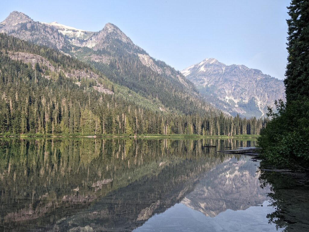
There is a book to self-register near the start of the trail and then it’s mostly a covered, easy, and boring 2-mile walk to Hyas Lake. There are lots of camping spots along Hyas and it’s very pretty, but I can’t see that being a final destination since it takes longer to drive from Cle Elum to the trailhead than it does to hike to the lake.
After Hyas Lake, you’ll take some switchbacks through the woods and gain a decent amount of elevation. When things start to level off, you’ll see a trail to the right that leads to Robin and Tuck Lakes. Keep straight and you’ll wind along some interesting, open, and uncovered views on flatter ground. This is a relatively pleasant and smooth part of the hike.
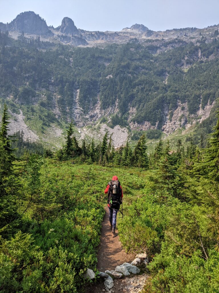
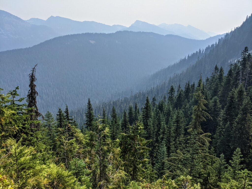
You’ll soon go back into the woods. After about 4.25 miles from the trailhead you’ll come to an intersection with the Pacific Crest Trail at Deception Pass. There are several camping spots around here. You might see people coming and going from different directions – keep following the signs for Marmot Lake.
After Deception Pass, the incline continues for about .75 miles. But, over the next 1.25 miles, you’ll lose about 700 feet of the precious elevation gain you already did. Not cool.
The last stretch to Marmot Lake is all uphill: almost 1,000 feet of relatively steep gain over 1.75 miles. While it might seem tough, it’s a mere warmup for the part from Marmot to Jade. Worth noting: there are a couple easy stream crossings between Deception Pass and Marmot Lake so there are multiple opportunities to filter water.
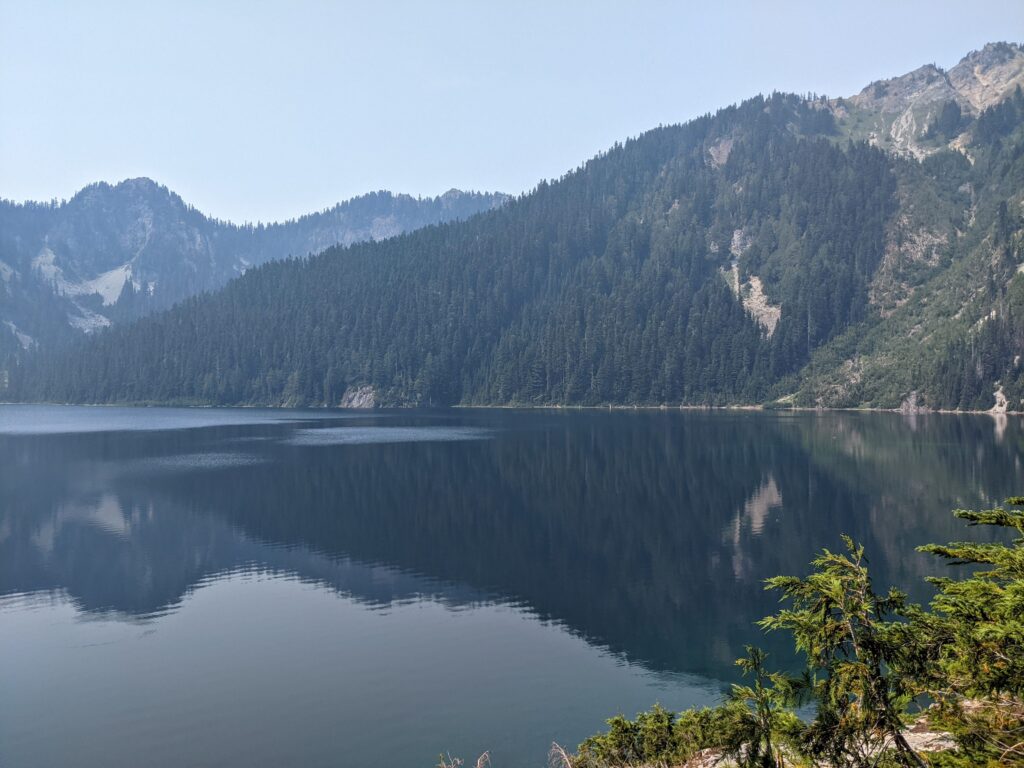
As you approach Marmot Lake, you’ll do a counter-clockwise U-turn as the trail runs along the east side of the lake.
There are multiple campsites and toilets at Marmot and you’ll probably be tempted to drop your pack and set up. It’s not a bad idea, but Marmot doesn’t really compare to Jade. There is a chance that you might not get a spot at Jade. No one wants to do the hardest part of the hike (from Marmot to Jade) with a full pack only to have to turn around, so you’ll have a decision to make. There’s no wrong choice but we are glad we got to camp at Jade. At the very least, take a break at Marmot and enjoy the views.
Marmot Lake to Jade Lake
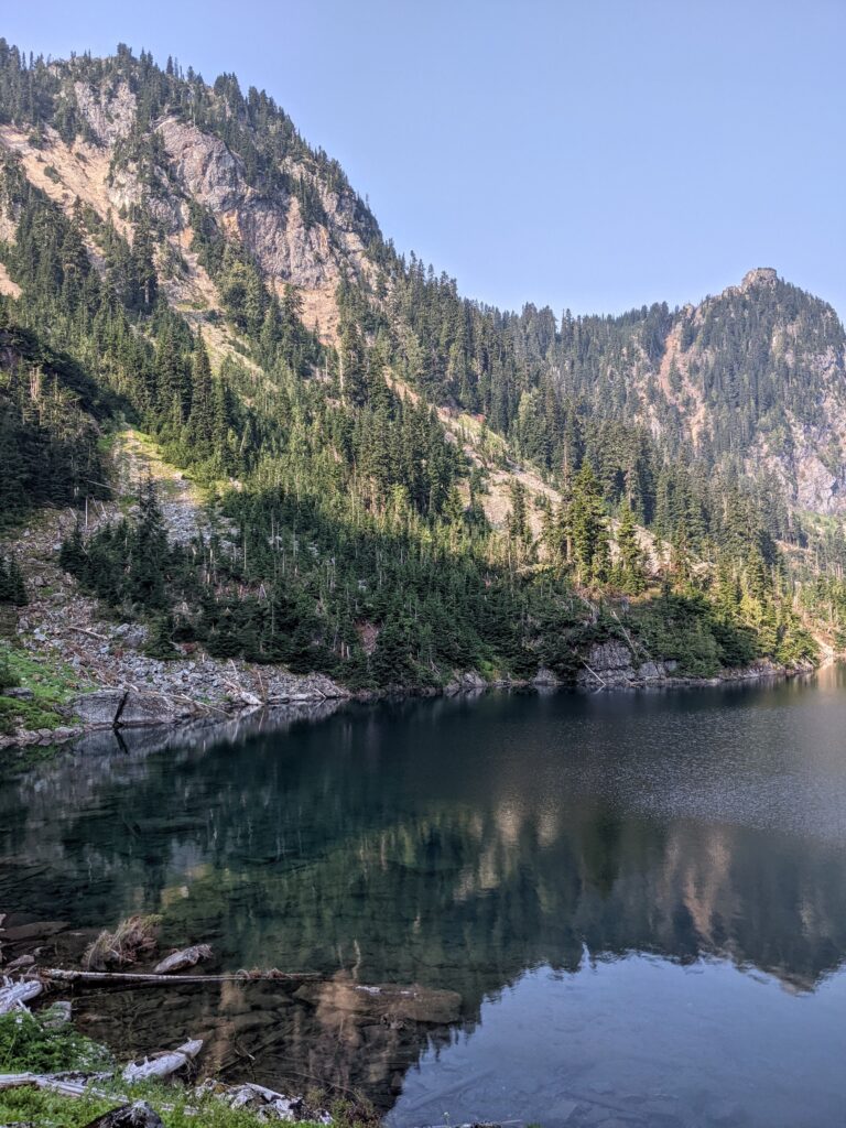
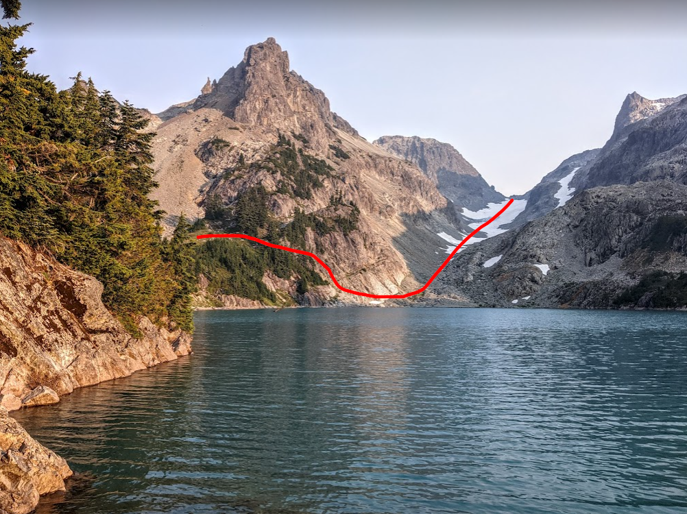
As you follow the path clockwise through the woods around the coastline of Marmot, you’re looking for a rather large boulder field up and to your left that leads to Jade Lake. You’ll first come across a rock field with a small stream/runoff coming down from high up. Do not try to go up here. A GPS is very helpful at this point. I use the Gaia GPS app on my phone. There is a one-time, yearly fee for offline use that is more than worth it.
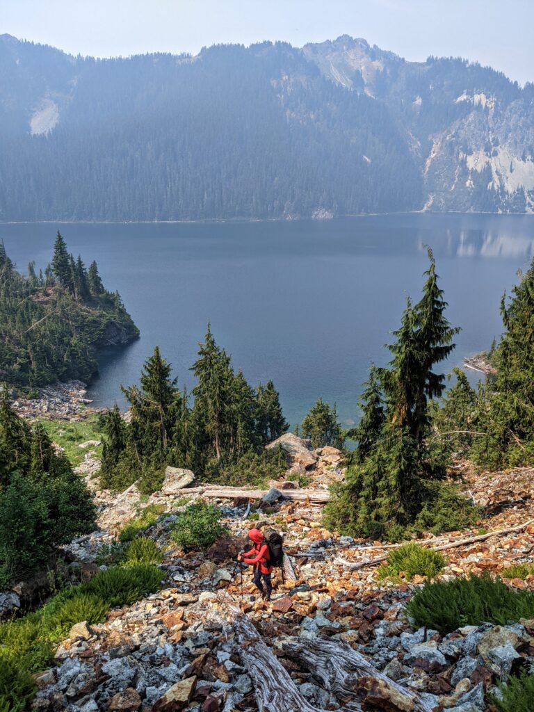
Eventually there will be another larger boulder field with cairns. This is where you head up – make sure to stay to the left side, just along the vegetation line. There’s a faint trail on that side that is much easier than going up through the rocks.
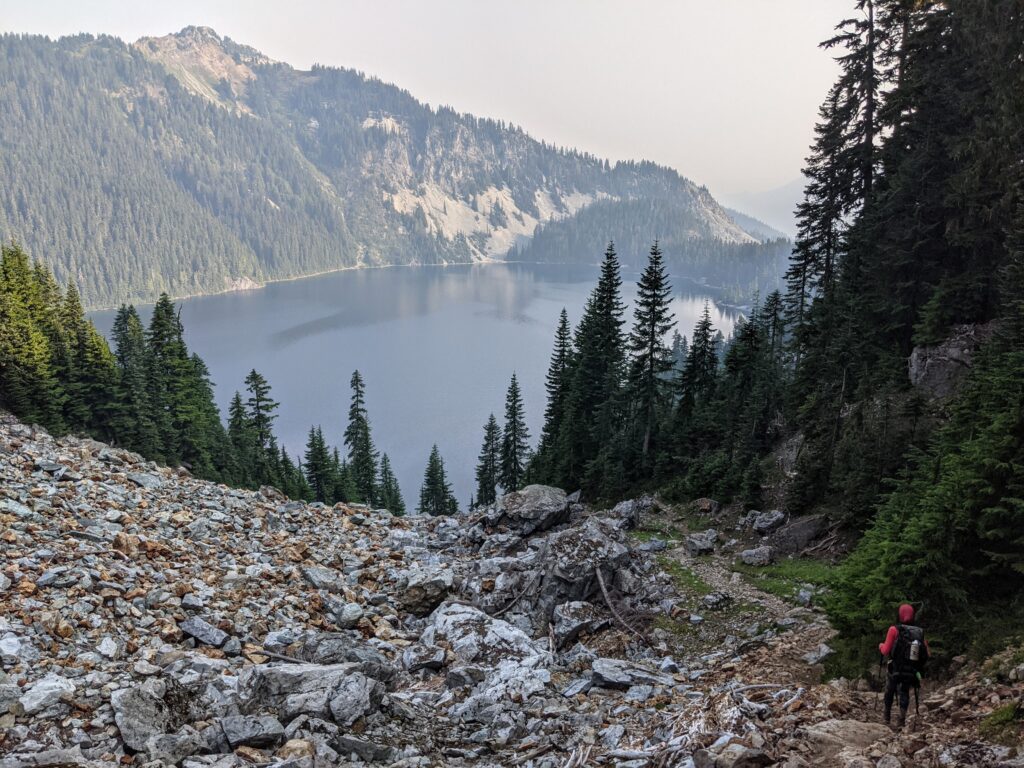
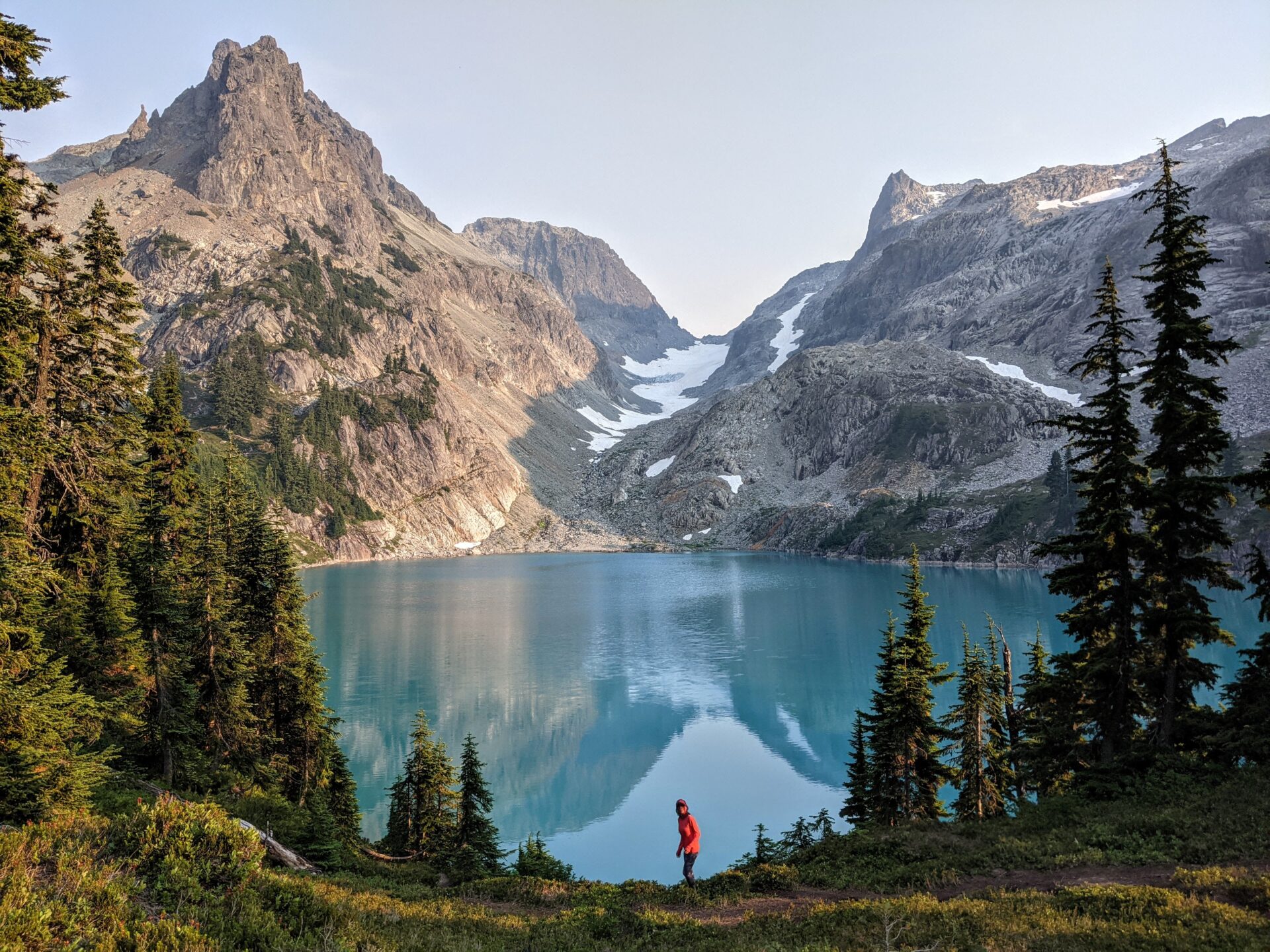
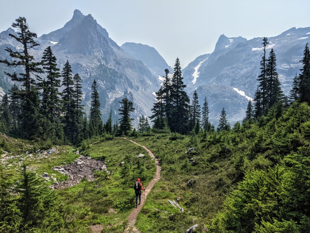
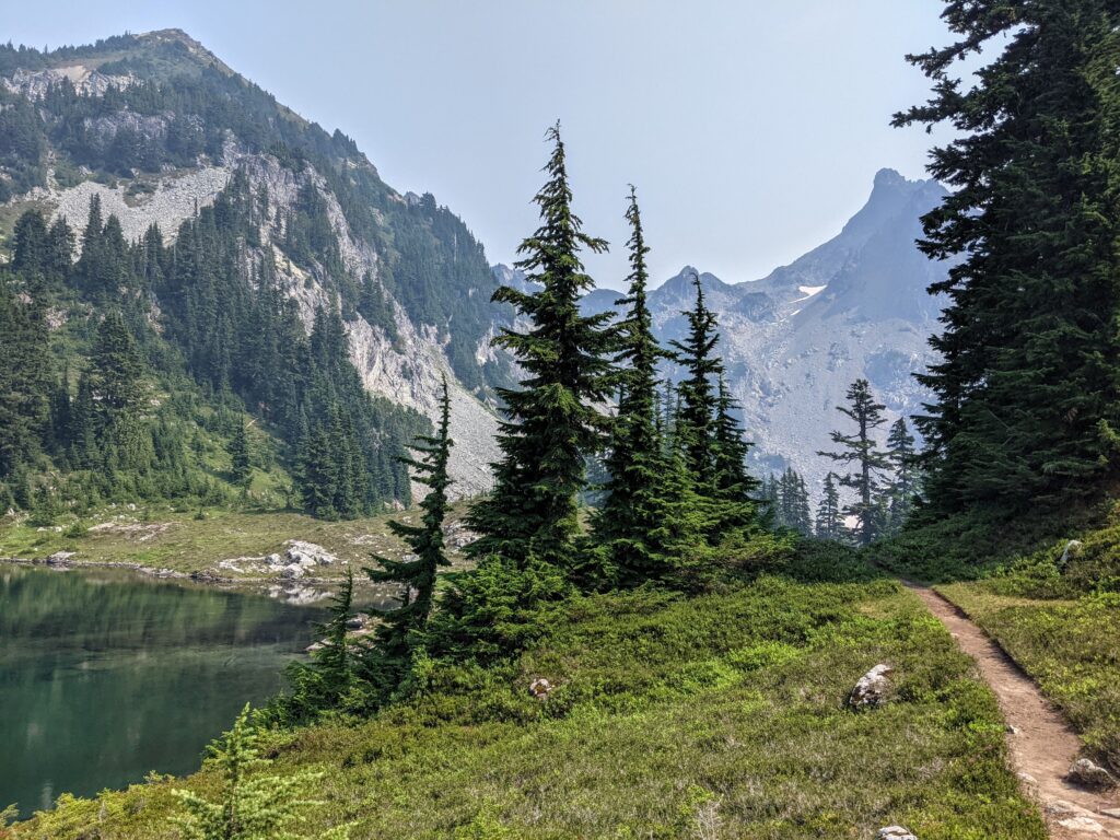
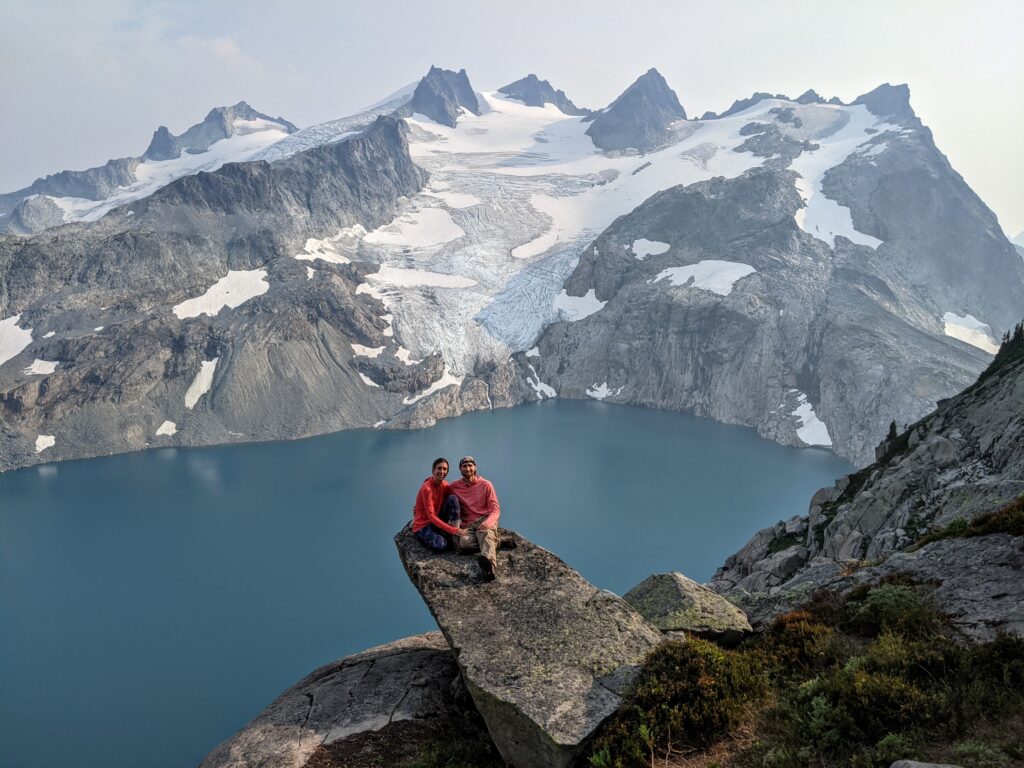
Once you get to the top of the boulder field you’re very close to Jade. The trail is very established and easy to find after the rocks. You’ll pass the small No Name Lake on your left. When you crest and start to descend the last hill just past No Name Lake, you’ll get your first breathtaking glimpse of Jade Lake.
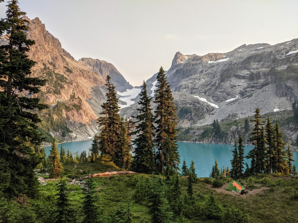
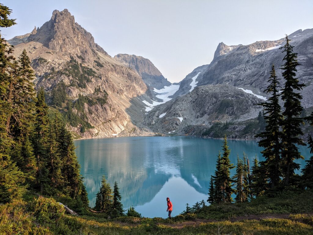
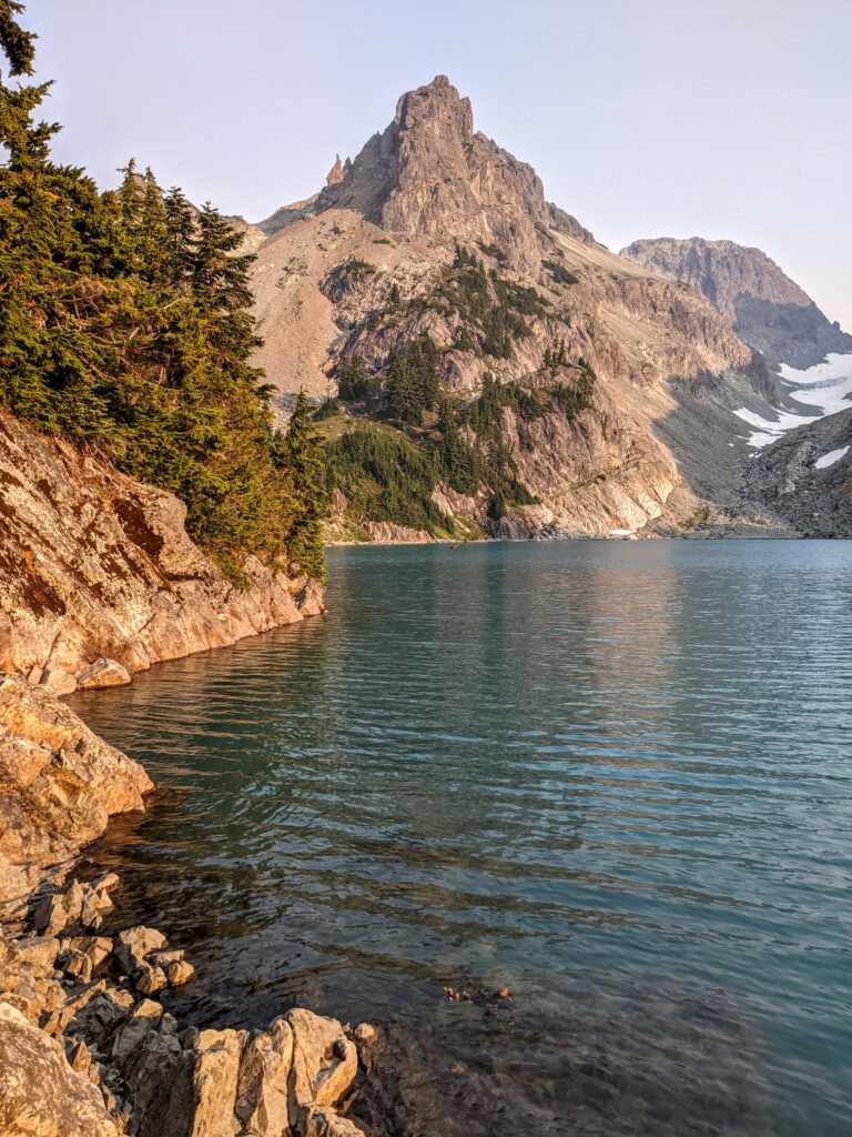
The trail leads right to the best view of Jade Lake that you see immediately above, where the trees part and you get both peaks (Lynch Peak to the left and Dip Top Peak to the right) in frame. We got an excellent camping spot right near the best view and there are additional spots if you continue along the path clockwise around the lake. If there’s nothing available, please follow the Leave No Trace principles and head back to No Name, maybe all the way back to Marmot, to camp in a designated spot.
It took us 7 hours total to get from the trailhead to Jade Lake, including a stop for lunch at Marmot.
Jade Lake to Dip Top Gap (you must)
Dip Top Gap is the col (lowest point of a ridge or saddle) between Lynch and Dip Top peaks across Jade Lake. It adds about 2.5 miles RT and 1,100 feet of elevation gain but is an absolute must-do if you’re at Jade. Since the hike to Jade is pretty strenuous, it’s best to save this for the following day. If you camped at Marmot, I’d recommend staying there and doing both Jade and Pea Soup the following day.
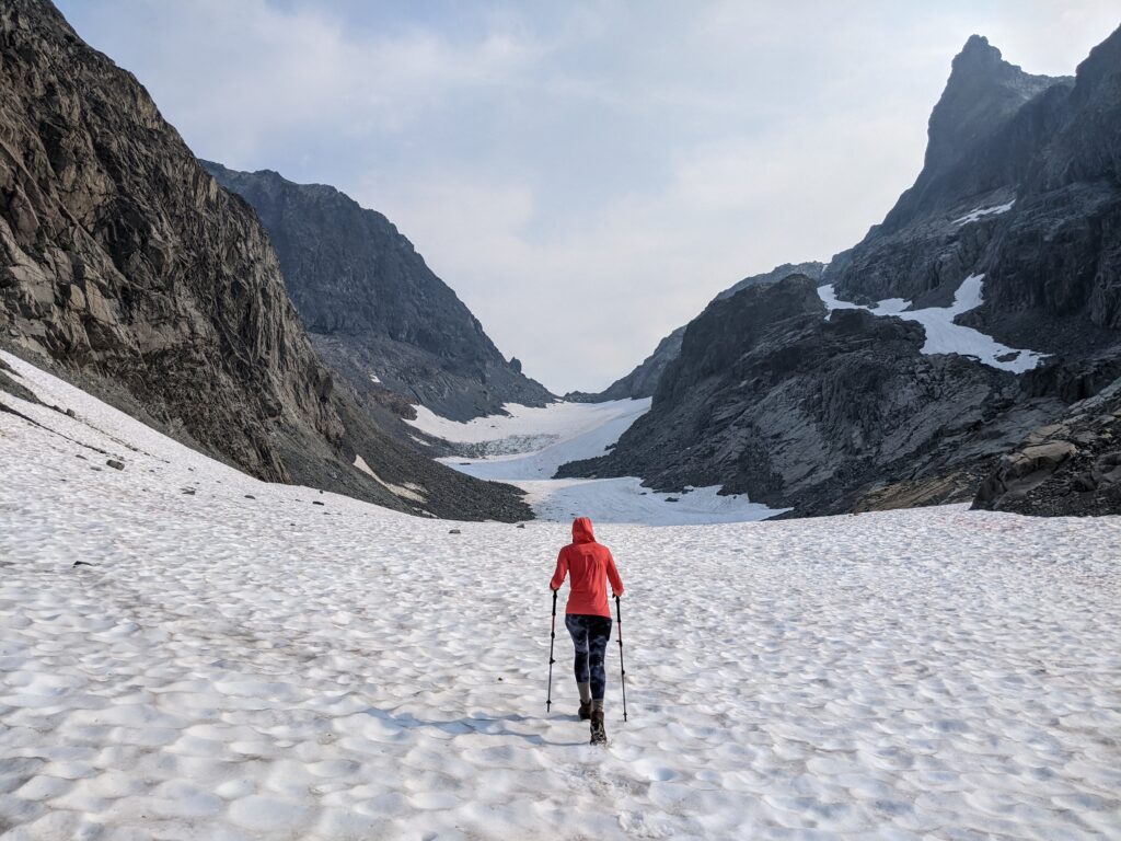
From Jade, follow the trail clockwise around the lake. Then, descend to the water level where the glacial runoff empties into the lake.
It’s as straightforward as it gets from there. Head up to the col where you’ll get the unbelievable view of Pea Soup Lake.
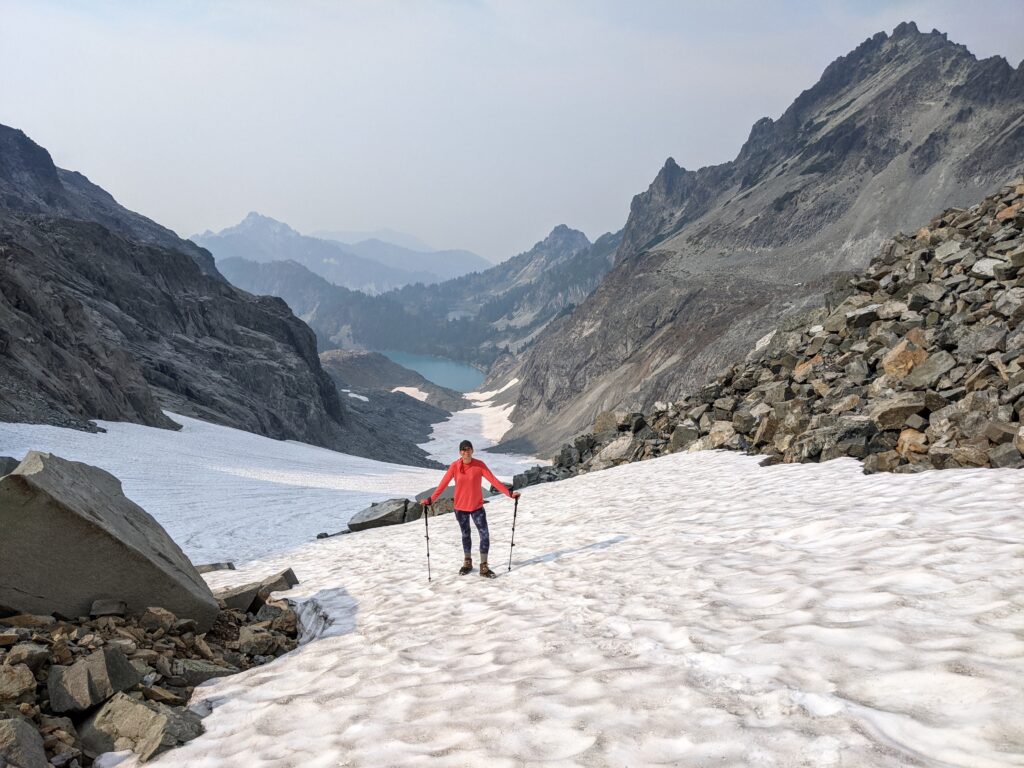
It took us about 2 hours total, including time to explore around the gap. We did not climb Dip Top Peak nor try to go down to Pea Soup Lake. We had microspikes and poles for the snow, which helped, but I wouldn’t say they were a necessity. They might be at other times if it’s icy, however.
We spent another night at Jade and retraced the same steps back to our car at the trailhead. It took us just over 5 hours to get back. Don’t forget about the 700 “extra” feet of elevation as you descend from Marmot then have an incline as you approach Deception Pass. That, coupled with the long drive once you get back to the trailhead, may seem awful. But, you’ll be riding high after getting to see these lakes with your own eyes.
Final thoughts
Jade and Pea Soup Lakes are two of the most beautiful alpine lakes I’ve ever seen. I’d put them up against any lakes in the world, including those in Switzerland or Norway. This hike is not easy but it is worth it.
You could do Marmot, Jade, and Dip Top Gap as a one-nighter, but 2 was perfect.
The mosquitos in mid-August were the worst we’ve ever experienced. I wouldn’t even think of doing this hike without long sleeves, pants, and a head net. Trust me, you’ll want them. Still got some bites through clothing, but the second we stopped moving or got out of the tent, they swarmed around us. The Thermacell Radius repellent unit worked way better than we expected – we were actually able to eat outside at times. Can’t recommend that and a head net enough.
Have you ever done this hike or have any questions? Leave a comment below!
Leave a reply