Guest post by DZR1107
Map tips: each color represents a different day. Click a marker to learn more about the spot, and click the star in the map header to save the entire map under Your Places in Google Maps.
Day 1
- Roan Mountain
- Sunset Park
We arrived at our AirBnb on the top of Beech Mountain. You can get very nice homes with expansive views for a reasonable price in the off-season. It’s 15 minutes from the top of the mountain to the nearby town of Banner Elk taking Beech Mountain Parkway, which doesn’t always show as an option on Google Maps.
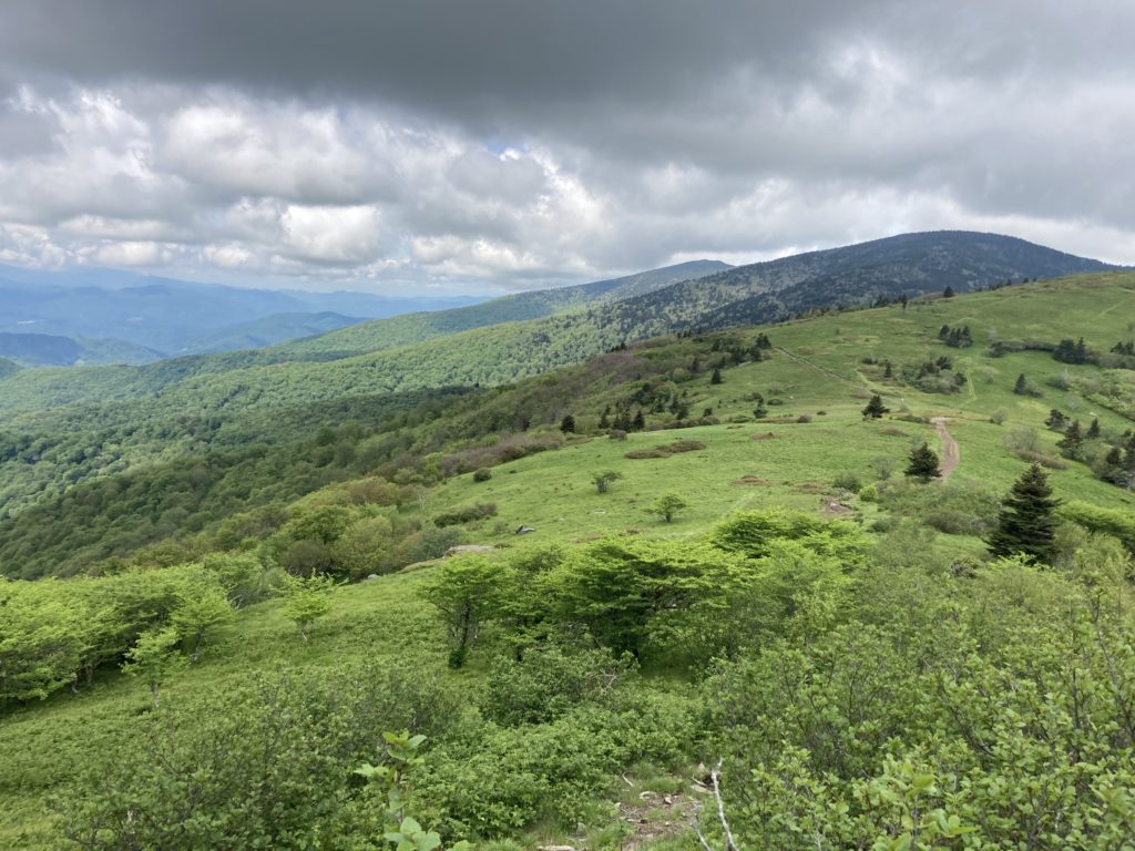
We left around 8:30 am to drive about 45 minutes to Roan Mountain, TN and hike the Grassy Ridge Bald via the Appalachian Trail. It is a small parking lot that fills up quickly with an outhouse, but we were able to find parking. The Appalachian Trail (AT) is continuous, but you want to cross the street to go the direction of the Grassy Bald. It is 5 miles round trip with over 1,000 feet elevation gain. You immediately deal with the ascent through some trees to get to the first bald. With an early-ish morning start, we essentially had the top of the first bald in the 3-bald series to ourselves, but this did start filling up as the day progressed. The trail then descends slightly before climbing back up to the top of Jane’s Bald, which is slightly smaller with more wild rhododendrons. At this point, I stopped, but some continued on to the top of Grassy Bald to get the views of the adjacent valley blocked previously by the bald itself. They said it was worth it to continue. Overall, it’s one of the best trails I’ve been on in the area for expansive mountain views, provided it’s not overcast.
After the hike, we relaxed at our AirBnB and tried to catch the sunset at Sunset Park on Beech Mountain, but it was too overgrown to see anything worthwhile.
Day 2
- The Blowing Rock
- Blowing Rock Grilled Cheese Cafe
- Julian Price Memorial Park
- Green Knob Trailhead
- Price Lake
We started off by going to The Blowing Rock in Blowing Rock. It’s a cute little spot that charges for admission and gives you a short walking path, access to the Blowing Rock, a one room museum, a snack shop, and the company of 3 property cats. If you have the time and it doesn’t look crowded, it’s not a bad little touristy stop.
We grabbed lunch at the Blowing Rock Grilled Cheese café, which offered delicious sandwiches and ate them at the Julian Price Park picnic area off the Blue Ridge Parkway. The picnic area was very nice with several picnic benches, parking, and rest rooms, but lacked great views.
We then backtracked slightly to the Green Knob Loop trail, a 2.2 mile with 515 ft elevation gain hike. We started walking along the lake, which quickly takes you into a forest of rhododendrons. This would be absolutely breathtaking if they were in bloom, but we were probably two weeks early in the first week of June. It was still pretty regardless. It did include a lot of up and down along the path. You cross under the Parkway and the rhododendron forest ends at an active cow pasture. This was slightly a surprise, but the cows moved out of our way as we walked through the pasture uphill to the top of the knob. There is no grand view; it’s just a grassy field. You then descend into a forest and get dropped back out at the lake. If you’re looking for a peaceful nature walk, this is great but if you want views or dislike cows, stay away.
Our next stop was a flat walk around Price Lake. It was easy and good if you’re looking for a lightweight stretch of your legs. You can also rent kayaks and paddleboards. We continued on the Parkway to Linville and then headed back to relax at our AirBnB.
Day 3: Lower Pond Creek
This was a rainy day, so we stayed on Beech Mountain and in between rain tried to do a hike. We picked the Lower Pond Creek Trail, which follows a creek for 0.7 miles with 500 ft of descent. There are several waterfalls along the way, but the trail has a lot of roots and rocks, which make it difficult to maneuver if you have bad knees, balance, or are pregnant. We did not take the trail to it’s end destination since we realized it ends at a road and there was no “end” reward. I still recommend doing this if in the area, but I would just turn around after She Falls Falls. The ascent was not as bad as we were expecting on the hike down, but still gets the ticker going.
Day 4
- Linville Falls Visitor Center
- Sugar Cream Ice Cream Parlor
- Emerald Outback
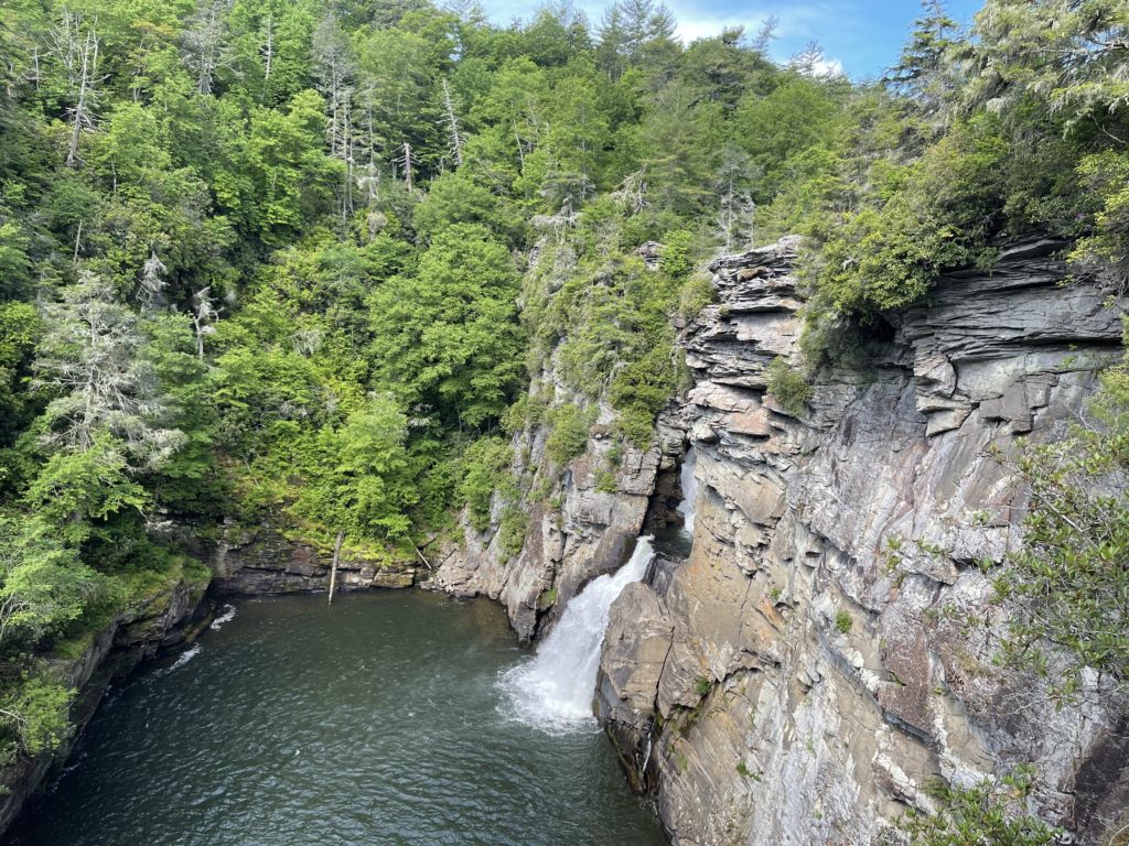
We got up early and drove down to the Linville Falls Visitor Center off the Blue Ridge Parkway and took both branches of the Plunge Basin Trail. The branch to the overlook does involve some elevation gain, but it is very do-able. The path to the bottom of the basin is more strenuous and involves climbing over rocks and roots. However, the view at the bottom is worth it. Afterwards, we hiked to the upper overlooks. You can also access these 4 overlooks by parking at the Linville Falls forest access, but the half-mile walk isn’t bad at all. Of all the views, the bottom of the Plunge Basin was the best.
We treated ourselves with delicious ice cream from Sugar Cream Ice Cream Parlour in Banner Elk before heading to Emerald Outback Trails. This is primarily a mountain bike trail system on the top of Beech Mountain by Land of Oz. It is a relaxing hike, but does not offer any sweeping vista views.
Overall, the Boone/Blowing Rock/Beech Mountain/Banner Elk area is very pretty and has a wide range of things to do – tourist attractions, wineries, hiking, waterfalls, etc.

Year traveled: June 2021

Leave a reply