Map tips: each color represents a different day. Click a marker to learn more about the spot, and click the star in the map header to save the entire map under Your Places in Google Maps.
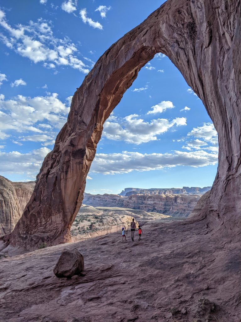
Day 1: SLC to Corona Arch
Flew into Salt Lake City and picked up rental car from Nu Car Rentals. Their office is offsite; it worked out fine but they do have onsite companies that are more expensive. We drove 4 hours to Moab. Checked into the Expedition Lodge, which we were happy with. Good location on the main road, pool and slide for kids, free breakfast and clean rooms. Walked to the Food Truck Park and grabbed dinner. Pretty expensive but decent variety.
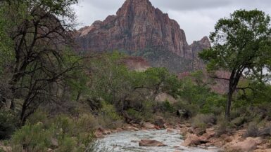
Drove to the Corona Arch Trailhead, which is about 10 miles down Potash road. Google Maps did some pretty odd things on both our phones for directions. It’s only 1 turn to the west on Potash road and 20 minutes total from the heart of Moab so I would rely on that. It’s a 3-mile RT hike with 500 feet of elevation gain. It should take around 2 hours or less. This is not in a national park so it’s maybe not as busy as Arches or Canyonlands. It’s equally as awesome, though. Highly recommend and very glad we did it.
Day 2: Canyonlands, Dead Horse Point, and Arches
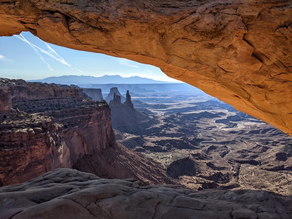
- Mesa Arch
- Grand View Point Overlook
- Shafer Canyon Overlook
- Dead Horse Point State Park
- Moab Brewery
- Windows
- Double Arch
- Balanced Rock
I would say you can’t get to Arches or Canyonlands National Park too early. Canyonlands actually has 4 distinct areas (Island in the Sky, Needles, the Maze, and the Rivers) but Island in the Sky is the closest to Moab, the most popular, and most likely the one you’re going to visit. We only went there but there are some cool longer hikes like Druid Arch in the Needles that we’d like to do someday.
We got to the Mesa Arch parking lot in Canyonlands (45 minute drive from Moab) a little after 7:30 am. There was no line to get in to the park but a decent amount of people at the arch, which is the most popular stop and one of the most recognized photos in the country. I thought it was overrated and wouldn’t really care for it, but ended up liking it quite a bit. You only need 15-30 minutes but could spend longer – it’s a very short walk from the parking lot on an easy trail. If you try to go here for the famous shot at sunrise, be prepared to stand shoulder-to-shoulder with other photographers.
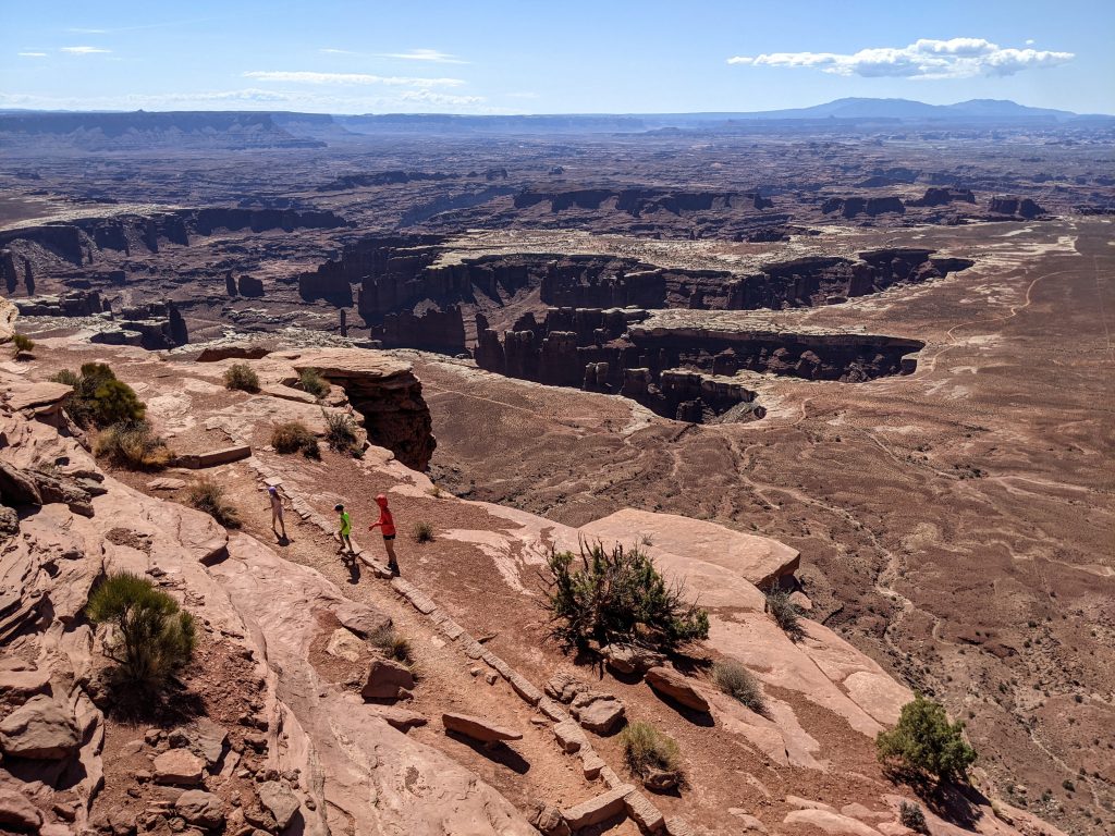
Next was Grand View Point, which is at the very end of the main road through the park. The view from there is great and there’s an easy 2-mile RT hike to an overlook. There’s no shade and you walk along the rim most of the way so be careful with kids. It’s a nice view but I wouldn’t say it’s a must-do; the view from where you park could suffice.
On our way out we stopped at Shafer Canyon Overlook and I thought that was another worthwhile stop (5-10 minutes). There was over a 1-hour wait just to get into the park as we were leaving shortly after 11 am on a Tuesday morning. Overall, I’m glad we went to Canyonlands National Park but I don’t consider it a standalone destination. It’s nice to group with Arches National Park and Corona Arch.
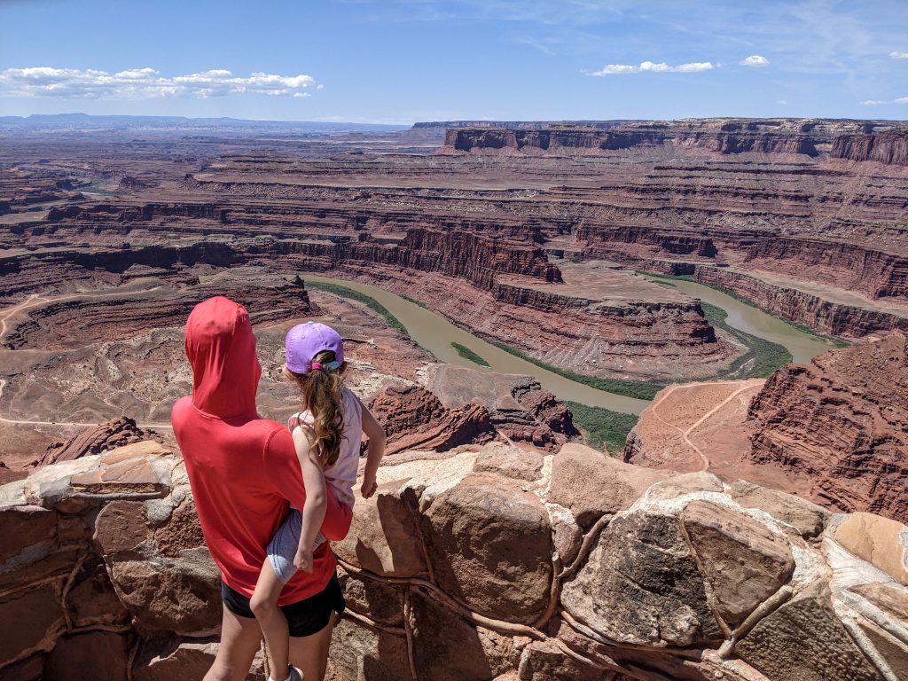
We then went to Dead Horse Point State Park, which you pass on the road from Moab to Canyonlands so it makes sense to do both the same day. You have to pay $20 separately to get in here and there’s really only 1 view that people go to see – it’s nice but we didn’t think it was worth it. I definitely would not go here before Canyonlands. DHPSP can be a quick stop of maybe 30-40 minutes if you want to see the river bend around an outcropping of the canyon, though.
Back to the Expedition Lodge for lunch (picked up some stuff from City Market – decent grocery store in Moab) to spend the hottest part of the day in the pool. Had dinner at Moab brewery – great beer but terrible food – then headed to Arches National Park (the entrance is 4 miles from Moab).
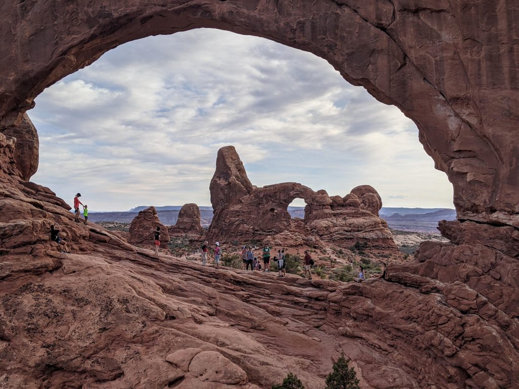
Arches has 1 main road that goes through the park, which is pretty expansive. There is some driving between the stops. We drove to the Windows trailhead (20 minutes from the entrance) and it was still PACKED at 6:30 pm. There’s about a 1-mile loop to go to North and South Windows and Turret Arch. Make sure to go through the North window and explore the other side to get the view looking back of Turret Arch framed in the window. Know there might be tons of people in your photo, however.
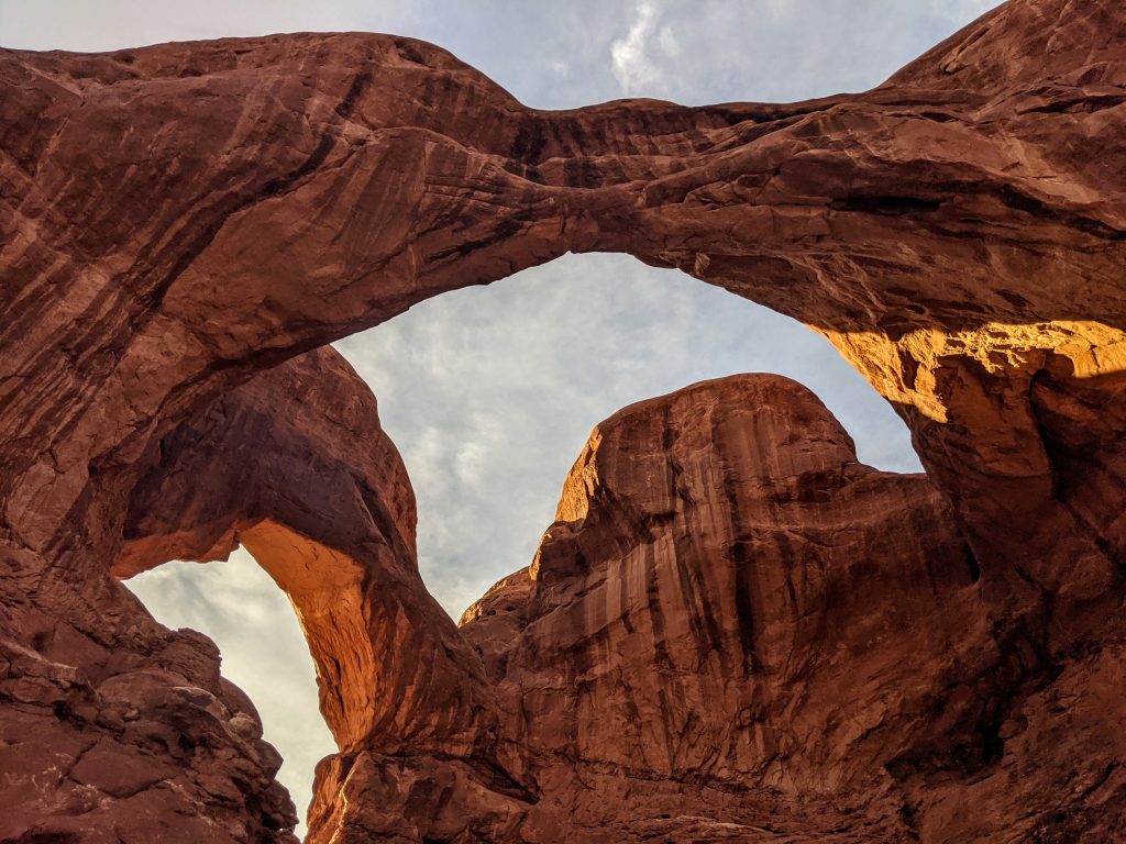
You could walk from there to the Double Arch parking area, which is just down the road, but you should be able to see if there are spots open and could drive to save you maybe 1/4-mile of walking. Double Arch was also packed – I’d guess you have to be there either really early or really late to not be around tons of people. Both areas are must-sees though, and are so close you have to do them together. Double Arch is a short walk from the parking area and could take anywhere from 15 minutes to however long you want to hang around.
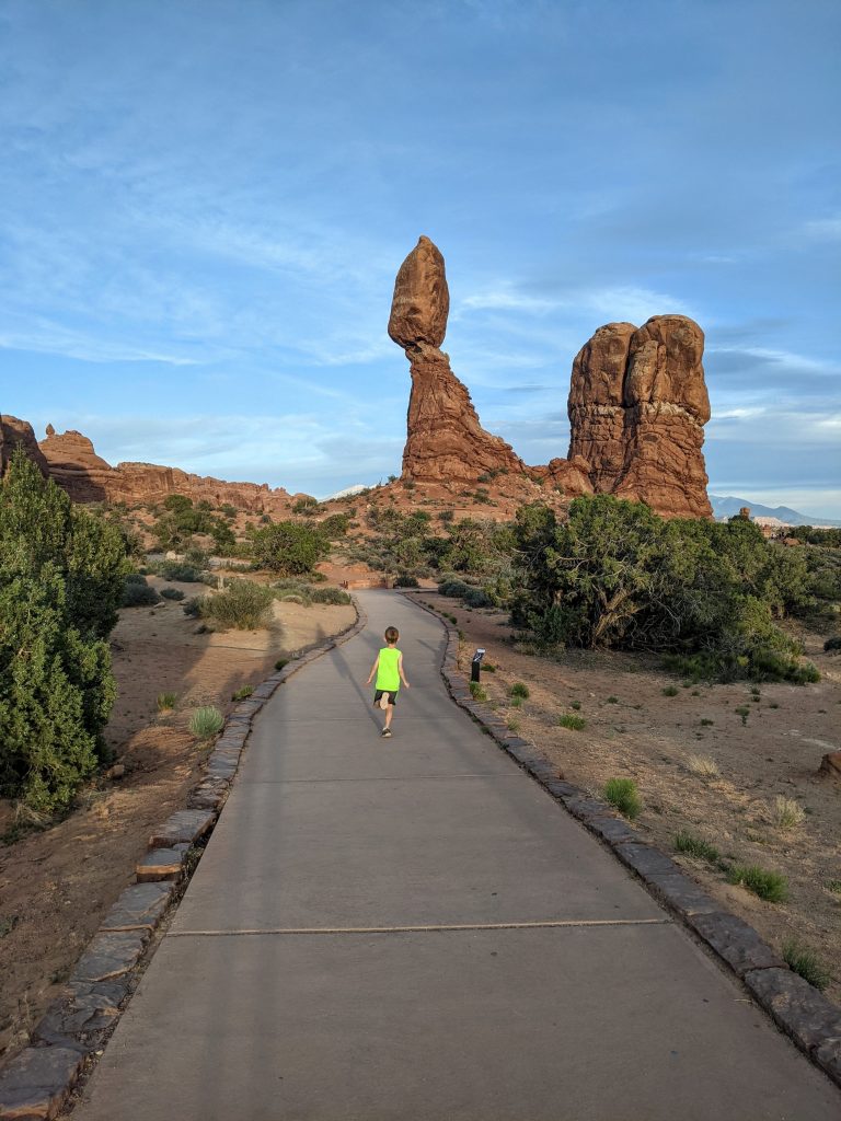
We stopped at Balanced Rock on the way out which is a very quick stop. You can walk up close to it but the view from the parking area alone is worth it.
Day 3: Arches to Ouray
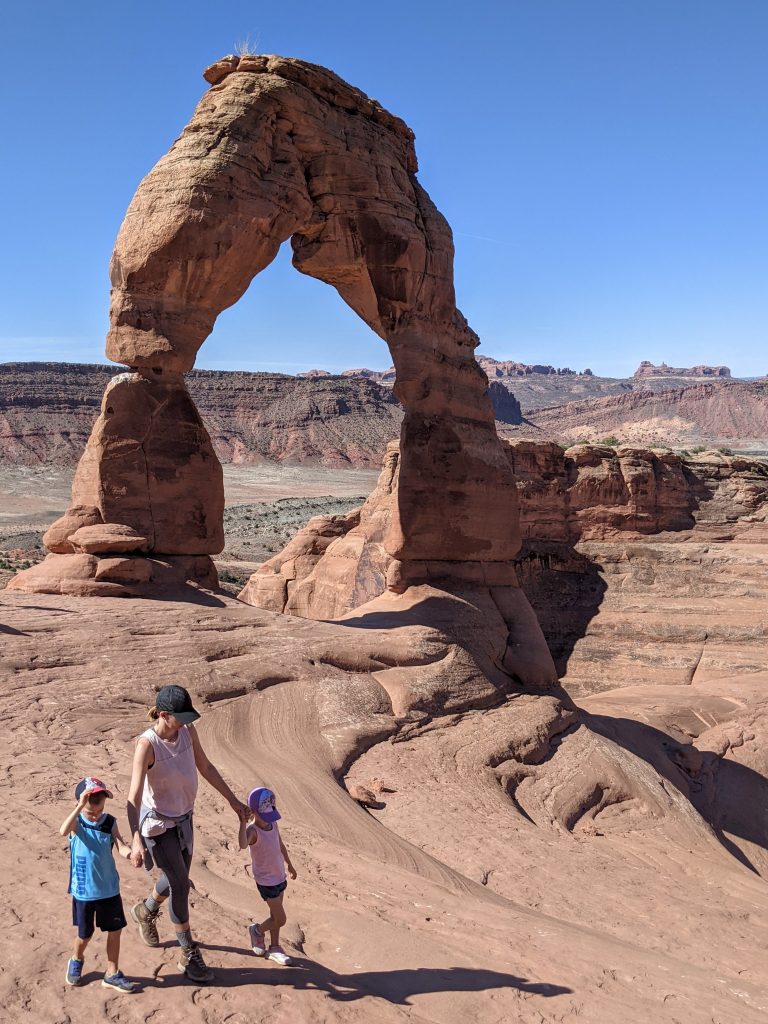
- Delicate Arch
- Sand Dune Arch
- Park Avenue
- MOYO – Moab Frozen Yogurt
- Ouray Brewery
We got to Arches later than we wanted, around 8 am, and I knew that was a mistake. There was a short line to get in, but the line to get to the Delicate Arch trailhead (25 mins from entrance) wasn’t moving. People were turning around and when we got to the parking lot after about 10 minutes, a ranger was telling people to come back.
I was in the process of dropping off my wife and kids as I was going to go to the lower lookout point 1 mile down the road and jog back, but got very lucky as someone pulled out while we were doing that and the ranger said we could take that spot. No one else came down the road for a good 20-30 minutes and they closed entrance to the park completely around 8:30. Again, you can’t get there too early and we got very lucky.
The hike to Delicate Arch is 3 miles RT with 500 feet of elevation gain. A good portion is up a slab of rock in the sun, so go early if you can. There is some exposure towards the end if you’re not comfortable with heights but you can hug the canyon wall. There was a line to get your picture under the arch, which was good since there were a ton of people around.
Got our pictures, headed back and drove further into the park to visit Sand Dune Arch. This is a fun area for kids and since it’s in a very narrow slot canyon, you get shade. I wouldn’t say it’s a must-see but it is neat and you only need about 15 minutes here.
We could have kept driving to the Devil’s Garden trail at the very end of the main road. There’s a popular 8-mile RT hike to more arches. The most notable is Landscape Arch – 1.75 miles RT if you only want to see that. However, we didn’t feel the need to do that one.
On our way back out we stopped at Park Avenue so I could do that hike quickly. The trailhead is close to the entrance. It’s a 1-mile trail if you can have someone pick you up at the end. You’ll pass the end of the trail along the main road, heading further into the park. Alternatively, hike back up the trial for 2 miles RT.
The view from the trailhead is awesome. You should definitely get out to see it but could skip the hike. Overall, Arches was very neat and very busy. You could see the highlights in 1 day or spend several days. Just depends on how much you want to do and how much you can handle being out in the sun/heat. In the first week of June it was in the 90s by noon and regularly is over 100 during the summer.
We stopped for some excellent frozen yogurt at MOYO and then made the 3-hour drive to Ouray, Colorado. Checked in to Ouray Riverside Resort and had dinner at Ouray Brewery – good beer, food, and views from rooftop.
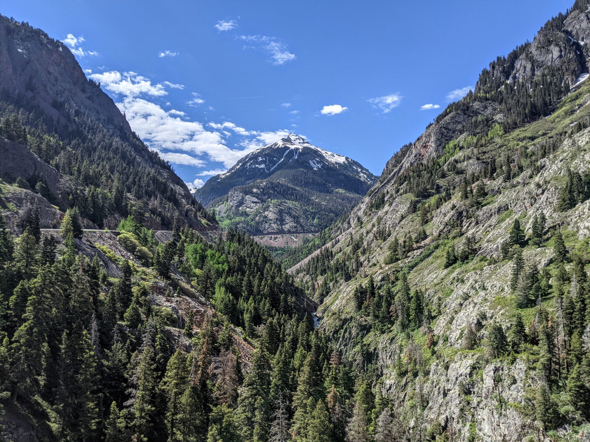
Day 4: The Million Dollar Highway
- Bear Creek Falls
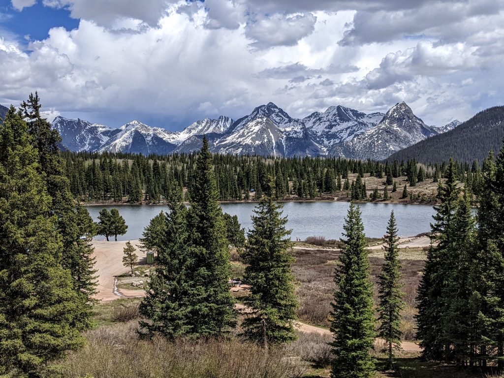
- Molas Lake
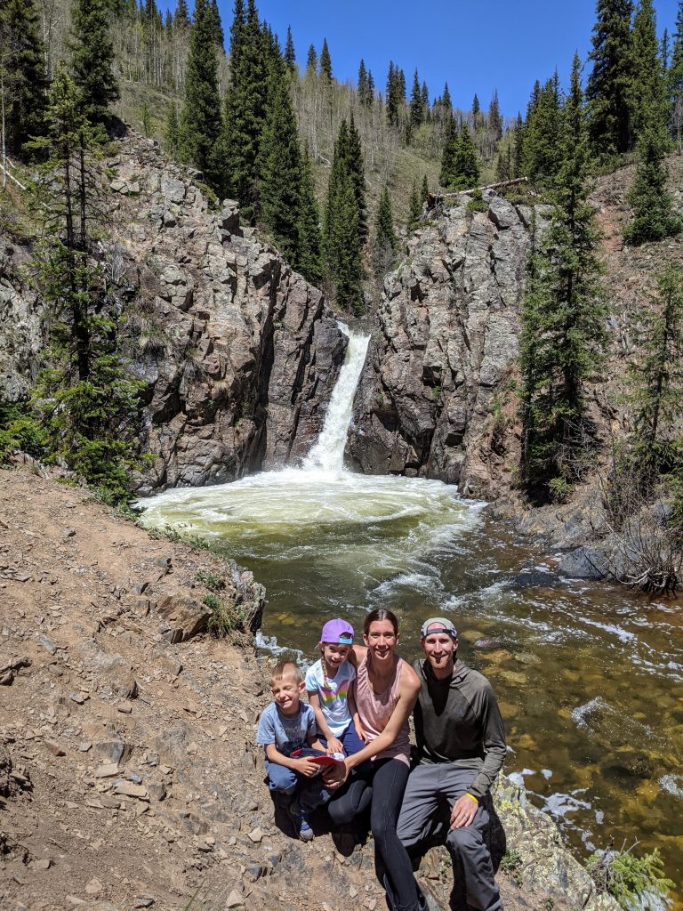
- Adrenaline Falls
- Avalanche Brewing Company
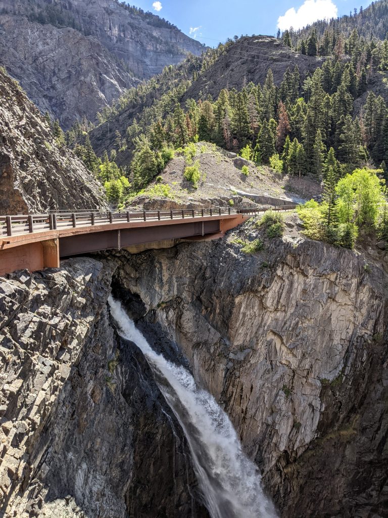
We drove down the Million Dollar Highway (US 550), which is said to be one of the most beautiful drives in the country. The most scenic part is the stretch between Ouray and Silverton, and our first stop heading south out of Ouray was Bear Creek Falls. There’s a pull-off on the south side of the road, just around a turn, and the waterfall is hidden from sight as it flows underneath the highway.
The waterfall isn’t the only reason to stop – you get a fantastic view of Mount Abrams perfectly centered between 2 sloping mountains (the quintessential view of Ouray/Million Dollar Highway). We made other stops for pictures along the way, although there are spots with no shoulder and steep drop-offs so you can’t always stop. Red Mountain Pass and Molas Lake were favorites.
Adrenaline Falls is about 2 miles down Lime Creek Road, which is a very rough road. It took about 20 minutes to go those 2 miles and there is a small pull-off for maybe 3 cars on the left side of the road. It is very easy to miss, so watch the odometer and look closely for a trail that leads down the hillside.
The trail is a little bit steep but short, and you can get to the falls in about 10 minutes. The water level was so high and you couldn’t get into the creek (nor could you cliff jump, which is possible when the flow is less). I don’t know if the long, slow, bumpy drive was worth it (need a high-clearance vehicle) but it is a nice setting and we had it all to ourselves. There are some hidden hot springs just off the highway with a great view of the mountains – you should ask a local if you want to find them.

Also, the waterfalls near South Mineral Campground look amazing and the Ice Lakes hike, which also starts from there, is very popular and scenic. That whole area was sadly closed due to damage from the 2020 wildfire so we couldn’t see any of it.
Had lunch at Avalanche Brewing Company in Silverton (good beer, good tacos, terrible pizza). Lastly, picked up groceries for most of our remaining meals at Duckett’s – the only grocery store in Ouray.
Day 5: Telluride
- Mystic Falls
- Telluride Gondola
- Bridal Veil Falls
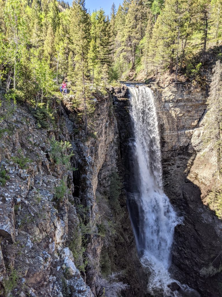
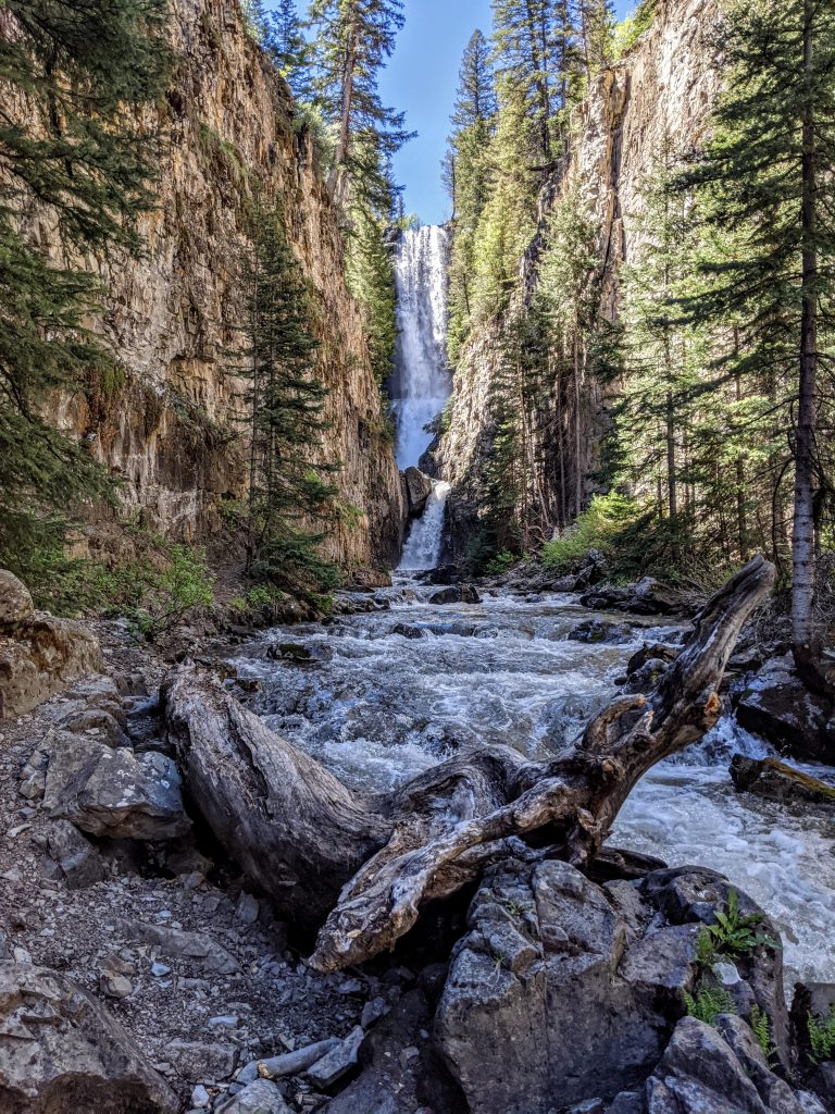
Drove 1 hour to Telluride along scenic Route 62. Went to the Ames Plant to park for the Mystic Falls hike. This is not a well-known waterfall but the top is easy to get to. We parked at the plant but there is an extremely rough road that takes you right to the trailhead. I’d park and walk as it’s only a 5-10 minute walk.
Instead of detailing instructions here, go to the World of Waterfalls website – there are pictures of every turn/part of the trail and perfect directions on how to get to both the top and bottom of the falls. Getting to the bottom requires route-finding skills, multiple creek crossings, respecting private property, and is not to be taken lightly. But if you can do it, it’s 100% worth it – the huge waterfall between the narrow cliffs does not look like it could be from Colorado, more like Hawaii or Central America.
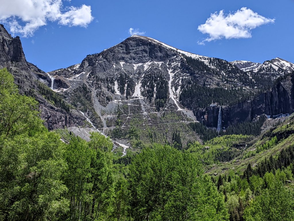
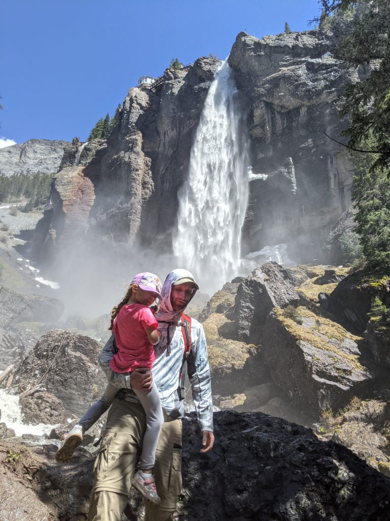
Next we drove into Telluride and parked at the free Carhenge Lot. Walked to the free gondola to take a ride up the mountain – very cool that such an “affluent” area has free parking and gondola rides. The view of the mountains, Bridal Veil Falls, Cornet Falls (easier, more accessible than Mystic and right in town), and Ingram Falls (seasonal) were spectacular on the way up and down. Didn’t spend much time up top but you can hike, bike, or ski depending on the season.
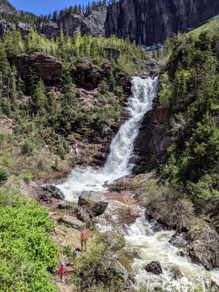
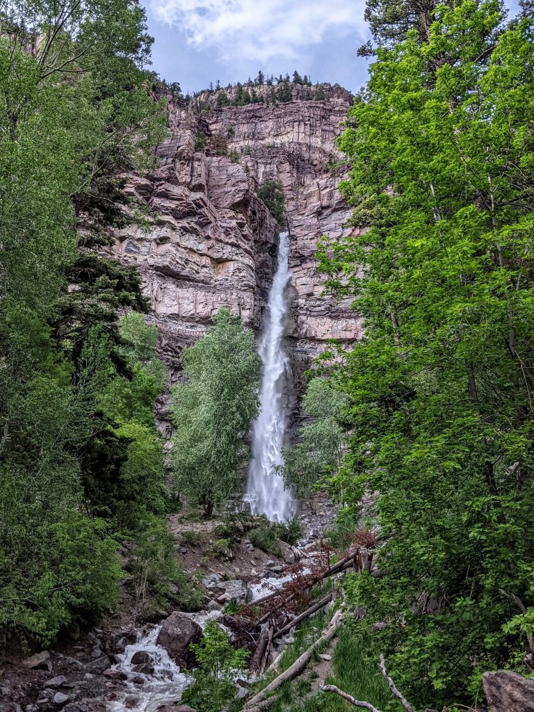
Took the main road through Telluride (Colorado Ave) until it dead-ends at the Bridal Veil Falls parking lot. The road actually continues up to the top of the falls, but it is a Jeep trail and only high-clearance vehicles should proceed.
The trail to the base of the falls, which are the tallest free-falling waterfall in the state, is about 2.5 miles RT with 1,000 feet of elevation gain. There is a creek crossing, and as of this writing there was not a bridge. We both had to get into knee-high water (only 1 of us on purpose) to safely get our kids across, so if you’re in snow-melt season, be prepared to get wet. You pass 2 other awesome waterfalls on the way, so look for short spur trails to your right (you’ll probably hear and see them from the main trail unless the flow is very low).
Great hike, highly recommend. You can continue up the jeep road to the top of the falls, and if you have even more time, the Jud Wiebe Memorial Trail also looked great. Back to Ouray for dinner at the cabin.
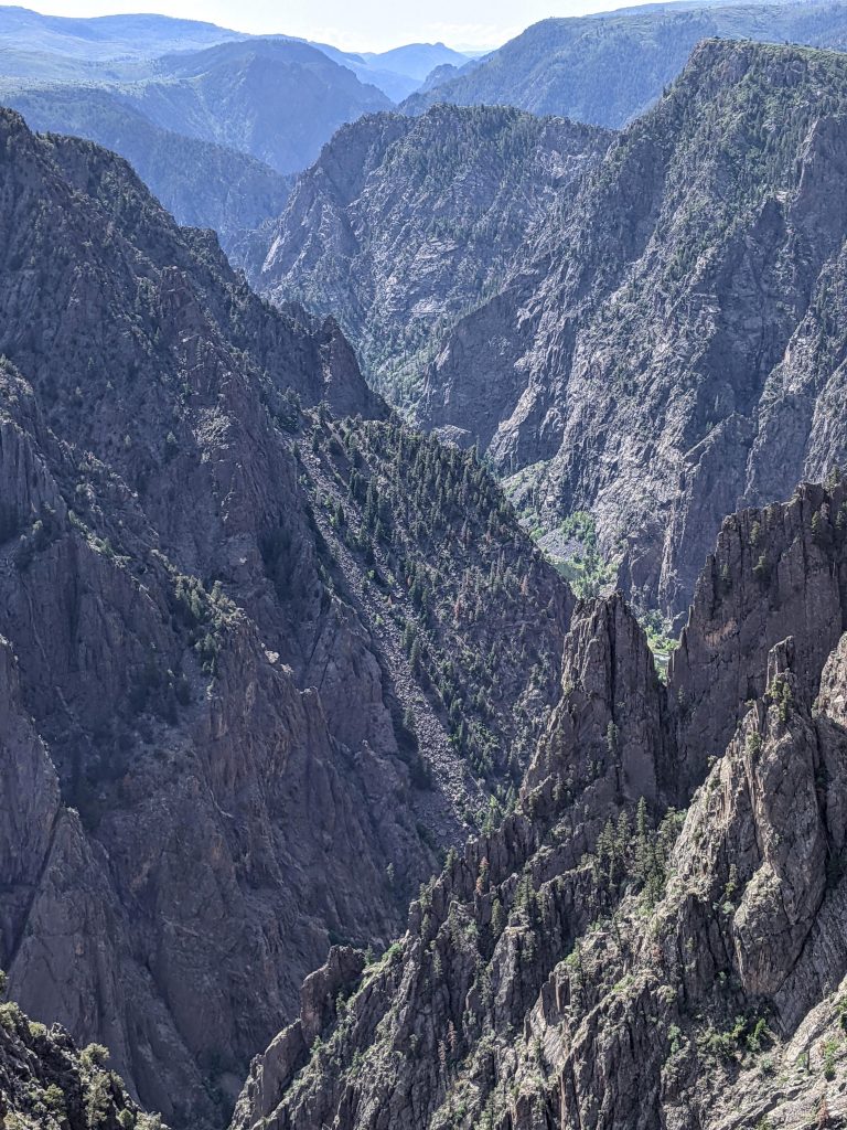
Day 6: Black Canyon of the Gunnison North Rim
- Exclamation Point
- Chasm View
- Narrows View
Drove 2 hours to the north rim of Black Canyon of the Gunnison National Park. First stop was the ranger station to do the 3-mile RT hike to Exclamation Point. Not much shade, get there as early as you can to be out of the sun and have better lighting. Continued just up the road to the North Rim Campground to do the 0.3 mile Chasm View loop trail. Also stopped at the Narrows viewpoint. They were all great viewpoints and there are more you can stop at. However, after visiting the south rim the next day, I can’t say the extra drive and time was worth it. The north rim is pretty out of the way and while there are far fewer people here than the south rim. I think you’re fine to just visit the south rim.
Day 7: Black Canyon of the Gunnison South Rim
- Tomichi Point
- Chasm View
- Painted Wall View
- Cedar Point Nature Trail
- Ouray Hot Springs Pool
- Cascade Falls Park
- Red Mountain Brewing
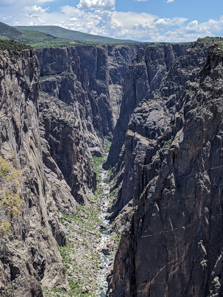
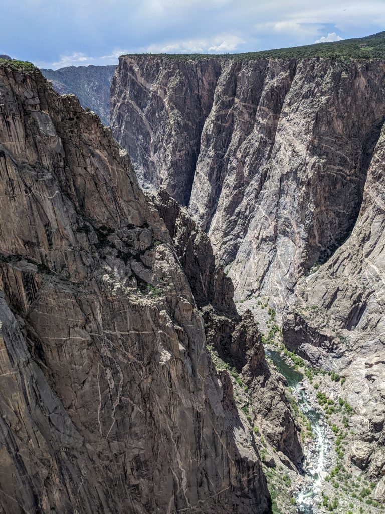
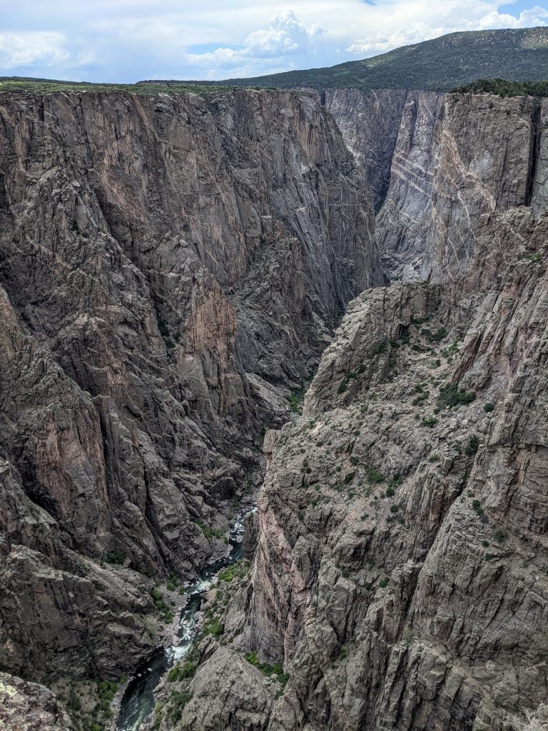
Drove 1 hour to the south rim of Black Canyon of the Gunnison. Stopped off at Tomichi Point (best view of the layers of the canyon – less than 5 minutes), Chasm View (ok, where canyon is at its narrowest point – less than 5 minutes), Painted Wall View (must-see – 10 minutes), and Cedar Point Nature Trail (best view in the park since you get a straight-on view of the river and Painted Wall, 0.3 mile trail, as long as you want).
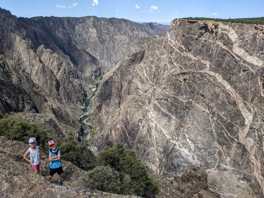
It might seem like a waste to go to a national park for less than a half day, but this park is incredible and very unique. The sheer, narrow cliffs on both sides are over 2,000 feet high. There’s a sign that says the Empire State Building would take up just over half of that height, which is unbelievable to think about.
You can hike down into the canyon and back up. Alternatively, the East Portal road takes you down to the river. It was closed due to construction when we were there, though.
This is the least-visited national park in Colorado. It’s not really close to any major cities and kind of out of the way but I’d say definitely go if you can. If you’re trying to do both rims the same day (which we considered), it will take 2 hours to drive between them.
Drove back to Ouray and went to the Hot Springs Pool. It’s expensive and while I struggle to say it was worth the cost, the kids loved it. It was perfect for families. They have a huge shallow heated pool that is between 2-3 feet deep and you’re surrounded by mountains on all sides. Played at the playground just beside the pool, did the 0.2 mile RT “hike” to Cascade Falls down the road (must-see) and had a good dinner at Red Mountain Brewing.
Day 8: Back to Salt Lake City
Very relaxed morning at the cabin and started the 6-hour drive to Salt Lake City around 11. Got dinner from the Dodo restaurant. I’d eaten there before and it was one of the reasons we drove there in time for dinner. Phenomenal food and dessert. Ate at the Sugar House Park right across the street so the kids could unwind after the drive.
Day 9: Twin Lakes hike
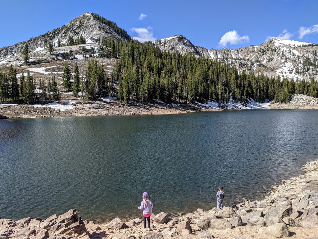
Our flight left in the afternoon so we drove up through Big Cottonwood Canyon to Brighton Ski Resort. There is a parking area for the Silver Lake Recreation Area, where the 2.5-mile RT hike to Twin Lakes Reservoir starts. You can walk around Silver Lake (1 mile loop) but the hike up to Twin Lakes is worth it (700 feet of elevation gain). Perfect morning activity. Had lunch and went back to the Sugar House Park until we had to go to the airport.
Final thoughts
Trying to decide where to stay in the San Juan Mountains can be a challenge. There are several options: Ouray, Silverton, Durango, Telluride, Ridgway. Ouray was perfect as a base and I’d stay there again. Plenty of dining options and things to do in the town, walkable, and convenient enough to all the other locations. There is a 2-mile loop trail along the sides of the river that’s great for morning runs and evening strolls. We skipped Baby Bathtubs and Box Canyon, which are other family-friendly activities right in Ouray.
You could fly in/out of Denver to do this trip, too. It’s a lot of driving either way so I’d go with whatever airport is cheaper.
Aside from the South Mineral Campground/Ice Lakes area, I really want to do the Blue Lakes hike which is between Ridgway and Telluride off of US 62. The view from the middle lake overlooking lower blue lake with Mount Sneffels in the background is absolutely stunning – I want to see that with my own eyes. On a return trip I’d go in July or August, however, to really explore up in the mountains. UPDATE: we did! Check out the links below.
Year traveled: June 2021
Leave a reply