
The most important thing on this page: please follow the 7 principles of Leave No Trace whenever hiking (and all the time, actually – most are pretty good general life tips, too):
- Plan ahead and prepare
- Travel and camp on durable surfaces
- Dispose of waste properly
- Leave what you find
- Minimize campfire impacts
- Respect wildlife
- Be considerate of other visitors
Now, on to the Queen’s Garden and Navajo Loop Trail. Here are the quick facts:
- Where: Bryce Canyon National Park, Utah
- More specifically, where: Start at either Sunrise Point or Sunset Point.
- Distance and elevation: 3 miles (4.8 km) total with 625 feet (190 meters) of elevation gain.
- Highest point: 8,100 feet (2,470 meters) at Sunrise Point.
- Why you should hike this trail: a relatively easy trail that goes through the most interesting hoodoo formations in the park.
- Fee or permit? Regular National Park entrance fee only, no permit.
- Best time of year: early (May – June) or late (September) summer are best, but it doesn’t usually get too hot because of the higher elevation. Winter can bring snow and ice but generally accessible all year long.
- Closest commercial airport: Las Vegas, Nevada (LAS) and Salt Lake City, Utah (SLC) are both about 4 hours from the park. St. George, Utah (SGU) is about 2 hours away but has far fewer flight options.
Tips to remember for the Queen’s Garden and Navajo Loop in Bryce Canyon
- Queen’s Garden is an out-and-back trail that starts at Sunrise Point. You’ll take that, then 1 of the 2 trails that make up the Navajo Loop. Confusing, I know, but the map below should clear things up.
- The Navajo Loop takes you down into the canyon from Sunset Point and loops back up to the same spot.
- Two Bridges and Wall Street are two trails that combine to form the Navajo Loop. You’ll only take one or the other on this hike.
- Wall Street is about 0.25 miles longer, has narrow walls, a shorter and more aggressive switchback section, and gives more of a slot canyon feel.
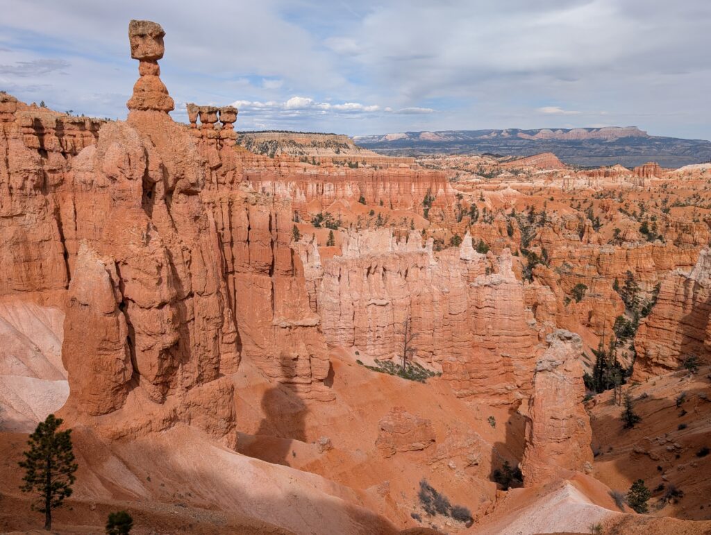
- Two Bridges is more expansive, has two natural rock bridges (thus the name), and has the view of Thor’s Hammer.
- Wall Street closes in the winter so you may have no choice but to take the Two Bridges trail.
- Most people recommend doing the trail in a clockwise direction.
- Lighting is best in the morning.
- You can add the Peekaboo Loop Trail to double the mileage (6 miles total) and get away from the crowds. Queen’s, Navajo, and Peekaboo is often referred to as the figure-8 trail.
Getting to the trailhead(s)
You can start this hike at either Sunrise Point or Sunset Point. You may see Sunrise Point labeled as “Queen’s Garden Trailhead” and Sunset point labeled as “Navajo Loop Trailhead.” Coming in the one-way entrance to the park, the turnoff for Sunrise Point will be first. Both areas have sizeable parking lots but they can fill up in peak times. The flat, paved Rim Trail connects both points with an easy walk. I’d save the Rim Trail portion for the end of the hike no matter where you start.
There is also a free shuttle that can pick you up at several spots including Bryce Canyon City, before you even enter the park. View the stops and timing information here.
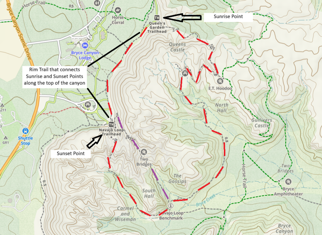
Map courtesy of Gaia GPS
Starting at Sunrise Point
You’ll have a gradual, easier descent into the canyon. The climb out, at the end, will be along the Two Bridges or Wall Street trail. Both have steeper switchbacks which can be more strenuous. However, you may find climbing the steep part easier on your body than descending it.
Starting at Sunset Point
You’ll have to make the choice to take Two Bridges or Wall Street right at the beginning. Both trails have switchbacks and the trail narrows as you get closer to the floor of the canyon. That makes for a pretty awesome and dramatic entrance. You’ll also have an easier time coming out of the canyon on the gradual ascent.
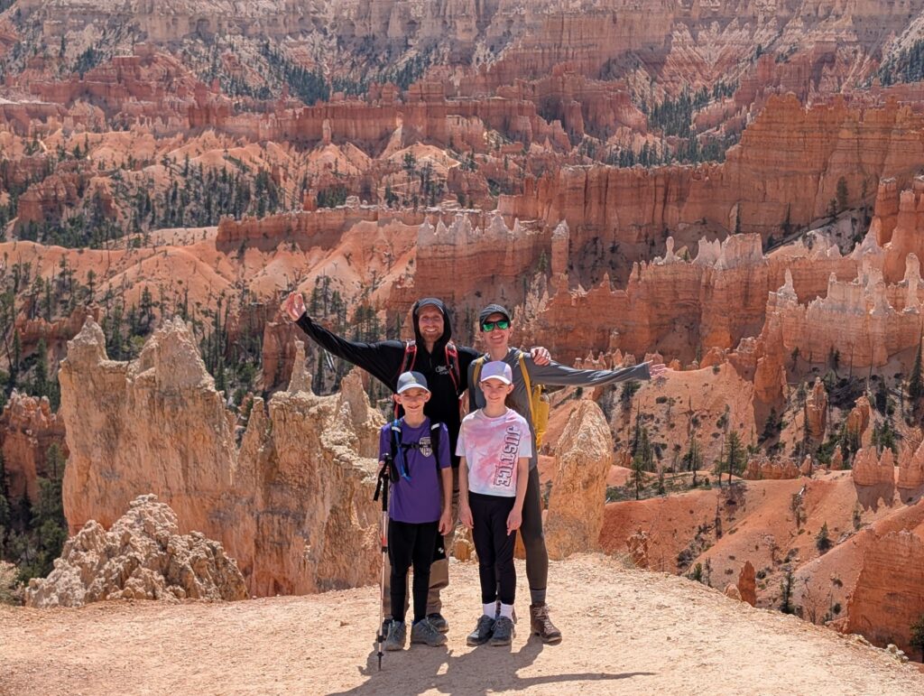
We started at Sunrise Point on our latest visit and went clockwise so that’s the route this guide will follow. I don’t think there’s a wrong choice, however.
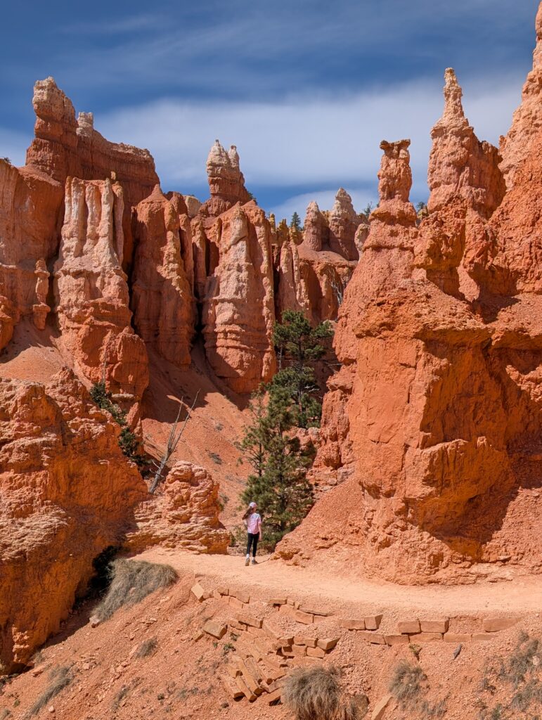
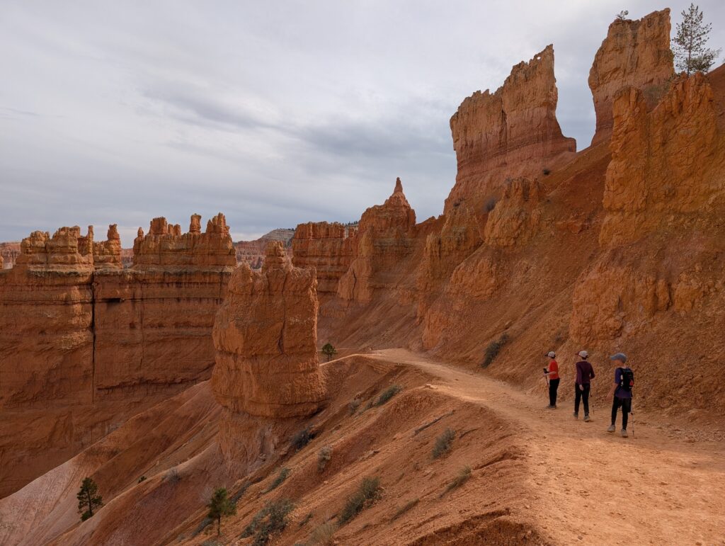
Sunrise Point into the canyon
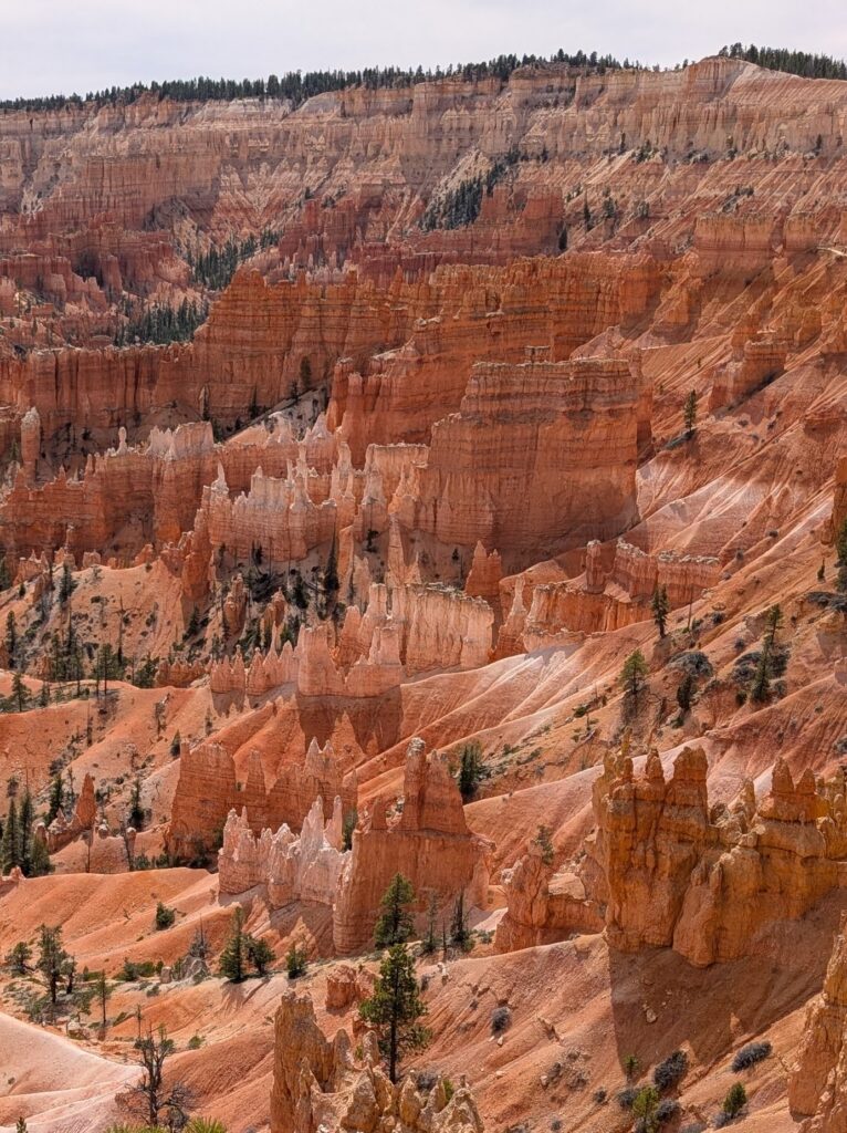
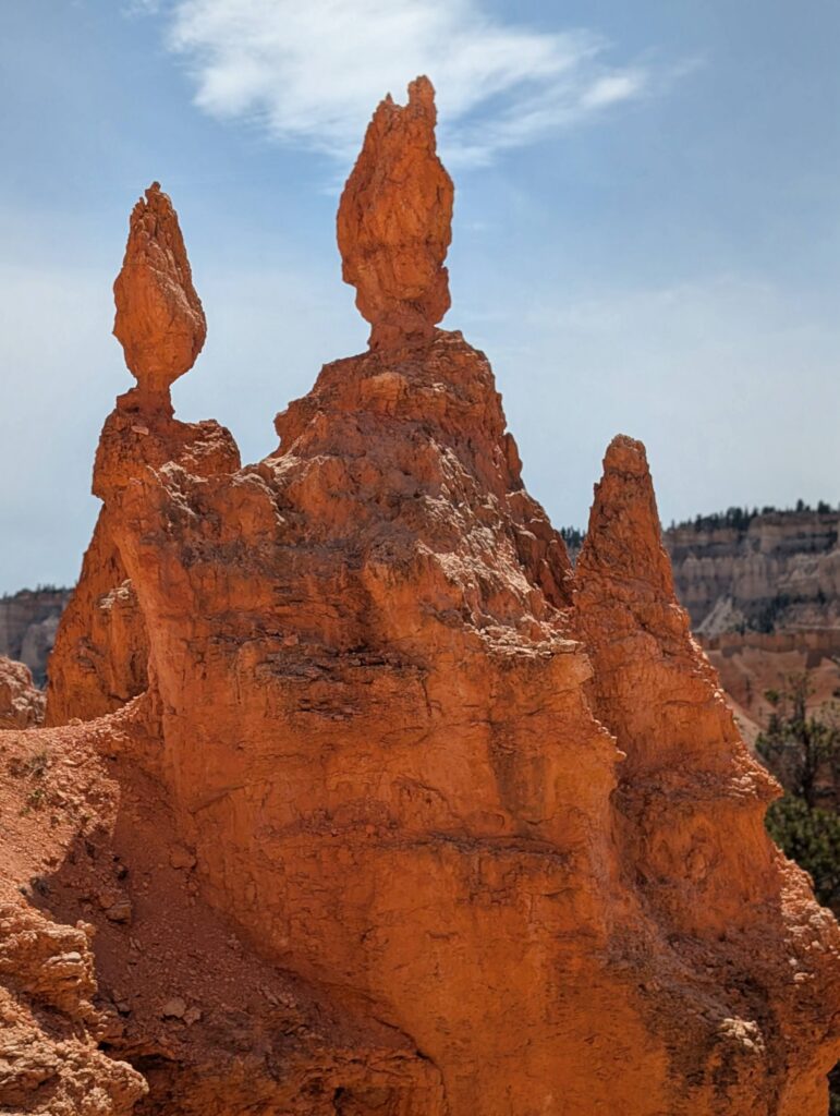
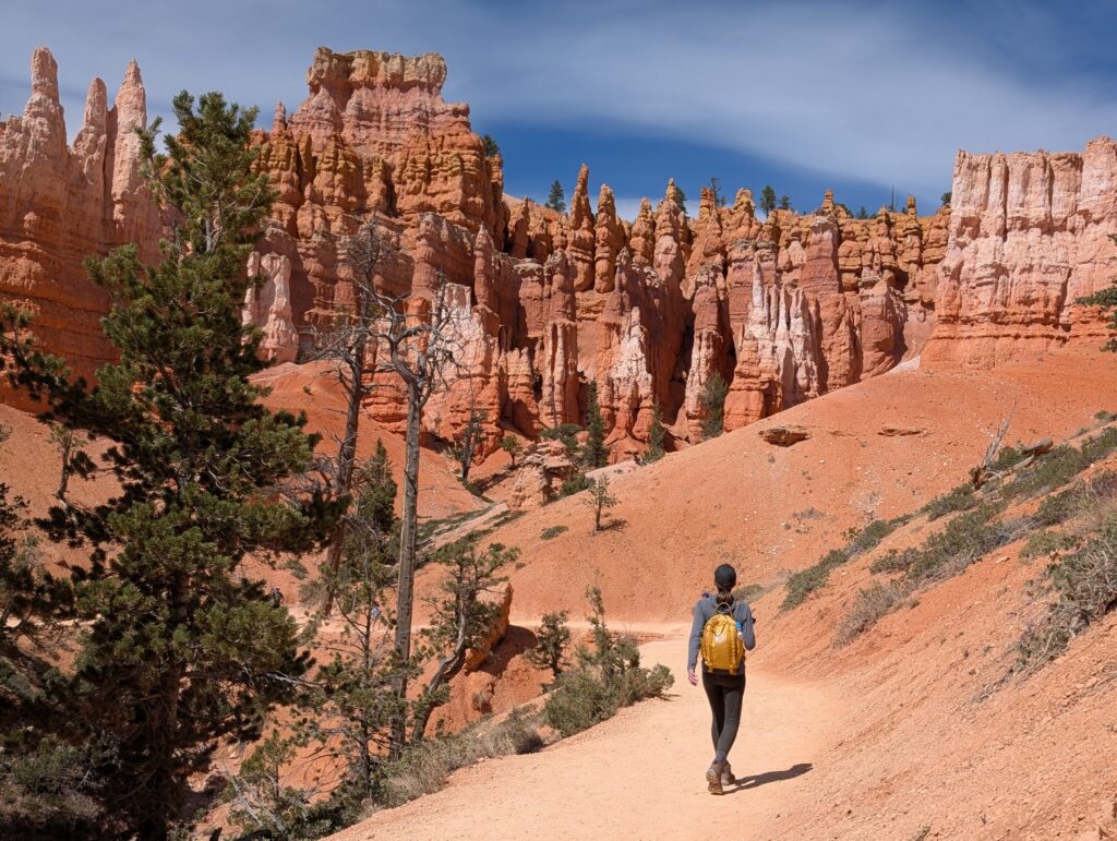
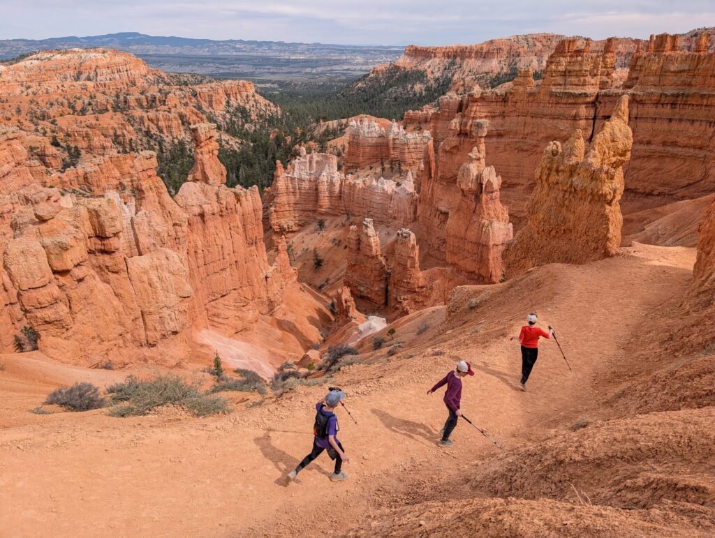
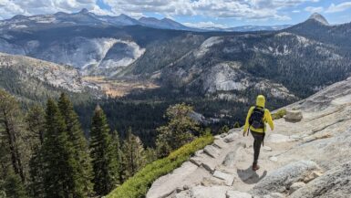
The views start right away. We had a hard time getting any momentum because it was picture after picture after picture. Looking back on all the photos, some of my favorites from the entire hike were from this initial stretch. The colors don’t look real.
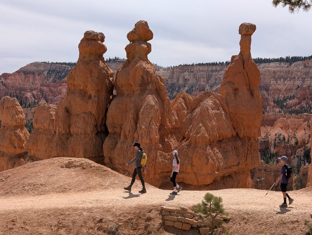
The trail gently descends and meanders for 0.5 miles before the first trail intersection. A horse trail continues straight and also turns to the left, but you’ll want to take the signed turn to the right to continue on the Queen’s Garden Trail. At the intersection, try to spot the trail further below that you’ll be on in a few minutes.
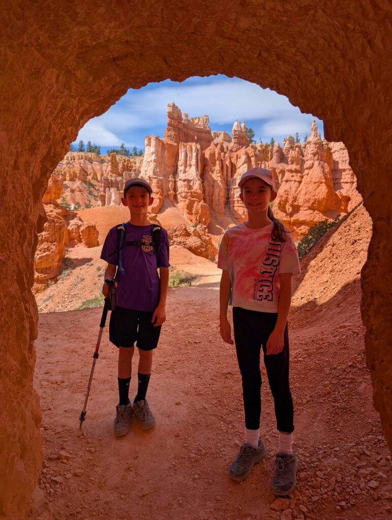
There is a really neat tunnel just beyond where they’re at in the photo above. You can actually see the outline of it if you follow the path to the left side of the photo. You may have to wait to get a photo with no one in it but it’s a great vantage point.
Along the canyon floor
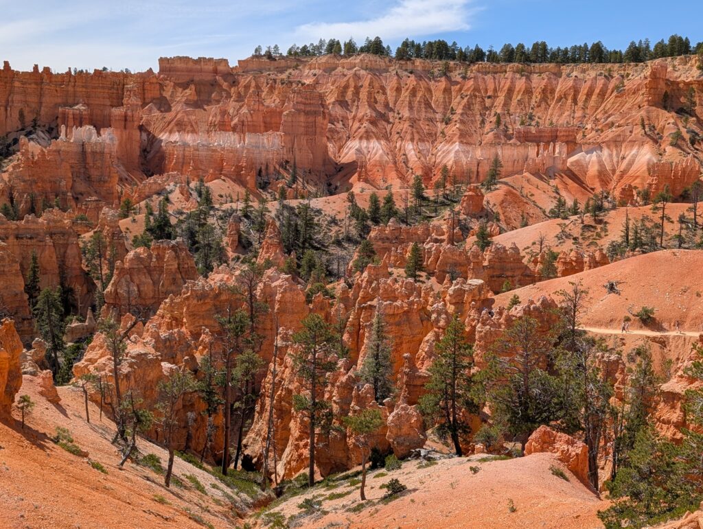
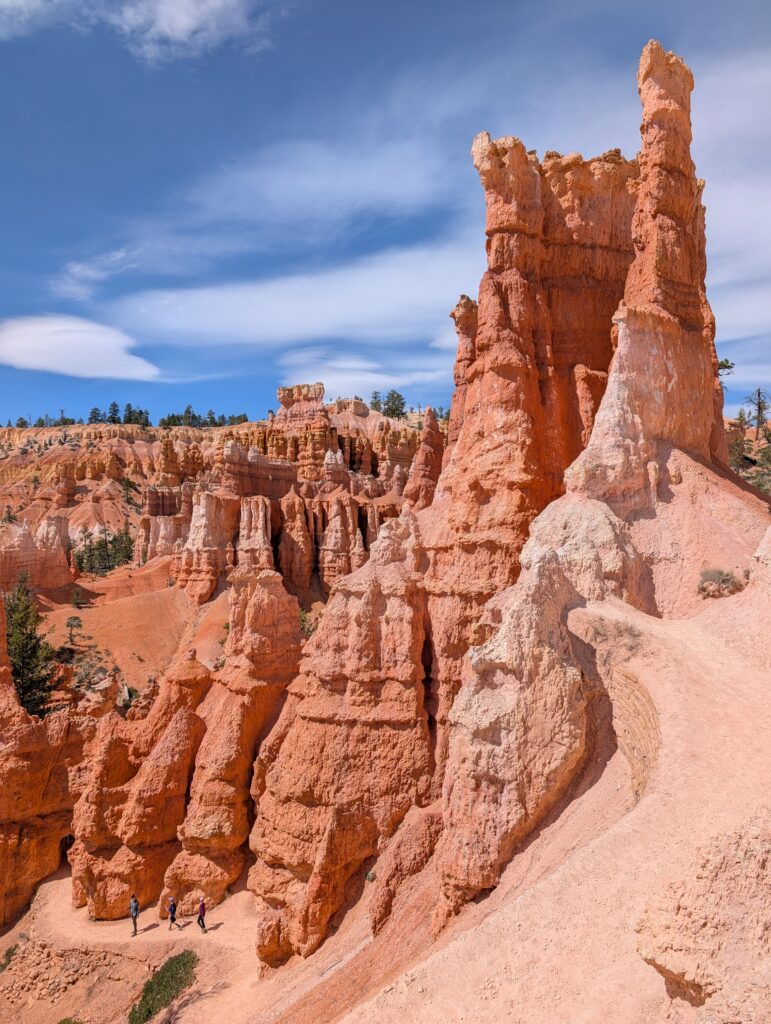
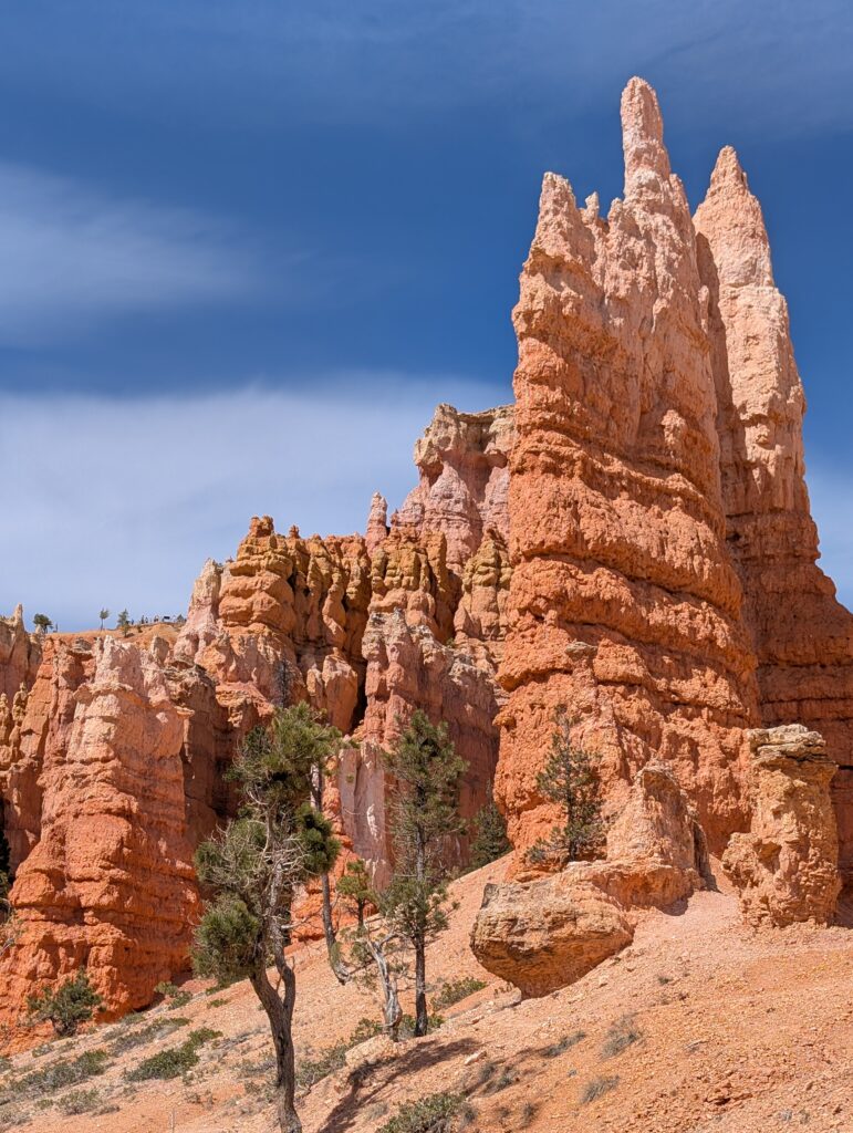
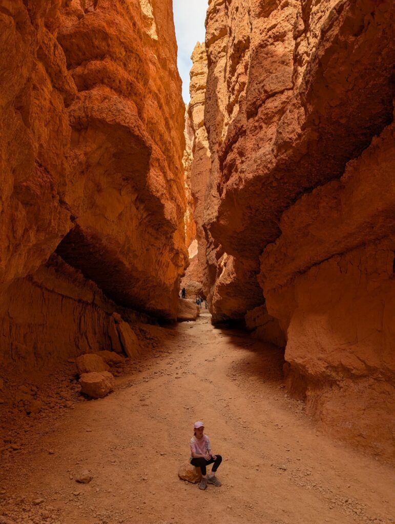
This next mile is a tale of two halves. The first half, after you go through that brief tunnel, goes through some awesome hoodoo sections. While you start the hike looking down at them, now you’re looking up.
You’ll likely put your phone in your pocket for most of the second half as it goes through wooded sections and the views mostly disappear. The descent is so slight that you may not even notice it cruising through and you’ll arrive at the Navajo Trail in no time. This is where you’ll decide if you want to ascend to Sunset Point via Wall Street or Two Bridges. Two Bridges will go to the right and Wall Street is to the left. Again, there’s no wrong choice, but my vote is to take Wall Street up.
Taking Wall Street back to the top of the canyon
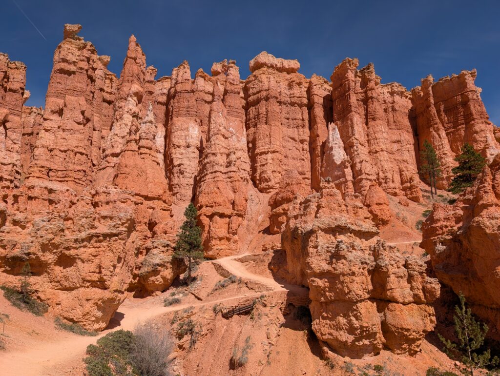
Wall Street is 0.5 miles long and most of the elevation gain is at the end along a series of switchbacks. The first part is rather nondescript, but then some giant trees appear seemingly out of nowhere. This is one of the neatest parts of the entire park.
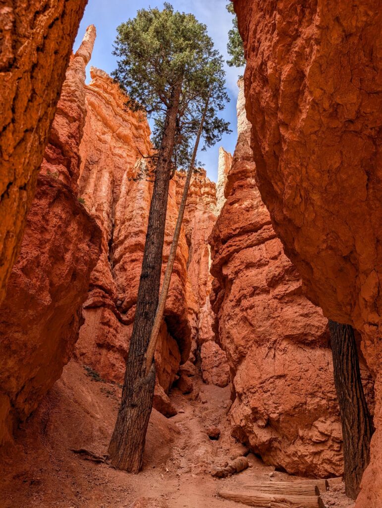
The switchbacks start right after going through the slot canyon section. Luckily, the views looking up are stunning.
And then equally stunning looking back down, once you get near the top.
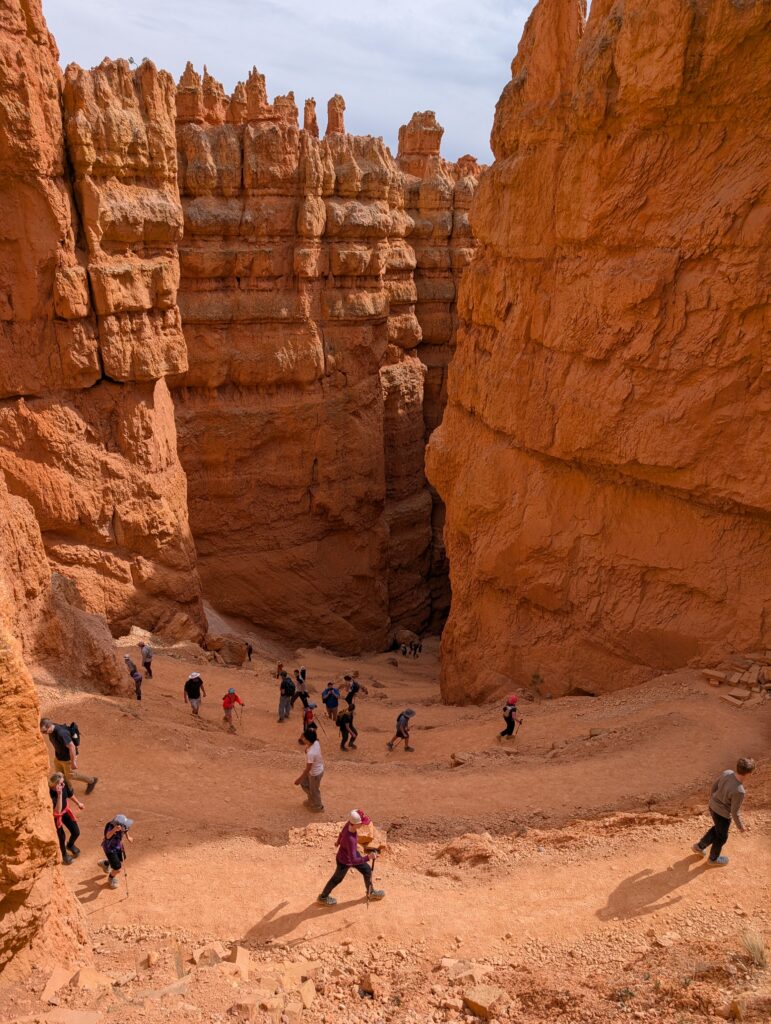
Once you get to the top, you can head down the Two Bridges trail from Sunset Point, see Thor’s Hammer, and go back up in less than 10 minutes. That allows you to do Wall Street and see Thor’s Hammer, which is well worth it. And, you could go even further if you want to see the switchback section of that trail. It’d be less than a mile total if you go all the way down and back up, and there are far worse ways to spend your time and energy.
Either way, you have the last 0.5 miles along the Rim Trail from Sunset Point back to Sunrise Point.
That’s it! Please leave a comment below if you have any questions or feedback.
Leave a reply