If you take away nothing else from this page: please follow the 7 principles of Leave No Trace whenever hiking (and all the time, actually – most are pretty good general life tips, too):
- Plan ahead and prepare
- Travel and camp on durable surfaces
- Dispose of waste properly
- Leave what you find
- Minimize campfire impacts
- Respect wildlife
- Be considerate of other visitors
Now, on to Black Elk Peak and Little Devil’s Tower. Here are the quick facts:
- Where: Black Hills National Forest, South Dakota
- More specifically, where: the trailhead is at Sylvan Lake in Custer State Park
- Distance and elevation: 7.8 miles (12.5 km) with 1,700 feet (520 meters) of total elevation gain
- Highest point: 7,244 feet (2,210 meters) at Black Elk Peak
- Why you should hike this trail: a family-friendly loop trail with unique rocks jutting up all over the place. Plus, you’ll summit the highest peak east of the Rockies.
- Fee or permit? Yes – $20 for a 7-day pass to Custer State Park
- Best time of year: May-October
Tips
- There are lots of trail intersections along this loop and the trail names are numbers, so it can be a little confusing. You’ll want to remember trails 9, 3, and 4: 9 connects Sylvan Lake and Black Elk Peak; 3 connects 9 and 4; and 4 takes you back to Sylvan Lake while passing the side trail to Little Devil’s Tower.
- You can hike this loop clockwise or counter-clockwise. I recommend clockwise because you save the best for last (Little Devil’s Tower) and you’d miss the views approaching the Cathedral Spires if you went the other way.
- You’ll go up, then down, then up again in either direction. The scramble up to Little Devil’s Tower is probably the most challenging part of the hike but our 4-year olds did it with just a little help so it’s not too bad.
- There is a separate trailhead for Little Devil’s Tower further east on Needles Highway (Route 87). You could park there as well, but there are more spots, real bathrooms, and you can take a swim at Sylvan Lake post-hike if you start and end there.
- There is no water on the trail so make sure you have plenty.
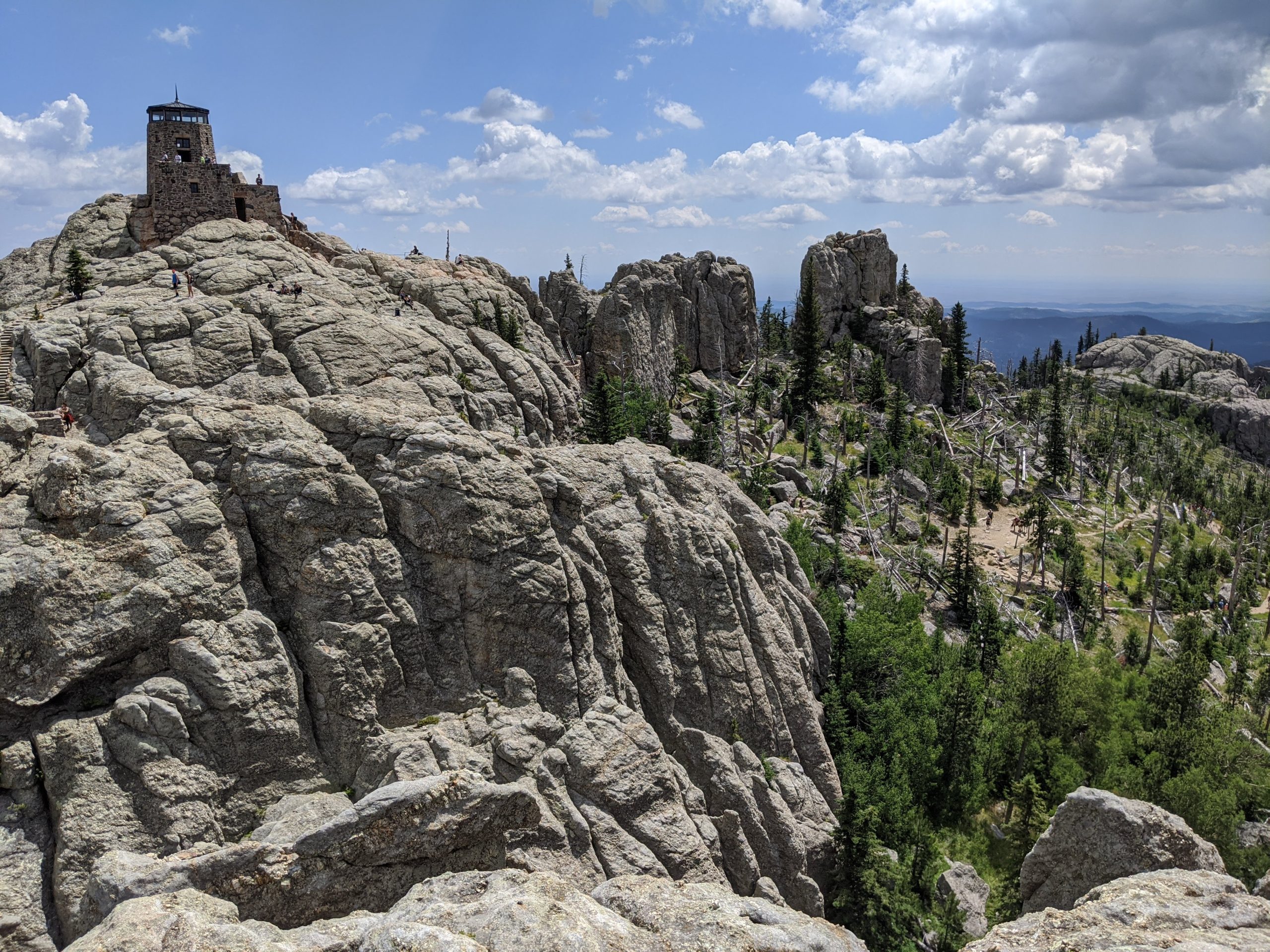
- Black Elk Peak was formerly known as Harney Peak, but was rightfully given back its Native American name in 2016.
- We did this as part of an 8 day trip to South Dakota and Wyoming – full details here.
The details
The trailhead is at Sylvan Lake in one of the United States’ best parks: Custer State Park. When I say it’s one of the country’s best parks, I’m including National Parks as well – it’s that spectacular. The nearest airport is Rapid City, South Dakota, and Sylvan Lake is about a 45 minute drive from there. You don’t have to go to the city of Custer, which is further south, unless you’re staying there. There is a $20 fee per vehicle to get into the park; it’s good for 7 days and well worth it as there are plenty of other sights and hikes to fill in multiple days.
Once you park at Sylvan Lake, walk past the bathrooms on the right (east) side of the lake on a paved path and you’ll find a trail map.
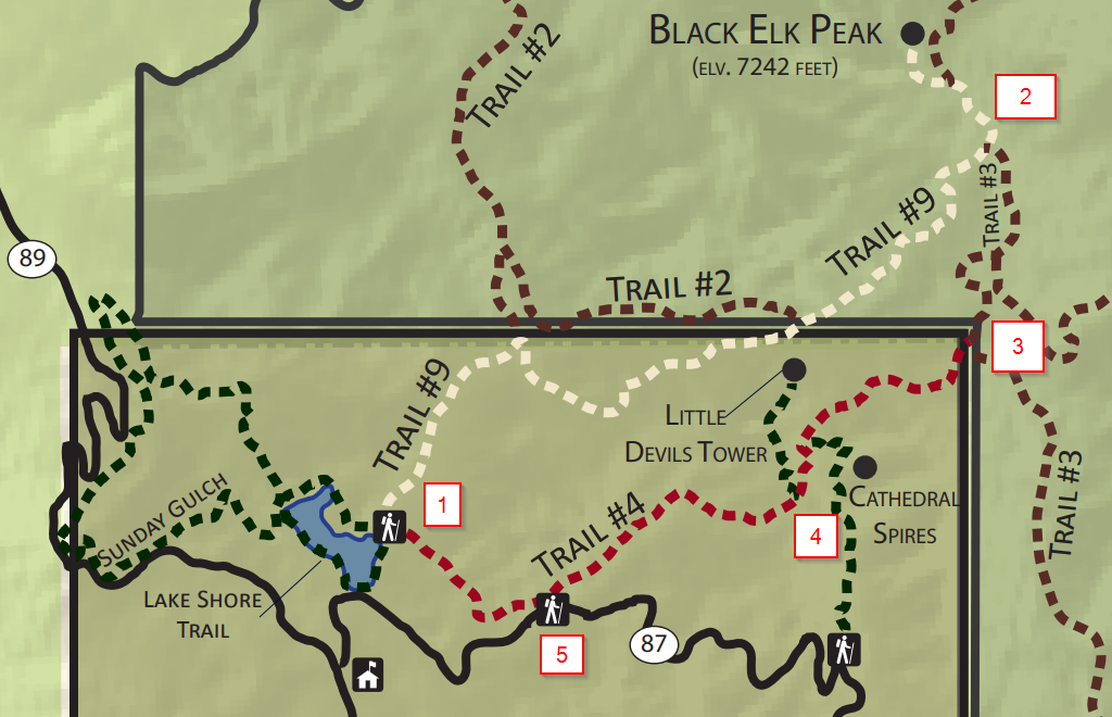
Map key:
1 - The trailhead at Sylvan Lake. Follow the white trail, Trail #9, all the way to Black Elk Peak and then descend the same way you came.
2 - On the way down, you'll reach an intersection where Trail #3 will branch off from Trail #9 to the left. You'll have already passed this on your way up, but this time you'll take Trail #3. Along the way, there will be another intersection with Trail #7, which will go to the left. Stay to the right to keep on Trail #3.
3 - You'll reach an intersection with Trail #4, which will branch off to the right (red on the map). Take this until you see the side trail to Little Devil's Tower.
4 - Break off to the right to scramble up to Little Devil's Tower. Come back the same way and take a right to continue on Trail #4 back to Sylvan Lake.
5 - The Little Devil's Tower Trailhead.
Sylvan Lake to Black Elk Peak (3.3 miles)
Once you head out on Trail #9 you may notice that the crowd of people didn’t stay behind at the lake. This is about as easy a trail as you can find to get to the top of a mountain, and many people can and want to say they’ve summited the highest point east of the Rockies. Know that you probably won’t be alone on this stretch, but we were by ourselves for a good bit on trails 3 and 4.
The first part of the hike is on a street-wide dirt and gravel path. Eventually you’ll get into the woods. There is a self-issued, free permit station that each group will need to fill out when you enter the Black Peak Wilderness. While there should be one there, never a bad idea to have a pen or pencil with you. You’ll catch glimpses of Black Elk Peak on your way up. While it looks really far away, time passes quickly.
One thing you'll want to make note of on the way up: keep an eye out for the intersection with Trail #3. When you descend, this is where you'll break off to head to Little Devil's Tower.
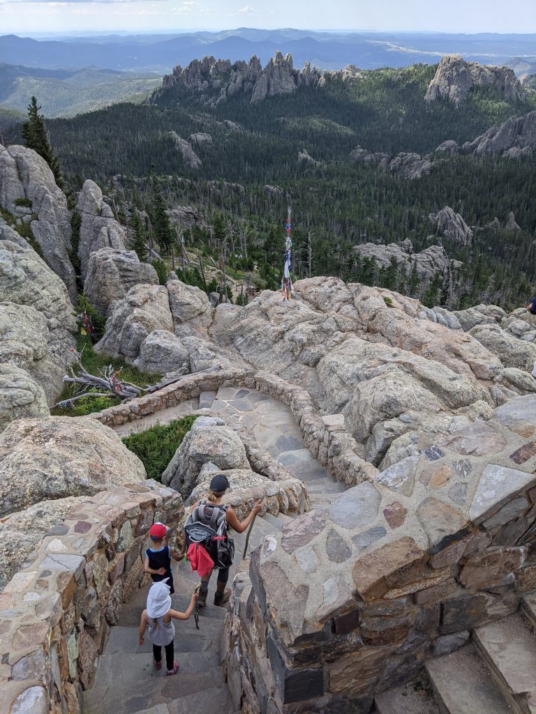
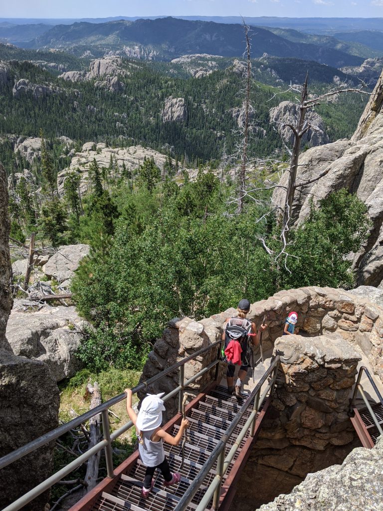
The elevation gain up to Black Elk Peak is 1,100 feet and it takes 3.3 miles to get there from Sylvan Lake. This is probably the least interesting part of the loop but there are still nice views from time to time. It’s a pretty gradual incline that gets a bit steeper at the very end, when you break off to the left for the short stretch that dead-ends at the top. Again, you’ll want to stay on Trail #9 and follow signs to Black Elk Peak the whole way. It also gets narrow as there are stone and metal steps that get you all the way to the top of the fire tower.

Black Elk Peak to Little Devil’s Tower (2.5 miles)
Once you’ve spent some time admiring the view atop Black Elk Peak, you’ll descend the same way you came. Retrace your steps for 0.5 miles until you come to the divergence with Trail #3, which you hopefully made notice of on the way up.
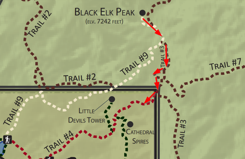
You’ll make a left to take Trail #3 and now you’ll be on new territory. Stay on Trail #3 (there will be a split with Trail #7) for about 0.8 miles until you get to Trail #4. All the trail splits are marked, but this is where a GPS can really come in handy. I recommend Gaia GPS, which I have on my phone and has helped me countless times.
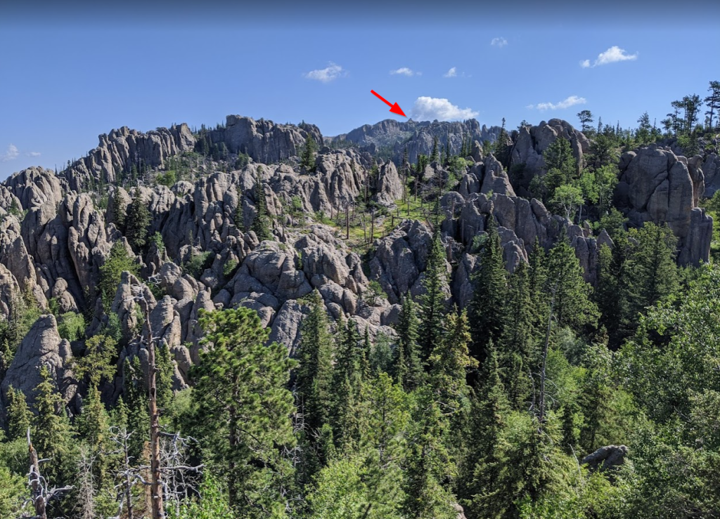
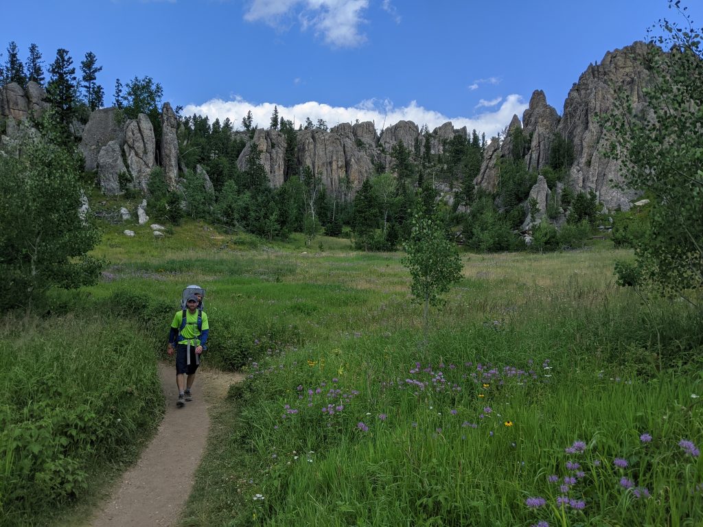
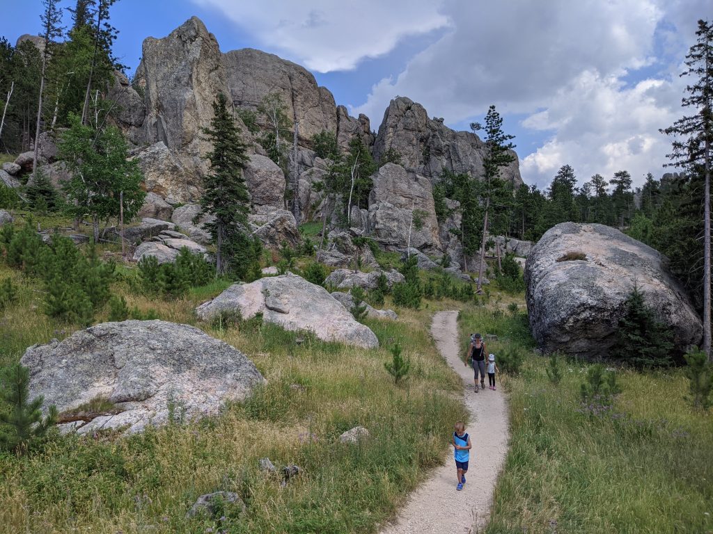
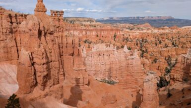
After you make a right on Trail #4, you have about another 0.8 miles until you get to the Little Devil’s Tower trail. This area is one of my favorite stretches of the hike. The big rocks get closer and closer and eventually you’ll pass through an area where they’re all around you.
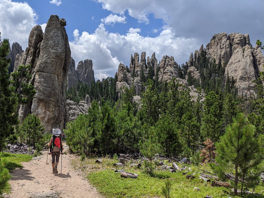
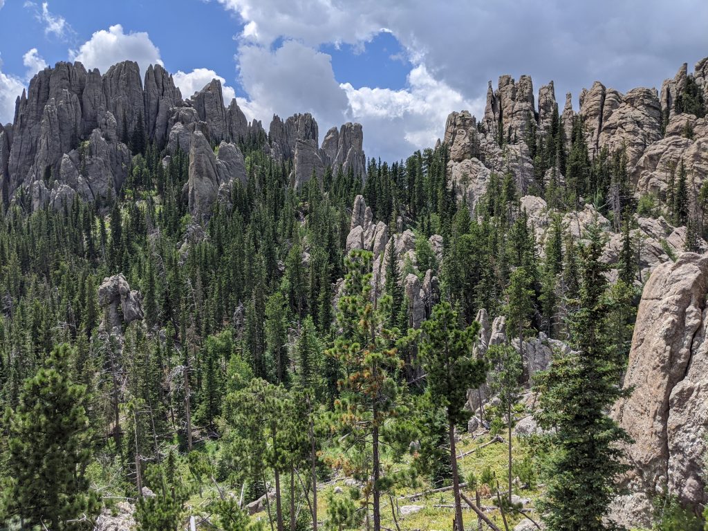
Between this section and the trail to Little Devil’s Tower, you’ll see signage for another trail that breaks off to the left for Cathedral Spires. You must go to Cathedral Spires. However, I think it’s better coupled with an end-to-end drive of the Needles Highway. The Cathedral Spires hike can be done in 1-2 hours when starting from its own trailhead. However, if you don’t have that opportunity, take the side trail and tack it on here. The detour would be less than 1 mile total and will probably take less than an hour.
Whether you take the Cathedral Spires trail or not, it’s helpful as a marker. You’re less than 0.25 miles from the trail to Little Devil’s Tower. There is not a typical trail sign to mark the way to Little Devil’s Tower. Instead, there are blue markers on the rocks and a pole that has “LDT” etched into it. The turnoff can be missed if you’re not looking for it.
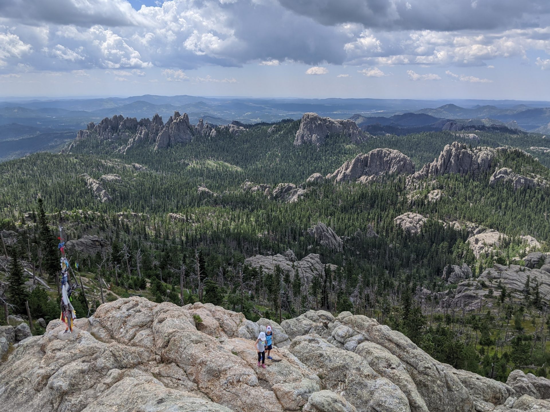
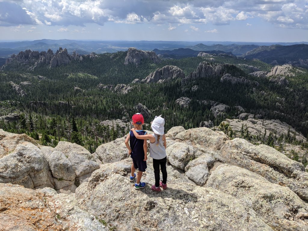
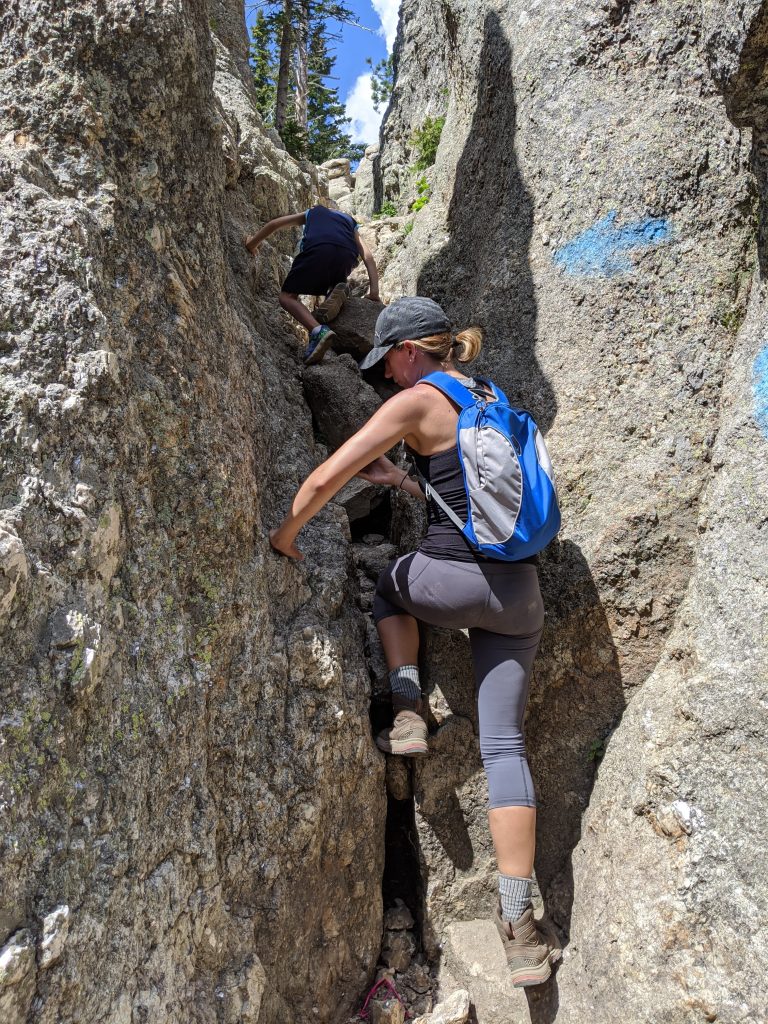
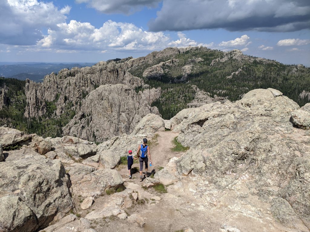
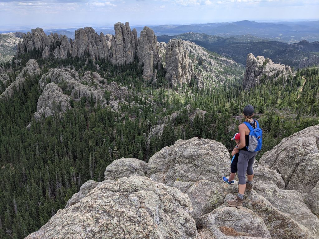
The trail to Little Devil’s Tower is on your right (opposite side of the trail to Cathedral Spires) and covers 0.4 miles to the summit. There are some areas where you’ll likely need all 4 limbs. There isn’t much exposure unless you choose to go to the edge at the top. The trickier parts are climbing up and over rocks in some of the narrower areas. Follow the blue markers to stay on the trail.
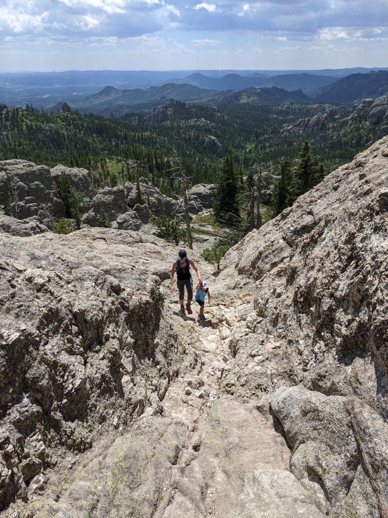
You’ll have a great view in all directions when you make it to the top, which is why I think this is the best part of the hike.
Little Devil’s Tower back to Sylvan Lake (2 miles)
Once you’re done on the summit, go another 0.4 miles to get back to Trail #4. You have about 1.5 miles left to Sylvan Lake. You’ll pass the Little Devil’s Tower Trailhead, which does have toilets. If you don’t need a pit stop, keep cruising back to lake. It’s a nice stroll through more rocks and meadows. Then you’re back!
Have you ever hiked Black Elk Peak and Little Devil’s Tower, or have questions on it? Please leave a comment below!
Leave a reply