If you take away nothing else from this page: please follow the 7 principles of Leave No Trace whenever hiking (and all the time, actually – most are pretty good general life tips, too):
- Plan ahead and prepare
- Travel and camp on durable surfaces
- Dispose of waste properly
- Leave what you find
- Minimize campfire impacts
- Respect wildlife
- Be considerate of other visitors
Now, on to the Maple Pass Loop. Here are the quick facts:
- Where: North Cascades, Washington. The hike and trailhead are not actually in North Cascades National Park, although part of the trail does go along the park boundary and you’ll have views into the park.
- More specifically, where: the Maple Pass Trailhead (aka Rainy Pass Trailhead) on North Cascades Highway (Route 20). The closest town is Mazama.
- Distance and elevation: 6.4 miles (10.3 km) with 2,100 feet (640 meters) of total elevation gain
- Highest point: 6,950 feet (2,120 meters) at Maple Pass
- Why you should hike this trail: arguably the best big-mountain views in the country – unbelievable scenery pretty much the entire way.
- Fee or permit? Yes – Northwest Forest or America the Beautiful pass. However, there is a $5 cash self-service station at the trailhead so you don’t need to have anything ahead of time.
- Best time of year: June-October. There can be some snow at the highest parts all year long and lots of snow in the shoulder months.
Tips for the Maple Pass Loop
- The big debate is whether to do this clockwise or counterclockwise. There is no wrong choice, but I vote counterclockwise simply because I think the views are better. You will have a steep, long descent, however, so you may want to go clockwise if that won’t agree with your knees. Clockwise will be a long, steep initial ascent and gradual descent.
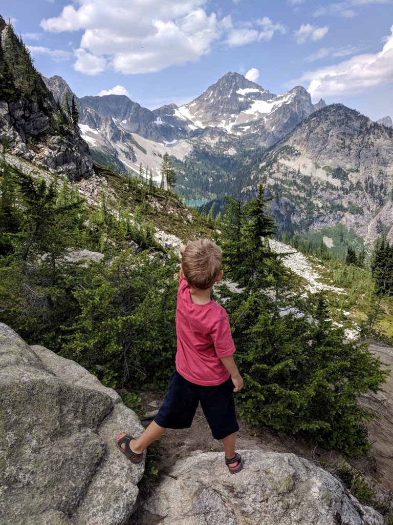
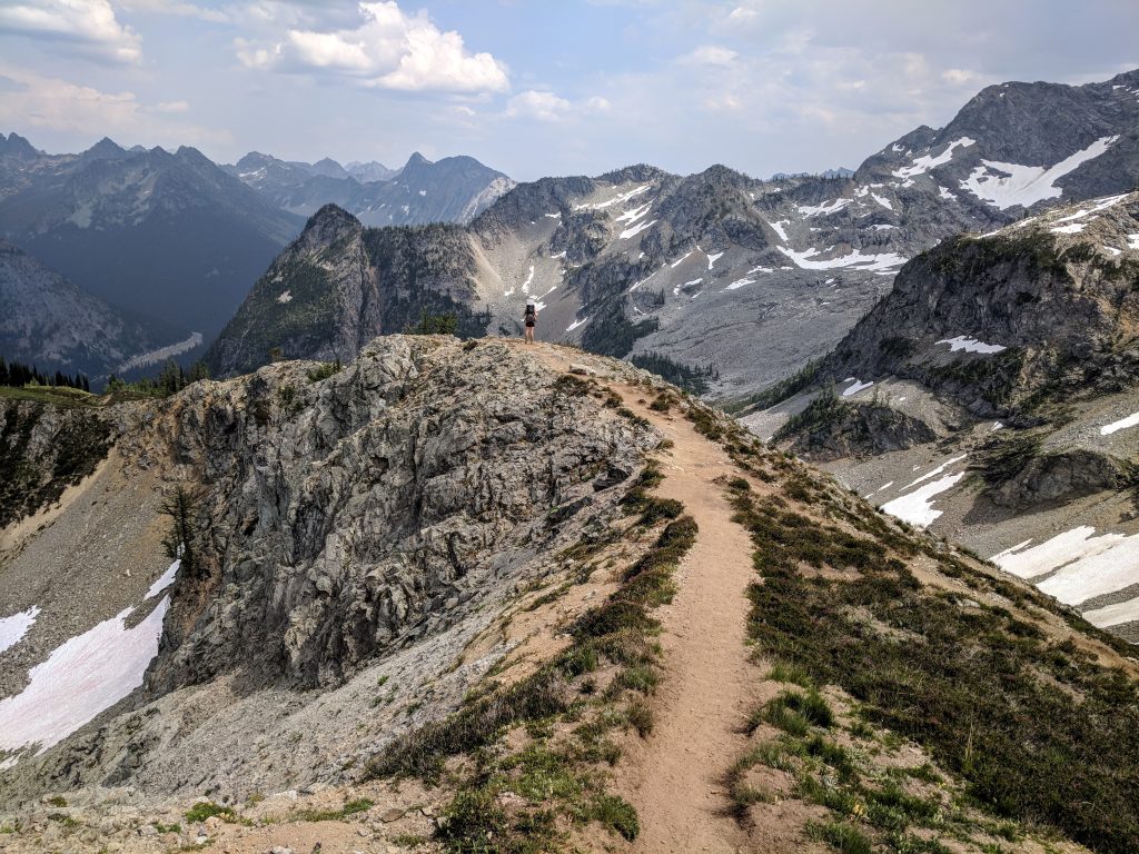
- Whichever way you choose, constantly turn around! There are mountains in every direction and since it’s a loop hike you won’t get the other perspective on the way back. The picture above is a view you’d have when hiking clockwise. If I didn’t turn around, I’d have missed it.
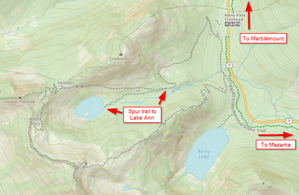
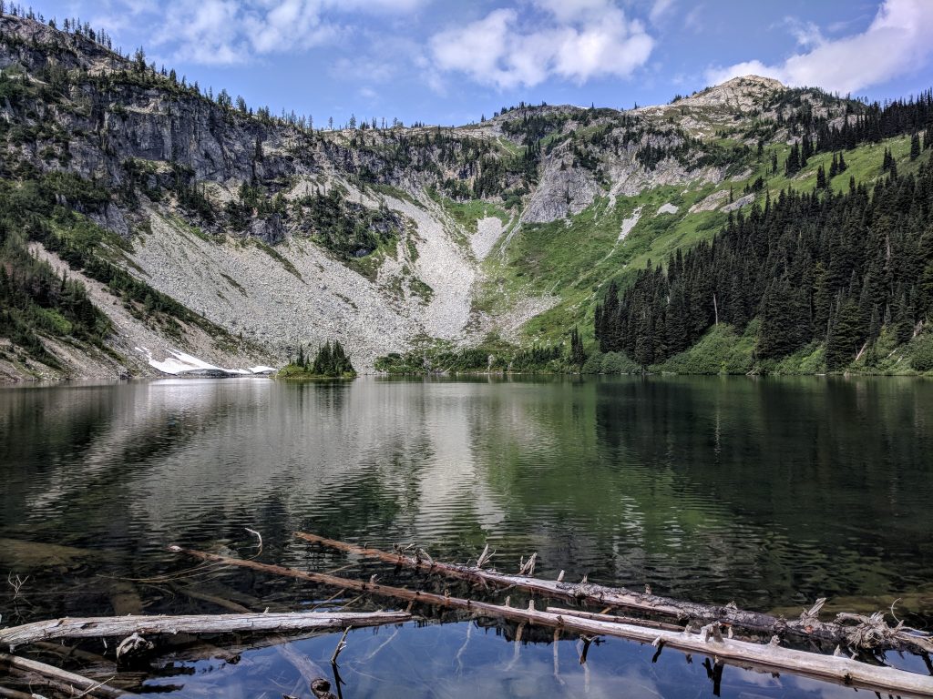
- There is no water access along the trail unless you take the detour to Lake Ann. But…
- The detour to Lake Ann is not worth it.
- You must go to the nearby Washington Pass Observation Site – it’s 5 miles east of the trailhead and the views 50 feet from the parking lot are unbelievable.
- Bugs can be very bad on this hike in the middle of summer.
The details
I’ll start out by stating this might be my favorite hike in the United States. No other trail that I’ve been on has peak after peak after peak in every direction as consistently as this one does.
To get started, you’ll drive to the Maple Pass Trailhead (aka Rainy Pass Trailhead) on Route 20. There is no lodging nearby so unless you’re camping, you’ll probably be coming from Mazama or Winthrop on the east side or from Marblemount on the west side.
There are a decent amount of parking spots at the Maple Pass Loop trailhead but it can fill up so you should get there early (as always). There is a station where you can put $5 cash in an envelope after you park and put the Recreation Pass tag on your dashboard. Alternatively, you can buy an annual or daily Northwest Forest Pass online in advance and an America the Beautiful pass will also suffice. There are bathrooms at the trailhead.
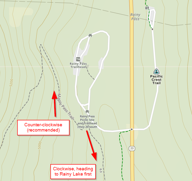
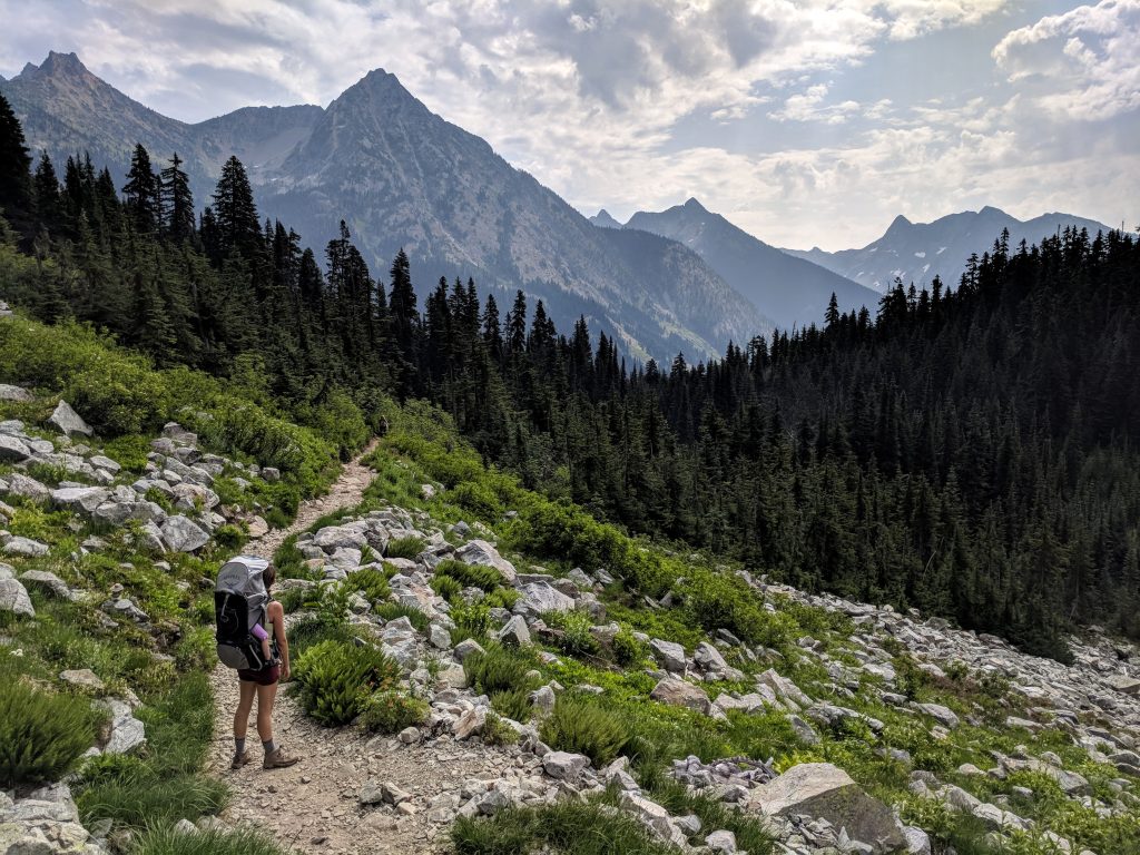
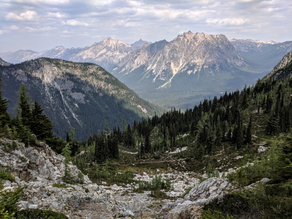
This guide will detail the trail in a counter-clockwise direction. You’ll make a right from the trailhead at the parking lot. The initial climb up through the woods is pleasant and not aggressive with a few longer switchbacks. Once you come out of the trees and pass through a mini boulder field, make sure to turn around to get your first awesome view:
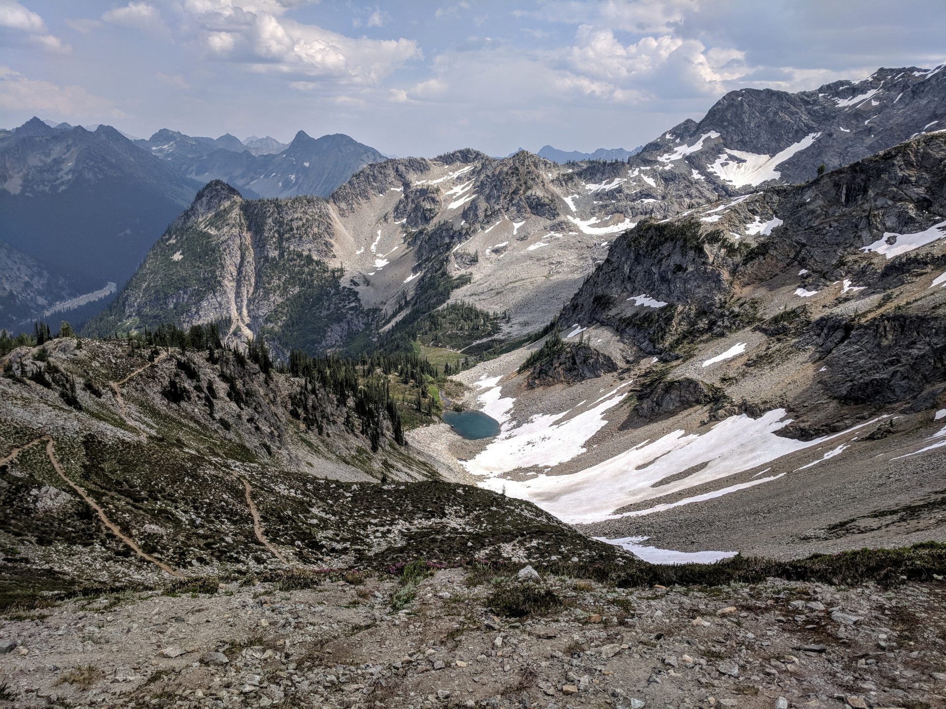
You’ll go back into the trees and after about 1.25 miles from the trailhead you’ll see a trail that breaks off to the left and goes downhill. This is the way to Lake Ann and will add 1 mile total to go there and back. There is not much room to explore around the lake and the extra mile is not worth it at all. Here’s the view from the water’s edge:
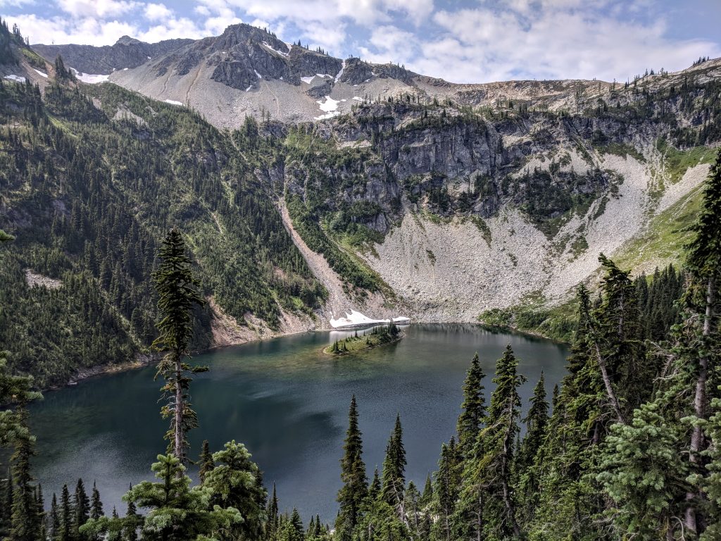
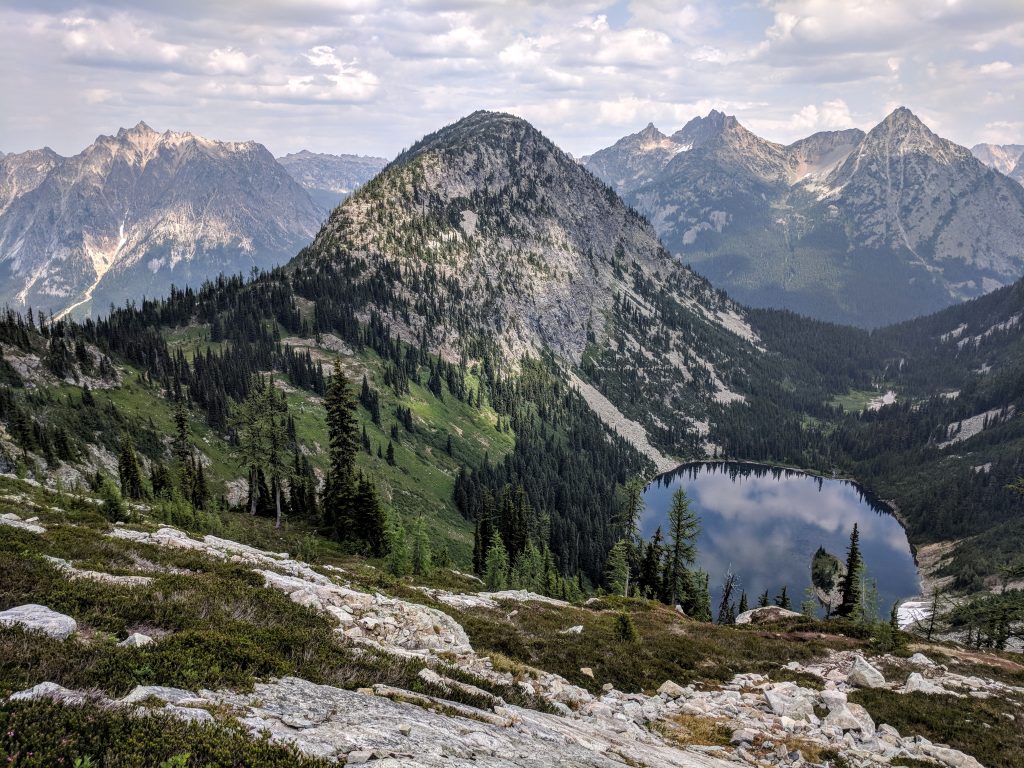
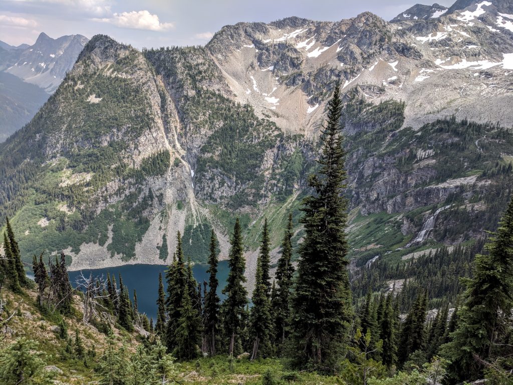
Continuing on the main loop trail, you’ll steadily gain elevation and pop back out of the woods. Shortly after you’ll get your first glimpse of Lake Ann from above. This is one of the best views of the trail. It’s right in front of you, which is one of the reasons I recommend hiking counter-clockwise.
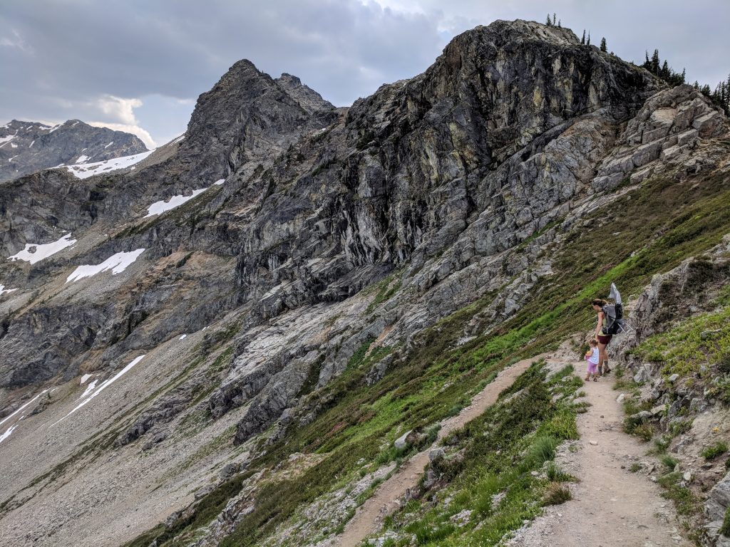
The trail continues uphill along the length of the lake and you have a beautiful view the whole time. Take care to not hurt your neck while constantly peering to the left. Once you’re almost equal with the end of the lake you’ll come to a few shorter switchbacks then a meadow that leads to Heather Pass. The Maple Pass Loop is sometimes referred to as the Heather-Maple Pass Loop since it goes to both. Heather Pass, or along the switchbacks shortly after, is a decent area to stop for a snack or rest as the incline gets aggressive. Luckily, the views in almost every directions are stunning so you don’t notice the difficulty as much.
Eventually the trail somewhat levels out and you loop around the lake from above. To the left is a straight-on view of Lake Ann nestled between peaks. The North Cascades National Park boundary is to the right.
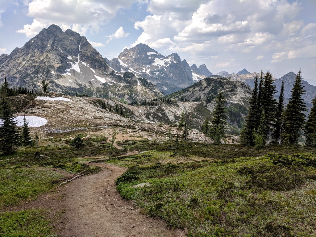
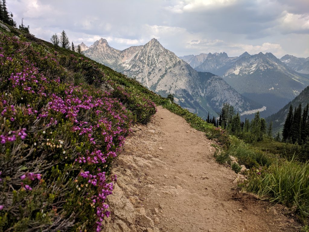
You’ll ascend again as you start to curl back around to head in the direction of the trailhead and approach Maple Pass. The best views through this part are looking back:
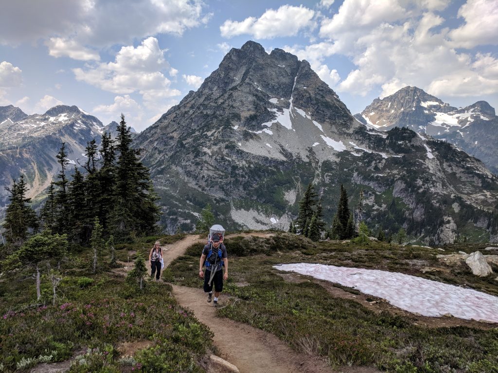
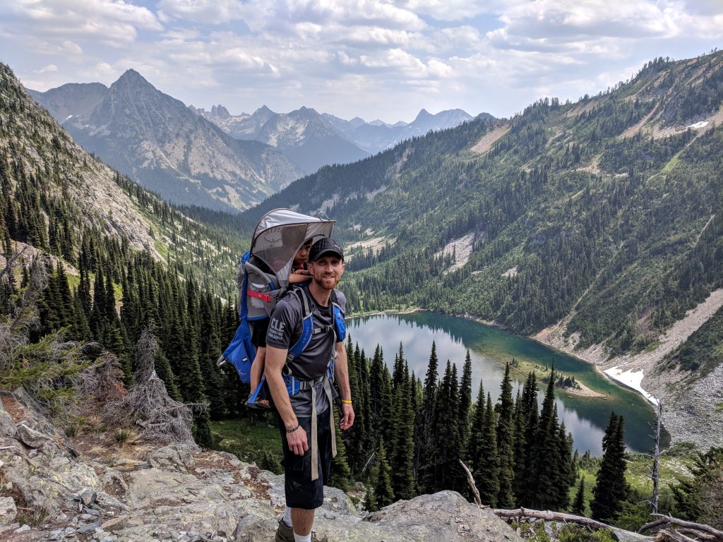
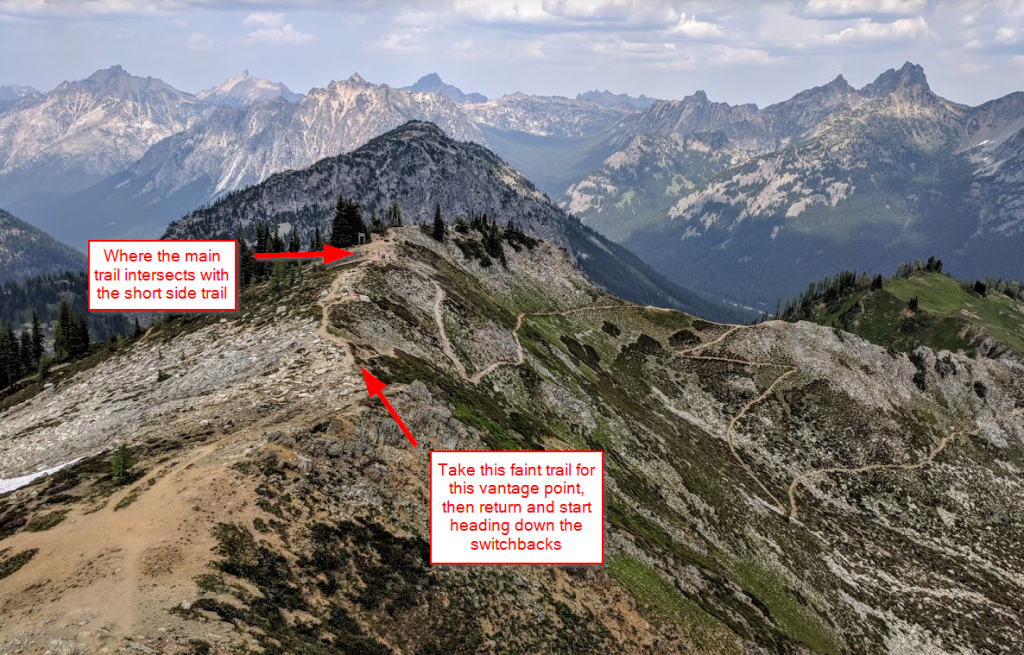
After 3 miles from the trailhead you’ll reach Maple Pass. About 0.75 miles after Maple Pass is an area where there’s a cross trail that doesn’t seem to lead anywhere in either direction. Instead of starting to descend on the switchbacks, take the trail that goes a little bit uphill for what I think is the best view of the area:
Now it’s time for the descent, which does take awhile. The spectacular views continue until you get back to the trees.

Along the way you’ll see Rainy Lake to your right. However, it’s difficult to get a decent picture from the trail.
It is 1.5 miles to the trailhead when you’re directly beside Rainy Lake. It’s a pretty steep descent with switchbacks through the woods and then a cruising, relatively flat finish on a paved path back to the trailhead. If you have time and energy, heading to Rainy Lake and back will add 1.2 miles. We did not, so I can’t say if it’s worth it, unfortunately. Judging by pictures I think it looks more interesting than Lake Ann’s shoreline.
Have you ever done the Maple Pass Loop, or have questions on it? Please leave a comment below!
Leave a reply