If you take away nothing else from this page: please follow the 7 principles of Leave No Trace whenever hiking (and all the time, actually – most are pretty good general life tips, too):
- Plan ahead and prepare
- Travel and camp on durable surfaces
- Dispose of waste properly
- Leave what you find
- Minimize campfire impacts
- Respect wildlife
- Be considerate of other visitors
Now, on to the Mist Trail. Here are the quick facts:
- Where: Yosemite National Park, California
- More specifically, where: try to park at Half Dome Village and take the free shuttle to the Happy Isles stop
- Distance and elevation: ~7 mile (11 km) loop with ~2,000 feet (600 meters) elevation gain
- Highest point: 6,000 feet
- Why you should hike this trail: 2 of Yosemite’s best waterfalls and stunning views the whole way
- Best time of year: spring when the waterfalls are booming – they can be pretty dry in summer and after
- Fee or permit? Yes – National Park fee or pass and timed entry reservation
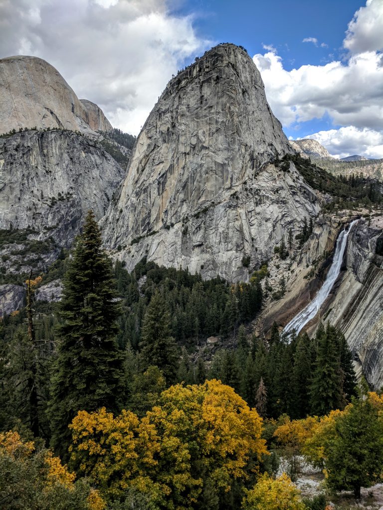
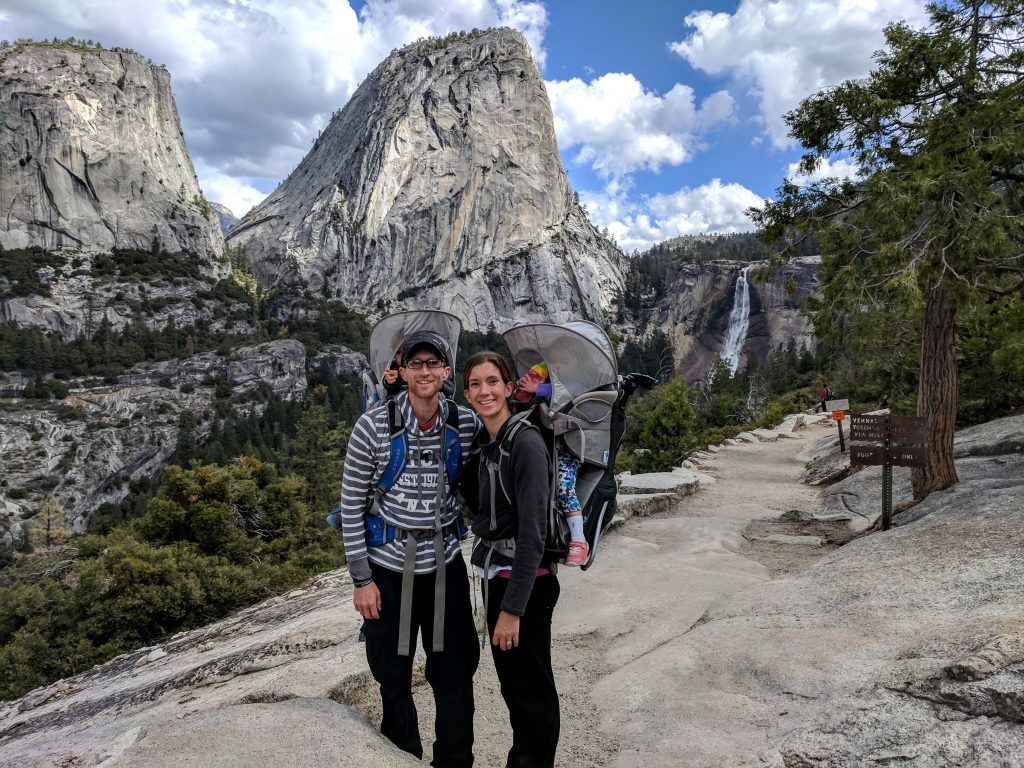
- Tip: take The Mist Trail up to Nevada Fall and come back around on the John Muir Trail – the best view is from the John Muir Trail looking at Nevada Fall with Liberty Cap towering above
- Tip: you can’t get there too early, both for parking at Half Dome Village and trail traffic
Map tips: each blue marker is a point of interest for the hike. Click a marker to learn more about the spot, and click the star in the map header to save the entire map under Your Places in Google Maps.
Getting there
As usual, an early start is best so get to Half Dome Village to get a parking spot and catch the free shuttle to stop 16 – Happy Isles. Every year there are more and more people that visit Yosemite, so it’s difficult to say “arrive by X o’clock and you’ll be fine.” You can’t get there too early, and you can always ask a Park Ranger when entering Yosemite if and when parking in the Village has been filling up.
You don’t have to take the shuttle; the trailhead is about a mile from Half Dome Village so you could walk. There is also a small trailhead parking lot (while I wouldn’t ever plan on parking here, I guess it can’t hurt to take a look), but that is still a half mile from the actual trailhead. Highly recommend saving yourself 1-2 miles extra of walking and taking the shuttle.
Trailhead to Vernal Fall
From the bus top, you’ll cross a small footbridge and take a right to follow signs Vernal Fall and Nevada Fall. You’ll cross the Vernal Fall bridge and eventually come to your first intersection about 1 mile into the hike. The John Muir Trail will be on your right. This is the spot where you’ll rejoin the Mist Trail on the way back down.
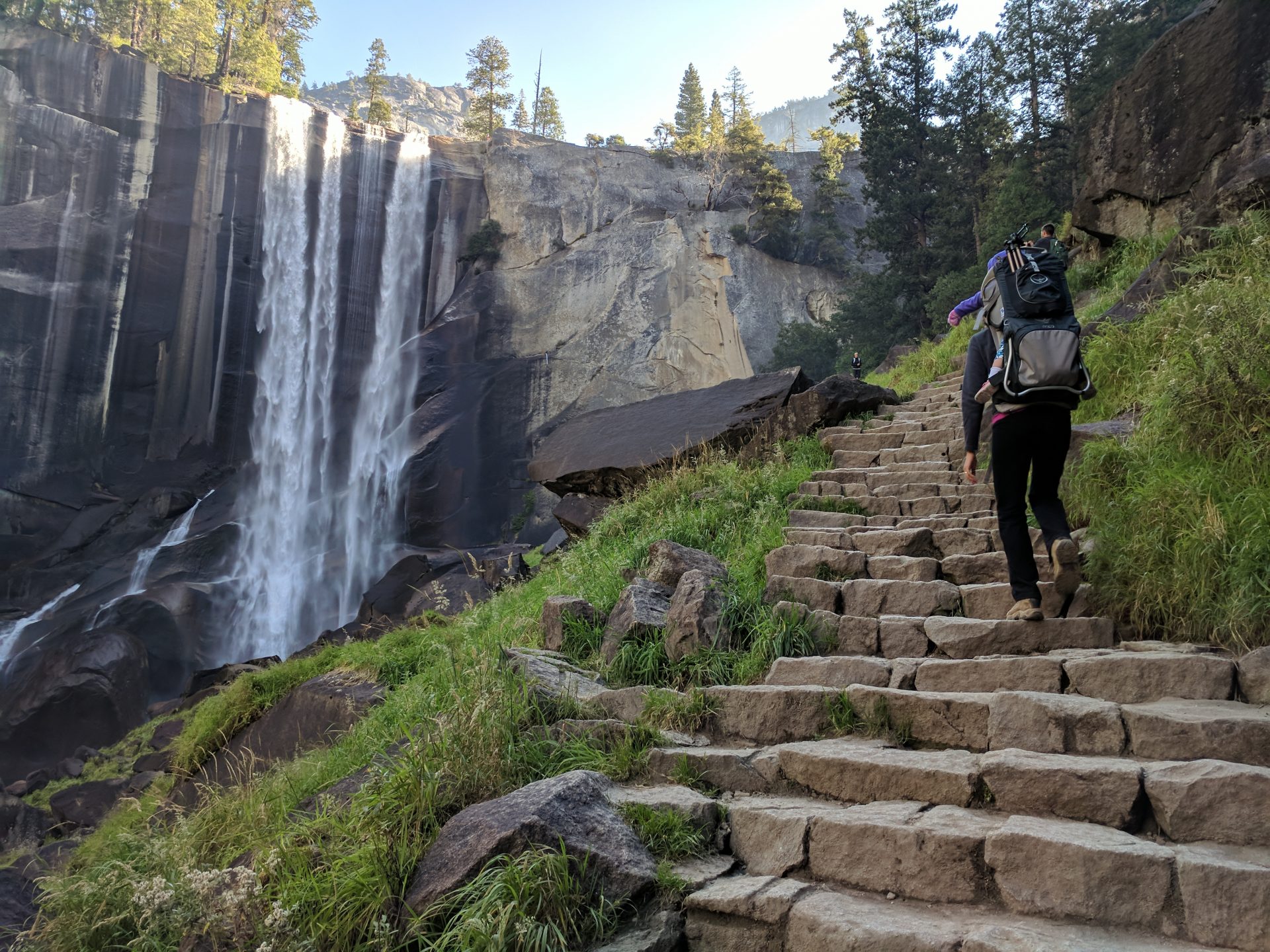
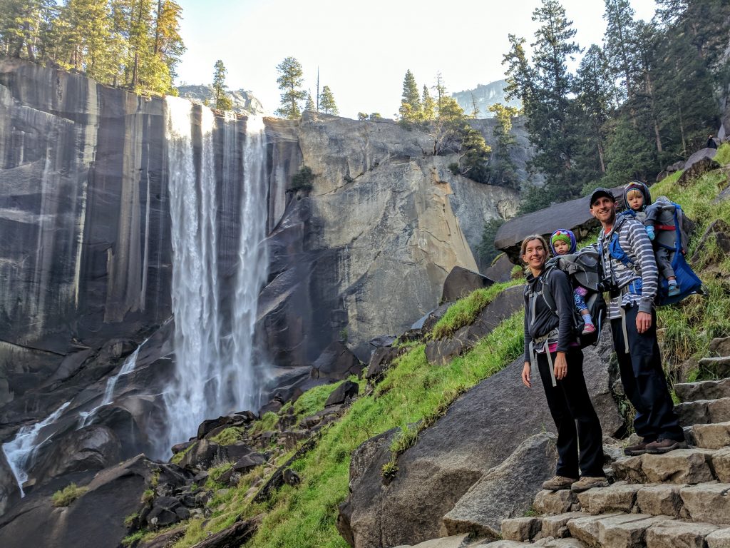
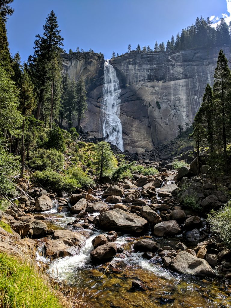
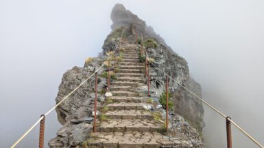
Keep going straight to stay on the Mist Trail and head to Vernal Fall, which you’ll reach in another half mile (about 1.5 miles from the trailhead). Taking the stairs towards and around Vernal Fall is one of the neatest parts of this hike.
Please take caution at the top of Vernal Fall – there are guardrails and signs to remind you that deaths happen here. You can head back for an easy 3-mile RT hike but you’re missing so much more – keep going to Nevada Fall.
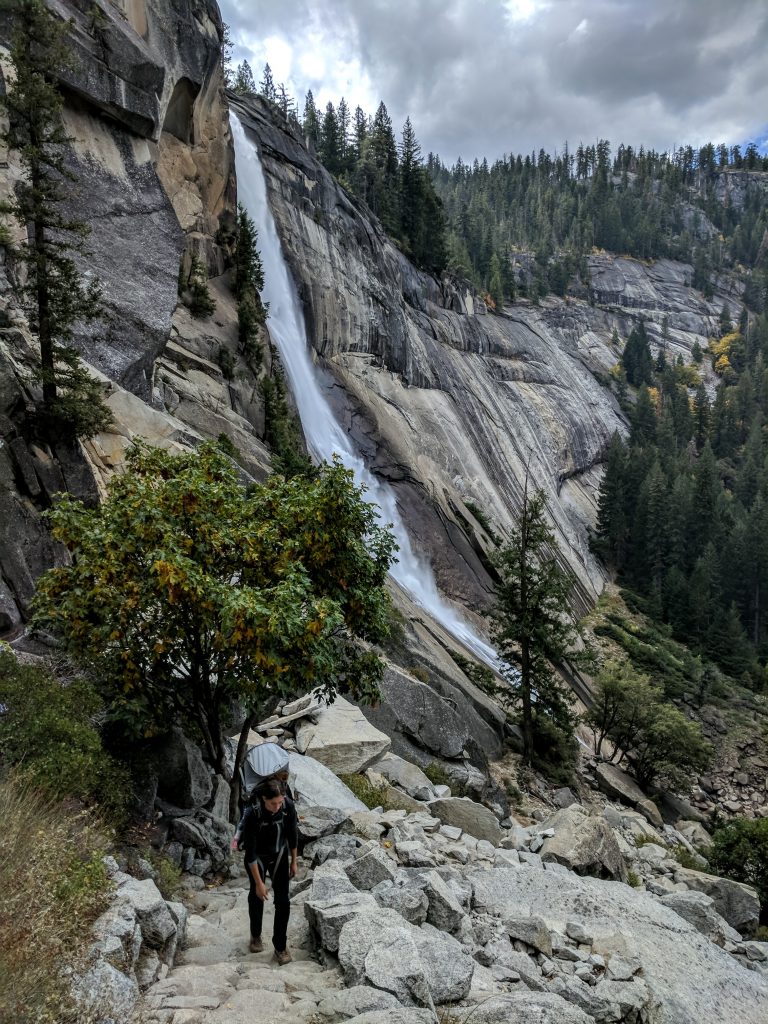
Vernal Fall to Nevada Fall
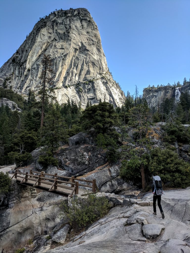
Stay on the Mist Trail and follow signs for Nevada Fall. You’ll gain a good bit of elevation in this stretch with a decent amount of switchbacks. Just under a mile from Vernal Fall is an intersection with the John Muir Trail again. This is where your time on the Mist Trail comes to an end. If you’re lucky enough to have permits to climb Half Dome, you’d turn left at this intersection. Nevada Fall is to the right, however, and about 3.4 miles total from the trailhead.
Nevada Fall back to the trailhead
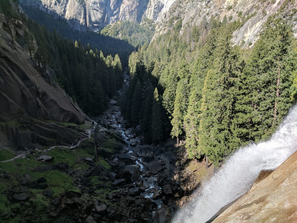
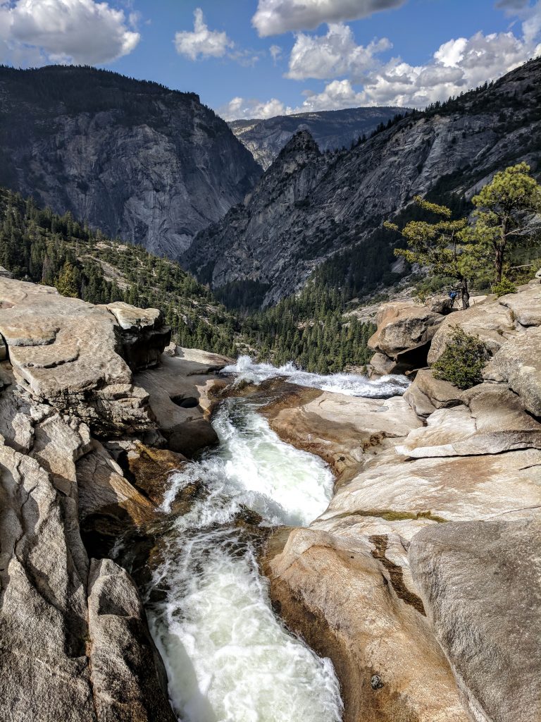
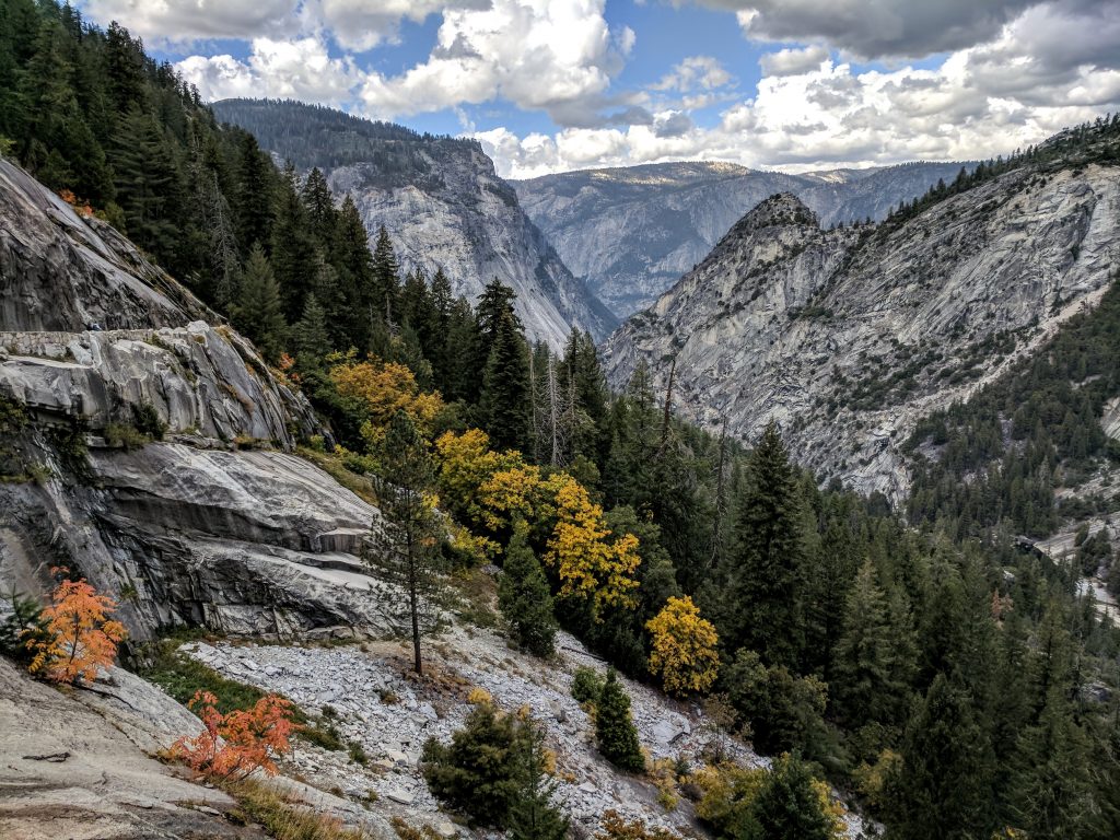
It’s pretty straightforward after crossing Nevada Fall. The John Muir Trail goes for about 2 miles back down to the Mist Trail. You may develop a kink in your neck from constantly looking right while admiring the most stunning view on this trail: Liberty Cap towering over Nevada Fall. The view below is after you cross over Nevada Fall – you can’t miss it.
There is an intersection at Clark Point for a trail that will also take you back to the Mist Trail. It’s not too much further in terms of mileage, but will add elevation. You’ll want to take a left to stay on the Muir Trail.
After the scenery so far on the hike, the last stretch back to the trailhead is pretty nondescript. Plus, you’ve already hiked part of it. Don’t miss the left turn when you get back to the Mist Trail. That will take you back down to the trailhead.
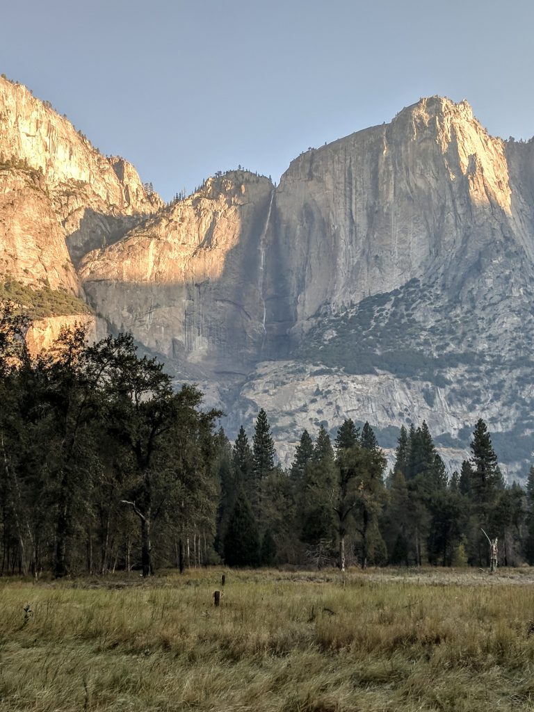
We went in October and got very lucky with the waterflow. Both waterfalls can be a trickle at that time of year, so spring will be the best time to go. Sure, you’ll have crowds, but it beats the disappointment of not having much of a waterfall to look at. As an example, here’s how dry Yosemite Falls was when we were there:
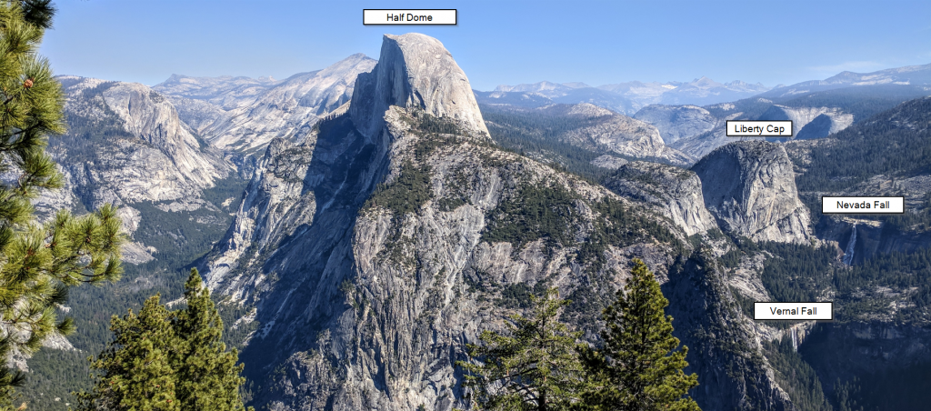
Lastly, while you’ll have to drive or hike to Glacier Point (which isn’t really near this hike), I thought this view from there is really neat in that it gives context to where Vernal and Nevada Falls are:
Leave a reply